Chilkoot Lake fishing map is available as part of iBoating : USA Marine & Fishing App(now supported on multiple platforms including Android, iPhone/iPad, MacBook, and Windows(tablet and phone)/PC based chartplotter.).
With our Lake Maps App, you get all the great marine chart app features like fishing spots, along with Chilkoot Lake depth map. The fishing maps app include HD lake depth contours, along with advanced features found in Fish Finder / Gps Chart Plotter systems, turning your device into a Depth Finder. The Chilkoot Lake Navigation App provides advanced features of a Marine Chartplotter including adjusting water level offset and custom depth shading. Fishing spots and depth contours layers are available in most Lake maps. Lake navigation features include advanced instrumentation to gather wind speed direction, water temperature, water depth, and accurate GPS with AIS receivers(using NMEA over TCP/UDP). Autopilot support can be enabled during ‘Goto WayPoint’ and ‘Route Assistance’.
Now i-Boating supports Fishing Points in Chilkoot Lake.
Have more questions about the Nautical Chart App? Ask us.
Fishing Info for Chilkoot Lake
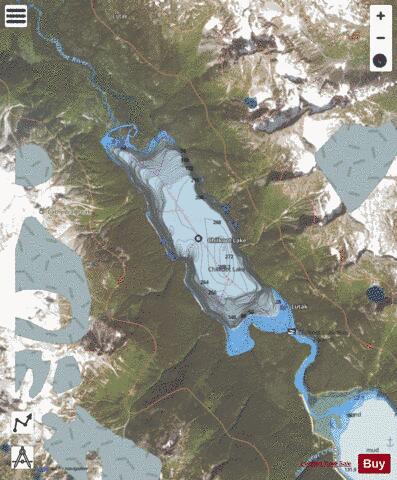
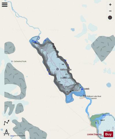
The Chilkoot Lake, in the Tlingit Indians region of Alaska, is also spelt Chilcoot Lake. Its other local names are the Akha Lake and Tschilkut S(ee), meaning "Chilkoot Lake". It is in Haines Borough, Alaska. Chilkoot also means "big fish". The lake has a ‘Recreation Site’ at its southern end near the outlet to the Chilkoot River, which is set amidst the Sitka spruce trees. Chilkoot River flows from the lake for a short length and debouches into the Lutak Channel at the head of the Chilkoot inlet near Haines. Chilkoot village, a settlement of Chilkoot Indians existed at the outlet of the lake, which was called Tschilkut or Tananel or Chilcoot; the lake is named after this village. This village is now a camping area developed by the State Parks and Outdoor Recreation Division of the Alaska Department of Natural Resources. The lake is a popular location for Kayaking. The Lake, approached from the park area, offers one of the best red salmon fishing locations in Southeast Alaska. Salmon fishing in the lake during the spawning period is done in four runs starting with mid-June and ending in mid-October when it is also the time for Bears to frequent the lake precincts to hunt for its favorite salmons. The Chilkoot Lake's commercial fishing of Sockeye salmon is worth about $1 million annually.
More on Wikipedia...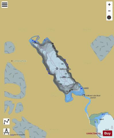
Chilkoot Lake Fishing Map Stats | |
| Title | Chilkoot Lake |
| Scale | 1:12000 |
| Counties | Haines |
| Nearby Cities | Haines, Port Chilkoot, Klukwan, Skagway, Excursion Inlet, Gustavus |
| Area * | 1756.55 acres |
| Shoreline * | 11.43 miles |
| Min Longitude | -135.64 |
| Min Latitude | 59.33 |
| Max Longitude | -135.56 |
| Max Latitude | 59.38 |
| Edition Label 1 | |
| Edition Label 2 | |
| Edition Label 3 | |
| Id | US_AA_AK_chilkoot_lake__ak |
| Country | US |
| Projection | Mercator |
| * some Stats may include nearby/connecting waterbodies | |
|