Quesnel Lake fishing map is included in Lakes and Rivers of British Columbia nautical charts folio. It is available as part of iBoating : Canada Marine & Fishing App (now supported on multiple platforms including Android, iPhone/iPad, MacBook, and Windows(tablet and phone)/PC based chartplotter. ).
With our Lake Maps App, you get all the great marine chart app features like fishing spots, along with Quesnel Lake depth map. The fishing maps app include HD lake depth contours, along with advanced features found in Fish Finder / Gps Chart Plotter systems, turning your device into a Depth Finder. The Quesnel Lake Navigation App provides advanced features of a Marine Chartplotter including adjusting water level offset and custom depth shading. Fishing spots and depth contours layers are available in most Lake maps. Lake navigation features include advanced instrumentation to gather wind speed direction, water temperature, water depth, and accurate GPS with AIS receivers(using NMEA over TCP/UDP). Autopilot support can be enabled during ‘Goto WayPoint’ and ‘Route Assistance’.
Now i-Boating supports Fishing Points in Quesnel Lake.
Have more questions about the Nautical Chart App? Ask us.
Fishing Info for Quesnel Lake
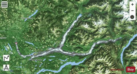
Quesnel Lake /kwɪˈnɛl/ is a glacial lake or fjord in British Columbia, Canada, and is the major tributary of the Fraser River. With a maximum depth of 511 m (1,677 ft), it is claimed to be the deepest fjord lake in the world, the deepest lake in BC, and the third-deepest lake in North America, after Great Slave Lake and Crater Lake. On August 4, 2014, the tailings pond of Mount Polley mine burst, spilling tailings into Polley Lake and Quesnel Lake and temporarily depriving residents of Likely, British Columbia, of fresh water for household use. In 2017, the Mount Polley mine was granted a permit to discharge mine wastewater into Quesnel Lake. Forestry, mining and fishing are popular in this area. Quesnel Lake is also a trophy lake because live bait or barbed hooks are not allowed. Catch-and-release restrictions apply to Steelhead fish shorter than 10 cm or longer than 50 cm. Rainbow trout, Dolly Varden and other species of lake trouts are common. Fish habitats established in Hazeltine creek are supporting the trout population in local waterways include in Quesnel lake. Quesnel lake offers the ability to fish right from shore and along tributary streams, or to explore the lake by boat, kayak, canoe, or paddleboard during the summer months.
More on Wikipedia...Popular fish species in this lake include Rainbow trout.
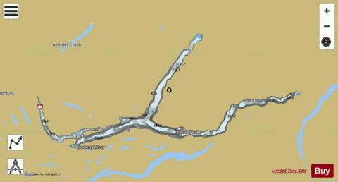
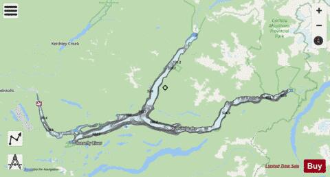
Quesnel Lake Fishing Map Stats | |
| Title | Quesnel Lake |
| Scale | 1:24000 |
| Districts | Cariboo |
| Nearby Cities | Williams Lake, One Hundred Mile House |
| Area * | 67142.13 acres |
| Shoreline * | 206.04 miles |
| Min Longitude | -121.55 |
| Min Latitude | 52.46 |
| Max Longitude | -120.35 |
| Max Latitude | 52.78 |
| Edition Label 1 | |
| Edition Label 2 | |
| Edition Label 3 | |
| Id | CA_BC_CA_BC_Quesnel |
| Country | CA |
| Projection | Mercator |
| * some Stats may include nearby/connecting waterbodies | |
|