Lake Monomonac fishing map is available as part of iBoating : USA Marine & Fishing App(now supported on multiple platforms including Android, iPhone/iPad, MacBook, and Windows(tablet and phone)/PC based chartplotter.).
With our Lake Maps App, you get all the great marine chart app features like fishing spots, along with Lake Monomonac depth map. The fishing maps app include HD lake depth contours, along with advanced features found in Fish Finder / Gps Chart Plotter systems, turning your device into a Depth Finder. The Lake Monomonac Navigation App provides advanced features of a Marine Chartplotter including adjusting water level offset and custom depth shading. Fishing spots and depth contours layers are available in most Lake maps. Lake navigation features include advanced instrumentation to gather wind speed direction, water temperature, water depth, and accurate GPS with AIS receivers(using NMEA over TCP/UDP). Autopilot support can be enabled during ‘Goto WayPoint’ and ‘Route Assistance’.
Now i-Boating supports Fishing Points in Lake Monomonac.
Have more questions about the Nautical Chart App? Ask us.
Fishing Info for Lake Monomonac
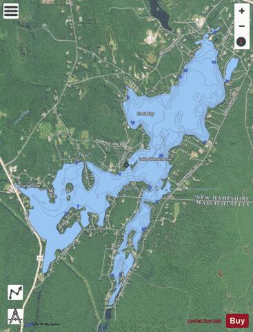
Lake Monomonac is an artificial lake that straddles the border between Rindge, New Hampshire, and Winchendon, Massachusetts, in the United States. It was created from a small pond in New Hampshire by the construction of dams on the North Branch of the Millers River, a part of the Connecticut River watershed. Lake Monomonac is 594 acres (240 ha) in size, with 411 acres (166 ha) in New Hampshire and the remaining 183 acres (74 ha) in Massachusetts. The lake has a maximum recorded depth of 22 feet (6.7 m) and an average depth of 10 feet (3.0 m). The lake is classified as a warmwater fishery, with observed species including smallmouth and largemouth bass, black crappie, chain pickerel, white perch, pumpkinseed, bluegill, horned pout, and green sunfish.
More on Wikipedia...Popular fish species in this lake include Black crappie, Brown bullhead, Chain pickerel, Green sunfish, Largemouth bass, Pumpkinseed and Smallmouth bass.
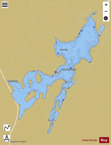
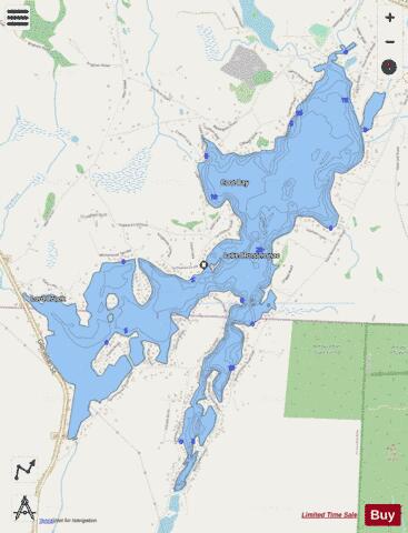
Lake Monomonac Fishing Map Stats | |
| Title | Lake Monomonac |
| Scale | 1:3000 |
| Counties | Worcester, Cheshire |
| Nearby Cities | Rindge, Winchendon, Jaffrey, Sharon, South Ashburnham, Ashburnham, Baldwinville, Gardner, New Ipswich, Peterborough |
| Area * | 593.57 acres |
| Shoreline * | 15.03 miles |
| Min Longitude | -72.02 |
| Min Latitude | 42.70 |
| Max Longitude | -71.98 |
| Max Latitude | 42.73 |
| Edition Label 1 | |
| Edition Label 2 | |
| Edition Label 3 | |
| Id | US_NH_00609942 |
| Country | US |
| Projection | Mercator |
| * some Stats may include nearby/connecting waterbodies | |
|