Devils Lake fishing map is available as part of iBoating : USA Marine & Fishing App(now supported on multiple platforms including Android, iPhone/iPad, MacBook, and Windows(tablet and phone)/PC based chartplotter.).
With our Lake Maps App, you get all the great marine chart app features like fishing spots, along with Devils Lake depth map. The fishing maps app include HD lake depth contours, along with advanced features found in Fish Finder / Gps Chart Plotter systems, turning your device into a Depth Finder. The Devils Lake Navigation App provides advanced features of a Marine Chartplotter including adjusting water level offset and custom depth shading. Fishing spots and depth contours layers are available in most Lake maps. Lake navigation features include advanced instrumentation to gather wind speed direction, water temperature, water depth, and accurate GPS with AIS receivers(using NMEA over TCP/UDP). Autopilot support can be enabled during ‘Goto WayPoint’ and ‘Route Assistance’.
Now i-Boating supports Fishing Points in Devils Lake.
Have more questions about the Nautical Chart App? Ask us.
Fishing Info for Devils Lake
Devils Lake is a lake in the U.S. state of North Dakota. It is the largest natural body of water and the second-largest body of water in North Dakota after Lake Sakakawea. It can reach a level of 1,458 ft (444 m) before naturally flowing into the Sheyenne River via the . On June 27, 2011, it reached an unofficial historical high elevation of 1,454.3 ft (443.3 m). The cities of Devil's Lake and Minnewaukan take their name from the lake as does the Spirit Lake Reservation, which is located on the lake's southern shores.
More on Wikipedia...Popular fish species in this lake include Common carp, Northern pike and Walleye.
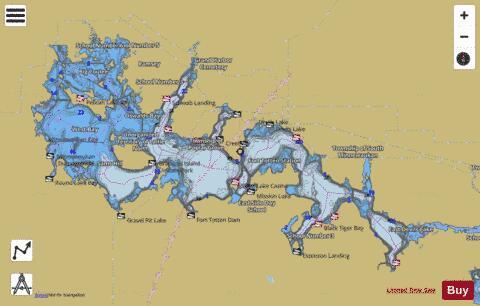
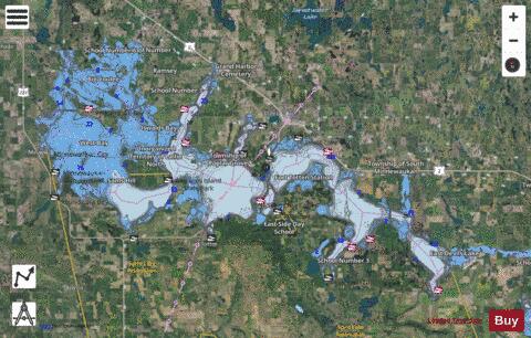
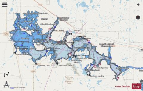
Devils Lake Fishing Map Stats | |
| Title | Devils Lake |
| Scale | 1:48000 |
| Counties | Benson, Ramsey |
| Nearby Cities | Lakewood Park, Minnewaukan, Fort Totten, Tokio, Devils Lake, Crary, Warwick, Churchs Ferry, Brinsmade, Oberon |
| Area * | 110763.24 acres |
| Shoreline * | 531.01 miles |
| Min Longitude | -99.27 |
| Min Latitude | 47.91 |
| Max Longitude | -98.53 |
| Max Latitude | 48.19 |
| Edition Label 1 | |
| Edition Label 2 | |
| Edition Label 3 | |
| Id | US_ND_275 |
| Country | US |
| Projection | Mercator |
| * some Stats may include nearby/connecting waterbodies | |
|