Harriet fishing map is available as part of iBoating : USA Marine & Fishing App(now supported on multiple platforms including Android, iPhone/iPad, MacBook, and Windows(tablet and phone)/PC based chartplotter.).
With our Lake Maps App, you get all the great marine chart app features like fishing spots, along with Harriet lake depth map. The fishing maps app include HD lake depth contours, along with advanced features found in Fish Finder / Gps Chart Plotter systems, turning your device into a Depth Finder. The Harriet Navigation App provides advanced features of a Marine Chartplotter including adjusting water level offset and custom depth shading. Fishing spots and depth contours layers are available in most Lake maps. Lake navigation features include advanced instrumentation to gather wind speed direction, water temperature, water depth, and accurate GPS with AIS receivers(using NMEA over TCP/UDP). Autopilot support can be enabled during ‘Goto WayPoint’ and ‘Route Assistance’.
Now i-Boating supports Fishing Points in Harriet.
Have more questions about the Nautical Chart App? Ask us.
Fishing Info for Harriet
Lake Harriet (Dakota: Bdé Umáŋ, "Other Lake") is a lake in the southwest part of Minneapolis, just south of Bde Maka Ska and north of Minnehaha Creek. The lake is surrounded by parkland as part of the Minneapolis Chain of Lakes. The lake has an area of 335 acres (1.36 km2) and a maximum depth of 85 feet (26 m).
More on Wikipedia...Popular fish species in this lake include Black crappie, Golden shiner, Green sunfish, Lake sturgeon, Largemouth bass, Northern pike, Pumpkinseed, Walleye, White sucker, Yellow bullhead and Yellow perch.
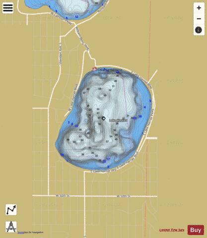
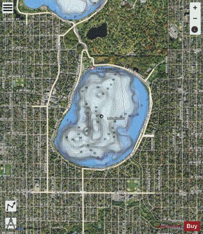
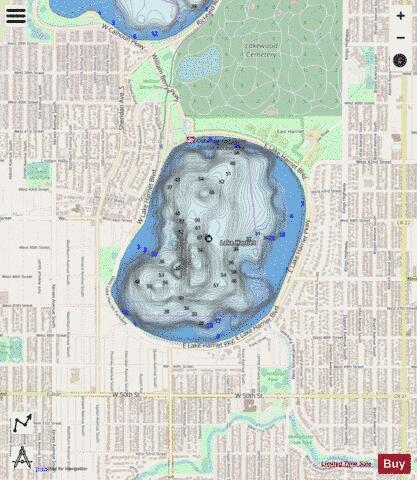
Harriet Fishing Map Stats | |
| Title | Harriet |
| Sailing Clubs in this Chart region | |
| Lake Harriet Yacht Club | |
| Scale | 1:6000 |
| Counties | Hennepin |
| Nearby Cities | Richfield, Saint Louis Park, Edina, Minneapolis, Bloomington, Golden Valley, Hopkins, Robbinsdale, Lauderdale, Crystal |
| Area * | 341.49 acres |
| Shoreline * | 2.70 miles |
| Min Longitude | -93.31 |
| Min Latitude | 44.92 |
| Max Longitude | -93.30 |
| Max Latitude | 44.93 |
| Edition Label 1 | |
| Edition Label 2 | |
| Edition Label 3 | |
| Id | US_MN_27001600 |
| Country | US |
| Projection | Mercator |
| * some Stats may include nearby/connecting waterbodies | |
|