Quabbin Reservoir fishing map is available as part of iBoating : USA Marine & Fishing App(now supported on multiple platforms including Android, iPhone/iPad, MacBook, and Windows(tablet and phone)/PC based chartplotter.).
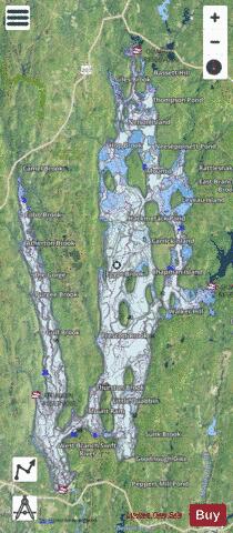
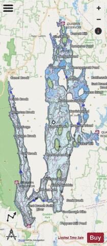
With our Lake Maps App, you get all the great marine chart app features like fishing spots, along with Quabbin Reservoir depth map. The fishing maps app include HD lake depth contours, along with advanced features found in Fish Finder / Gps Chart Plotter systems, turning your device into a Depth Finder. The Quabbin Reservoir Navigation App provides advanced features of a Marine Chartplotter including adjusting water level offset and custom depth shading. Fishing spots and depth contours layers are available in most Lake maps. Lake navigation features include advanced instrumentation to gather wind speed direction, water temperature, water depth, and accurate GPS with AIS receivers(using NMEA over TCP/UDP). Autopilot support can be enabled during ‘Goto WayPoint’ and ‘Route Assistance’.
Now i-Boating supports Fishing Points in Quabbin Reservoir.
Have more questions about the Nautical Chart App? Ask us.
Fishing Info for Quabbin Reservoir
The Quabbin Reservoir is the largest inland body of water in Massachusetts, and was built between 1930 and 1939. Along with the Wachusett Reservoir, it is the primary water supply for Boston, 65 miles (105 km) to the east, and 40 other cities and towns in Greater Boston. The Quabbin also supplies water to three towns west of the reservoir and acts as backup supply for three others. By 1989, it supplied water for 2.5 million people, about 40% of the state's population at the time. It has an aggregate capacity of 412 billion US gallons (1,560 GL) and an area of 38.6 square miles (99.9 km2).
More on Wikipedia...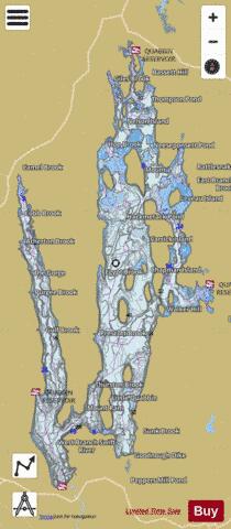
Quabbin Reservoir Fishing Map Stats | |
| Title | Quabbin Reservoir |
| Scale | 1:12000 |
| Counties | Franklin, Hampshire, Worcester |
| Nearby Cities | New Salem, Pelham, Shutesbury, Belchertown, Hardwick, Ware, Orange, Bondsville, Petersham, Wendell |
| Area * | 23932.24 acres |
| Shoreline * | 148.50 miles |
| Min Longitude | -72.38 |
| Min Latitude | 42.28 |
| Max Longitude | -72.24 |
| Max Latitude | 42.52 |
| Edition Label 1 | |
| Edition Label 2 | |
| Edition Label 3 | |
| Id | US_MA_00619370 |
| Country | US |
| Projection | Mercator |
| * some Stats may include nearby/connecting waterbodies | |
|