Hillsdale Reservoir fishing map is available as part of iBoating : USA Marine & Fishing App(now supported on multiple platforms including Android, iPhone/iPad, MacBook, and Windows(tablet and phone)/PC based chartplotter.).
With our Lake Maps App, you get all the great marine chart app features like fishing spots, along with Hillsdale Reservoir depth map. The fishing maps app include HD lake depth contours, along with advanced features found in Fish Finder / Gps Chart Plotter systems, turning your device into a Depth Finder. The Hillsdale Reservoir Navigation App provides advanced features of a Marine Chartplotter including adjusting water level offset and custom depth shading. Fishing spots and depth contours layers are available in most Lake maps. Lake navigation features include advanced instrumentation to gather wind speed direction, water temperature, water depth, and accurate GPS with AIS receivers(using NMEA over TCP/UDP). Autopilot support can be enabled during ‘Goto WayPoint’ and ‘Route Assistance’.
Now i-Boating supports Fishing Points in Hillsdale Reservoir.
Have more questions about the Nautical Chart App? Ask us.
Fishing Info for Hillsdale Reservoir
Hillsdale Lake is a reservoir located in the northwestern part of Miami County, in northeast Kansas and the central United States; it is approximately 30 mi (48 km) from Kansas City. The surface area of the lake is approximately 4,580 acres (18.5 km2), and the lake has a maximum depth of approximately 57 ft (17 m). Hillsdale Dam, impounding the Big Bull Creek to create the V-shaped reservoir, was completed in 1982 as a flood control project of the United States Army Corps of Engineers. Fix link* The reservoir has a normal storage capacity of 76,000 acre-feet. No hydroelectric power is generated by the earthen dam. Recreational facilities include Hillsdale State Park, opened in 1994.
More on Wikipedia...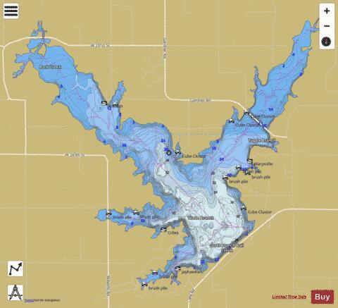
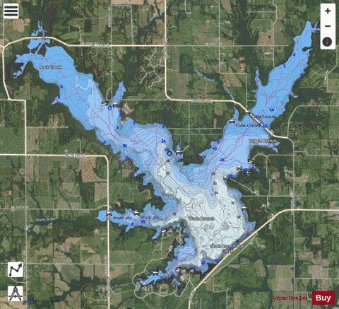
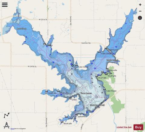
Hillsdale Reservoir Fishing Map Stats | |
| Title | Hillsdale Reservoir |
| Scale | 1:12000 |
| Counties | Miami |
| Nearby Cities | Hillsdale, Spring Hill, Edgerton, Paola, Wagstaff, Wellsville, Gardner, Clare, Chiles, Osawatomie |
| Area * | 4543.38 acres |
| Shoreline * | 47.24 miles |
| Min Longitude | -94.98 |
| Min Latitude | 38.64 |
| Max Longitude | -94.87 |
| Max Latitude | 38.72 |
| Edition Label 1 | |
| Edition Label 2 | |
| Edition Label 3 | |
| Id | US_KS_hillsdale |
| Country | US |
| Projection | Mercator |
| * some Stats may include nearby/connecting waterbodies | |
|