Grayson Lake fishing map is available as part of iBoating : USA Marine & Fishing App(now supported on multiple platforms including Android, iPhone/iPad, MacBook, and Windows(tablet and phone)/PC based chartplotter.).
With our Lake Maps App, you get all the great marine chart app features like fishing spots, along with Grayson Lake depth map. The fishing maps app include HD lake depth contours, along with advanced features found in Fish Finder / Gps Chart Plotter systems, turning your device into a Depth Finder. The Grayson Lake Navigation App provides advanced features of a Marine Chartplotter including adjusting water level offset and custom depth shading. Fishing spots and depth contours layers are available in most Lake maps. Lake navigation features include advanced instrumentation to gather wind speed direction, water temperature, water depth, and accurate GPS with AIS receivers(using NMEA over TCP/UDP). Autopilot support can be enabled during ‘Goto WayPoint’ and ‘Route Assistance’.
Now i-Boating supports Fishing Points in Grayson Lake.
Have more questions about the Nautical Chart App? Ask us.
Fishing Info for Grayson Lake
Grayson Lake is a 1,500-acre (6.1 km2) reservoir in Carter and Elliott counties in Kentucky. It was created by the United States Army Corps of Engineers in 1968 by impounding the Little Sandy River with the Grayson Dam, an earthen structure 120 feet high, creating a maximum capacity of 118,990 acre-feet. Sections of Kentucky Route 7 were re-routed as a result of the lake's creation. KY 7 now traverses a modern highway stretch around the park, crossing the dam also. The lake is the major attraction of Grayson Lake State Park.
More on Wikipedia...
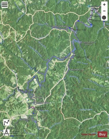

Grayson Lake Fishing Map Stats | |
| Title | Grayson Lake |
| Scale | 1:3000 |
| Counties | Carter, Elliott |
| Nearby Cities | Bruin, Newfoundland, Sandy Hook, Hitchins, Willard, Grayson, Webbville, Mazie, Olive Hill, Moon |
| Area * | 1217.51 acres |
| Shoreline * | 75.34 miles |
| Min Longitude | -83.11 |
| Min Latitude | 38.12 |
| Max Longitude | -82.97 |
| Max Latitude | 38.25 |
| Edition Label 1 | |
| Edition Label 2 | |
| Edition Label 3 | |
| Id | US_HH_KY_00493224 |
| Country | US |
| Projection | Mercator |
| * some Stats may include nearby/connecting waterbodies | |
|