LAKE HOLLINGSWORTH fishing map is available as part of iBoating : USA Marine & Fishing App(now supported on multiple platforms including Android, iPhone/iPad, MacBook, and Windows(tablet and phone)/PC based chartplotter.).
With our Lake Maps App, you get all the great marine chart app features like fishing spots, along with LAKE HOLLINGSWORTH depth map. The fishing maps app include HD lake depth contours, along with advanced features found in Fish Finder / Gps Chart Plotter systems, turning your device into a Depth Finder. The LAKE HOLLINGSWORTH Navigation App provides advanced features of a Marine Chartplotter including adjusting water level offset and custom depth shading. Fishing spots and depth contours layers are available in most Lake maps. Lake navigation features include advanced instrumentation to gather wind speed direction, water temperature, water depth, and accurate GPS with AIS receivers(using NMEA over TCP/UDP). Autopilot support can be enabled during ‘Goto WayPoint’ and ‘Route Assistance’.
Now i-Boating supports Fishing Points in LAKE HOLLINGSWORTH.
Have more questions about the Nautical Chart App? Ask us.
Fishing Info for LAKE HOLLINGSWORTH
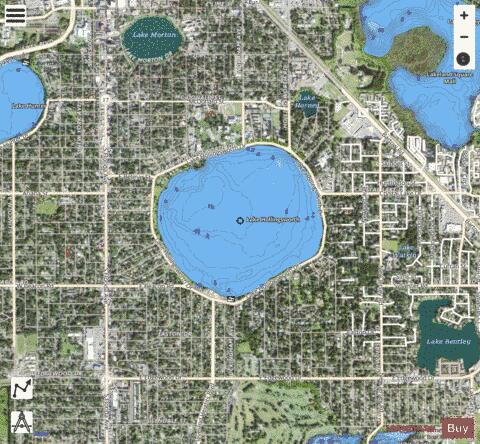
Lake Hollingsworth is a lake located near the center of the City of Lakeland, Florida. Its area is 350 acres (1.4 km2). The lake is located just east of South Florida Avenue and west of Bartow Road. Lake Hollingsworth Drive and a path for biking and walking known as the Lake-to-Lake Trail are located along the entire circumference of the lake. Florida Southern College is located on the north side of the lake, and from the path, an observer can see several of the buildings on campus designed by famed architect Frank Lloyd Wright. The lake is also a popular site for birdwatching, and some of the most commonly seen birds are roseate spoonbills, white pelicans, black-bellied plovers, and long-billed dowitchers. Lake Hollingsworth bears the name of John Henry Hollingsworth, a pioneer who settled there.
More on Wikipedia...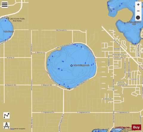
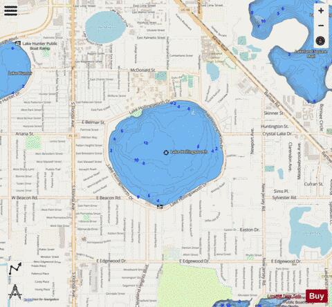
LAKE HOLLINGSWORTH Fishing Map Stats | |
| Title | LAKE HOLLINGSWORTH |
| Scale | 1:6000 |
| 1 ft Depth Contours for Anglers | Yes |
| Counties | Polk |
| Nearby Cities | Lakeland, Eaton Park, Medulla, Winston, Highland City, Gibsonia, Kathleen, Fuller Heights, Mulberry, Providence |
| Area * | 354.02 acres |
| Shoreline * | 2.77 miles |
| Min Longitude | -81.95 |
| Min Latitude | 28.02 |
| Max Longitude | -81.94 |
| Max Latitude | 28.03 |
| Edition Label 1 | |
| Edition Label 2 | |
| Edition Label 3 | |
| Id | US_FL_00284163 |
| Country | US |
| Projection | Mercator |
| * some Stats may include nearby/connecting waterbodies | |
|