Quartz fishing map is available as part of iBoating : USA Marine & Fishing App(now supported on multiple platforms including Android, iPhone/iPad, MacBook, and Windows(tablet and phone)/PC based chartplotter.).
With our Lake Maps App, you get all the great marine chart app features like fishing spots, along with Quartz lake depth map. The fishing maps app include HD lake depth contours, along with advanced features found in Fish Finder / Gps Chart Plotter systems, turning your device into a Depth Finder. The Quartz Navigation App provides advanced features of a Marine Chartplotter including adjusting water level offset and custom depth shading. Fishing spots and depth contours layers are available in most Lake maps. Lake navigation features include advanced instrumentation to gather wind speed direction, water temperature, water depth, and accurate GPS with AIS receivers(using NMEA over TCP/UDP). Autopilot support can be enabled during ‘Goto WayPoint’ and ‘Route Assistance’.
Now i-Boating supports Fishing Points in Quartz.
Have more questions about the Nautical Chart App? Ask us.
Fishing Info for Quartz
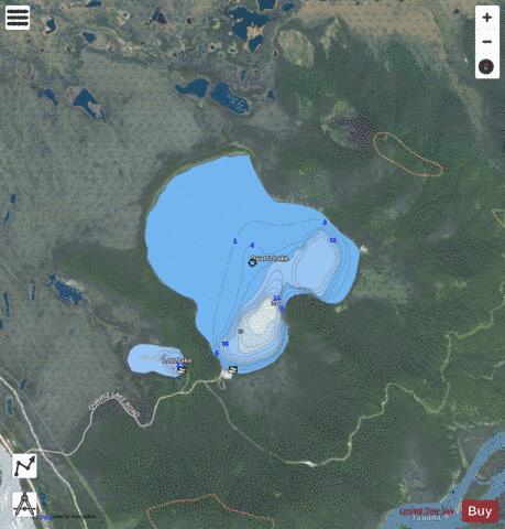
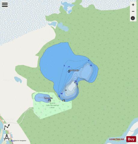
Quartz Lake is a mid-sized lake about 10 mi (16 km) north of Delta Junction, Alaska. It was named Quartz Lake by early mineral prospectors in the area. Much of the lake shore is private property but the Quartz Lake State Recreation Area is also located on the lake via a short access road from the Richardson Highway. The recreation area has campgrounds, hiking trails, public use cabins, and access to both Quartz Lake and nearby Little Lost Lake. The lake is fairly shallow in most places, even if well offshore, but has a few deeper areas as well. It is stocked with rainbow trout, Arctic char and salmon. Stocking is partially funded by the Sportfish Restoration Program, which uses tax money from the purchase of fishing equipment and boating fuels to fund hatchery programs.
More on Wikipedia...Popular fish species in this lake include Arctic char and Rainbow trout.
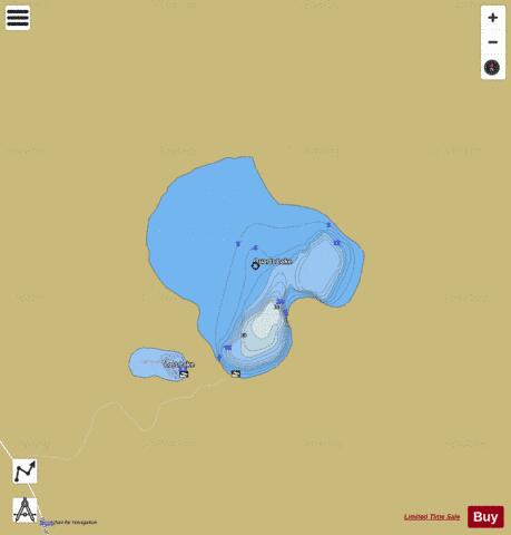
Quartz Fishing Map Stats | |
| Title | Quartz |
| Scale | 1:12000 |
| Counties | Southeast Fairbanks |
| Nearby Cities | Big Delta, Delta Junction, Donnelly, Deltana, Chena Hot Springs, Harding Lake |
| Area * | 1493.67 acres |
| Shoreline * | 6.49 miles |
| Min Longitude | -145.85 |
| Min Latitude | 64.20 |
| Max Longitude | -145.79 |
| Max Latitude | 64.23 |
| Edition Label 1 | |
| Edition Label 2 | |
| Edition Label 3 | |
| Id | US_AK_ak_reg3_quartzcontours_meters |
| Country | US |
| Projection | Mercator |
| * some Stats may include nearby/connecting waterbodies | |
|