Watchaug Pond fishing map is available as part of iBoating : USA Marine & Fishing App(now supported on multiple platforms including Android, iPhone/iPad, MacBook, and Windows(tablet and phone)/PC based chartplotter.).
With our Lake Maps App, you get all the great marine chart app features like fishing spots, along with Watchaug Pond depth map. The fishing maps app include HD lake depth contours, along with advanced features found in Fish Finder / Gps Chart Plotter systems, turning your device into a Depth Finder. The Watchaug Pond Navigation App provides advanced features of a Marine Chartplotter including adjusting water level offset and custom depth shading. Fishing spots and depth contours layers are available in most Lake maps. Lake navigation features include advanced instrumentation to gather wind speed direction, water temperature, water depth, and accurate GPS with AIS receivers(using NMEA over TCP/UDP). Autopilot support can be enabled during ‘Goto WayPoint’ and ‘Route Assistance’.
Now i-Boating supports Fishing Points in Watchaug Pond.
Have more questions about the Nautical Chart App? Ask us.
Fishing Info for Watchaug Pond
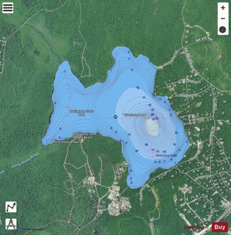
Watchaug Pond is a kettle pond (lake) located in southern Rhode Island, in the town of Charlestown. It is surrounded by the John Vincent Gormley 8-mile loop trail which was dedicated by Senator Jack Reed in 1999. The Vin Gormley trail is the second to last leg of the North-South Trail that transects the state. In addition it is near the Audubon Society's Kimball Wildlife Refuge. The 573-acre (2.32 km2) pond is within 3,000 acres (12 km2) of public land. There is a public cement boat ramp on Sanctuary Road. The Kettle Pond Visitor Center, operated by U.S. Fish and Wildlife Service and the Rhode Island National Wildlife Refuge, hosts school field trips and educational programs about the pond's flora, fauna and habitats.
More on Wikipedia...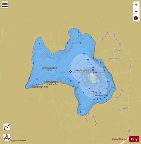
Watchaug Pond Fishing Map Stats | |
| Title | Watchaug Pond |
| Scale | 1:12000 |
| Counties | Washington |
| Nearby Cities | Bradford, Charlestown, Quonochontaug, Carolina, Weekapaug, Ashaway, Hopkinton, Hope Valley, Westerly, Wyoming |
| Area * | 574.25 acres |
| Shoreline * | 5.21 miles |
| Min Longitude | -71.71 |
| Min Latitude | 41.37 |
| Max Longitude | -71.68 |
| Max Latitude | 41.39 |
| Edition Label 1 | |
| Edition Label 2 | |
| Edition Label 3 | |
| Id | US_AA_RI_01217669 |
| Country | US |
| Projection | Mercator |
| * some Stats may include nearby/connecting waterbodies | |
|