Lefferts Lake fishing map is available as part of iBoating : USA Marine & Fishing App(now supported on multiple platforms including Android, iPhone/iPad, MacBook, and Windows(tablet and phone)/PC based chartplotter.).
With our Lake Maps App, you get all the great marine chart app features like fishing spots, along with Lefferts Lake depth map. The fishing maps app include HD lake depth contours, along with advanced features found in Fish Finder / Gps Chart Plotter systems, turning your device into a Depth Finder. The Lefferts Lake Navigation App provides advanced features of a Marine Chartplotter including adjusting water level offset and custom depth shading. Fishing spots and depth contours layers are available in most Lake maps. Lake navigation features include advanced instrumentation to gather wind speed direction, water temperature, water depth, and accurate GPS with AIS receivers(using NMEA over TCP/UDP). Autopilot support can be enabled during ‘Goto WayPoint’ and ‘Route Assistance’.
Now i-Boating supports Fishing Points in Lefferts Lake.
Have more questions about the Nautical Chart App? Ask us.
Fishing Info for Lefferts Lake
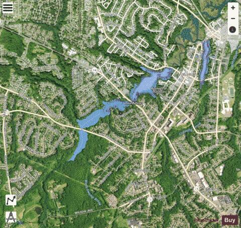
Lake Lefferts (Latitude: 40.414552, Longitude: -74.234589) is an engineered lake in Matawan, New Jersey. The lake is the result of the construction in 1928 of Lake Lefferts Dam, which captured and stored the flow of Matawan Creek. The lake is home to sunnies (sunfish), bluegill, crappies, bass, catfish, and pickerel. Near Ravine Drive is a recreational outdoor area, which includes a public fishing dock, boat launch, and canoe rental. Near Route 34 is MJ's at Buttonwood Manor, which is a sports bar, dining room, and catering facility.
More on Wikipedia...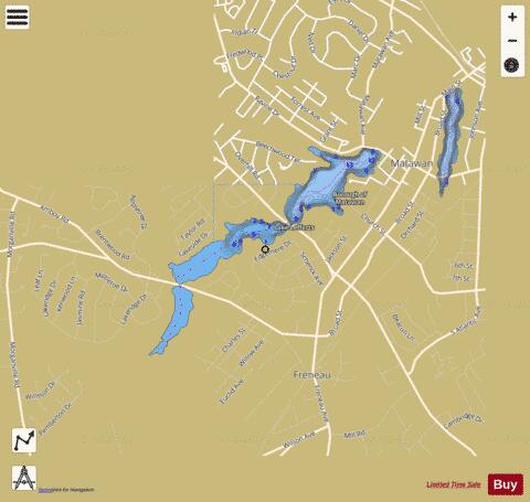
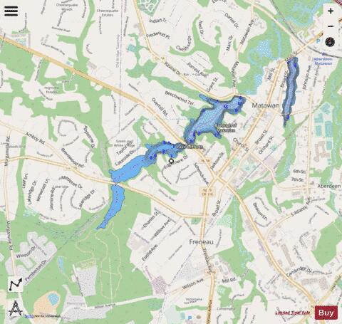
Lefferts Lake Fishing Map Stats | |
| Title | Lefferts Lake |
| Scale | 1:6000 |
| Counties | Middlesex, Monmouth |
| Nearby Cities | Matawan, Cliffwood, Strathmore, Morganville, Cliffwood Beach, Keyport, Hazlet, Laurence Harbor, Wickatunk, Browntown |
| Area * | 75.47 acres |
| Shoreline * | 3.95 miles |
| Min Longitude | -74.25 |
| Min Latitude | 40.40 |
| Max Longitude | -74.23 |
| Max Latitude | 40.42 |
| Edition Label 1 | |
| Edition Label 2 | |
| Edition Label 3 | |
| Id | US_AA_NJ_lefferts_lake_nj |
| Country | US |
| Projection | Mercator |
| * some Stats may include nearby/connecting waterbodies | |
|