รyeren fishing map is included in รstfold nautical charts folio. It is available as part of iBoating : Norway Marine & Fishing App (now supported on multiple platforms including Android, iPhone/iPad, MacBook, and Windows(tablet and phone)/PC based chartplotter. ).
With our Lake Maps App, you get all the great marine chart app features like fishing spots, along with รyeren lake depth map. The fishing maps app include HD lake depth contours, along with advanced features found in Fish Finder / Gps Chart Plotter systems, turning your device into a Depth Finder. The รyeren Navigation App provides advanced features of a Marine Chartplotter including adjusting water level offset and custom depth shading. Fishing spots and depth contours layers are available in most Lake maps. Lake navigation features include advanced instrumentation to gather wind speed direction, water temperature, water depth, and accurate GPS with AIS receivers(using NMEA over TCP/UDP). Autopilot support can be enabled during โGoto WayPointโ and โRoute Assistanceโ.
Have more questions about the Nautical Chart App? Ask us.
Fishing Info for รyeren
รyeren is a lake in the Glomma River watershed, southeast of Lillestrรธm. It is located within the municipalities of Enebakk, Skedsmo, Fet, and Rรฆlingen in Akershus county and Spydeberg and Trรธgstad municipalities in รstfold county. Lake รyeren is the ninth largest lake by area in Norway with a surface area of 84.7 square kilometers (32.7 square miles). It is 101 meters (331 feet) above sea level and 71 meters (233 feet) deep.
More on Wikipedia...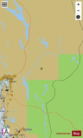
รyeren Fishing Map Stats | |
| Title | รyeren |
| Scale | 1:24000 |
| Min Longitude | 11.08 |
| Min Latitude | 59.64 |
| Max Longitude | 12.05 |
| Max Latitude | 60.44 |
| Edition Label 1 | |
| Edition Label 2 | |
| Edition Label 3 | |
| Id | NO_LK_M_113 |
| Country | Norway |
| Projection | Mercator |
| * some Stats may include nearby/connecting waterbodies | |
| |||||||||||||||||||||||||||||||||||||||||||||||||||||||||||||||||||||||||||||||||||||||||||||||||||||||
|