New! i-Hunting Topo Maps now available -  

iPhone / iPad Marine Navigation App  and WMTS App are now available -  

New! Macbook ChartPlotter, and Windows Marine Navigation App now available -  
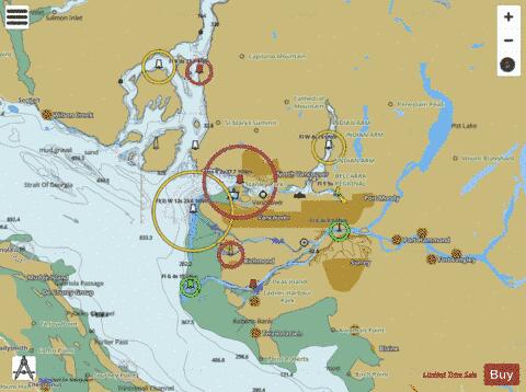
Greater Vancouver District Fishing Maps

Looking for fishing distinations in Greater Vancouver District? Our app supports the following lake maps in Greater Vancouver District. If marine chart / fishing map you are looking for is not listed in correct folio, please let us know.

Lake / Marine Chart TitleScale
Alouette Lake1:24000
Blaney Lake1:6000
Buntzen Lake1:12000
Burnaby Lake1:6000
Como Lake1:6000
Cypress Lake1:6000
Deer Lake1:6000
Killarney Lake1:6000
Latimer Pond1:6000
Mike Lake1:6000
Munday Lake1:6000
Norton Lake1:6000
Pinetree Gravel Pit (Lafarge) Lake1:6000
Placid Lake1:6000
Sasamat Lake1:6000
Whonnock Lake1:6000
Widgeon Lake1:12000
Fraser River (Derby Reach Regional Park, Maple Ridge) - Inland / Approach Chart (1:20,000)1:20000
Fraser River (Pacific Reach, Surrey) - Inland / Approach Chart (1:20,000)1:20000
Hatzic Lake (Mission) - Inland / Approach Chart (1:20,000)1:20000
Pitt Lake (Goose Island) - Inland / Approach Chart (1:25,000)1:25000
Pitt Lake (Temporary Boat Trailer Parking, Port Coquitlam) - Inland / Approach Chart (1:25,000)1:25000
Burrard Inlet (Grey Rocks Island) - Harbour Chart (1:8,000)1:8000
Burrard Inlet (Harbour Cruises, West Vancouver) - Harbour Chart (1:12,000)1:12000
Burrard Inlet (Heritage Harbour, Blue Pacific Yacht Charters, Vancouver) - Harbour Chart (1:8,000)1:8000
Burrard Inlet (Horseshoe Bay Public Dock, BC Ferries, West Vancouver) - Harbour Chart (1:12,000)1:12000
Burrard Inlet (Port Moody) - Harbour Chart (1:8,000)1:8000
Burrard Inlet (Second Narrows Bridge, TransLink SeaBus, North Vancouver) - Harbour Chart (1:8,000)1:8000
Burrard Inlet (Second Narrows Bridge, Vancouver) - Harbour Chart (1:8,000)1:8000
Burrard Inlet (Temporary Boat Trailer Parking, Valley Towing, Port Moody) - Harbour Chart (1:8,000)1:8000
Burrard Inlet (Third Narrows, New Westminster) - Harbour Chart (1:8,000)1:8000
Drayton Harbor1:30000
Drayton Harbor, WA1:12000
Fraser River (Derby Reach Regional Park, Maple Ridge) - Inland / Approach Chart (1:22,000)1:22000
Fraser River (Port Coquitlam) - Inland / Approach Chart (1:22,000)1:22000
Howe Sound (Ekins Point Outstation, BC Ferries, Squamish) - Inland / Approach Chart (1:45,000)1:45000
Navigational Sector (Surrey) - Inland / Approach Chart (1:22,000)1:22000
Parsons Channel (Derby Reach Regional Park, Maple Ridge) - Inland / Approach Chart (1:22,000)1:22000
Parsons Channel (Ministry of Transportation and Infrastructure, Pitt Meadows) - Inland / Approach Chart (1:22,000)1:22000
Semiahmoo Bay, WA1:12000
Silvermere Lake (Crescent Island) - Inland / Approach Chart (1:22,000)1:22000
South Arm Fraser River (Government Dock, Richmond) - Inland / Approach Chart (1:22,000)1:22000
South Arm Fraser River (New Westminster) - Inland / Approach Chart (1:22,000)1:22000
Strait of Georgia1:45000
Strait of Georgia (Government Dock, Delta) - Inland / Approach Chart (1:22,000)1:22000
Strait of Georgia - Harbour Chart (1:12,000)1:12000
Strait of Georgia - Inland / Approach Chart (1:22,000)1:22000
Strait of Georgia (Mud Bay Dock, BC Ferries- Gabriola Island, Nanaimo) - Inland / Approach Chart (1:45,000)1:45000
Strait of Georgia (Passage Island, BC Ferries, Passage Island) - Harbour Chart (1:12,000)1:12000
Strait of Georgia (Richmond) - Inland / Approach Chart (1:22,000)1:22000
Strait of Georgia (Westham Island) - Inland / Approach Chart (1:22,000)1:22000
Strait of Georgia (West Vancouver) - Inland / Approach Chart (1:22,000)1:22000
Greater Vancouver District Fishing App
Greater Vancouver Map - i-Fishing App