Alouette Lake fishing map is included in Lakes and Rivers of British Columbia nautical charts folio. It is available as part of iBoating : Canada Marine & Fishing App (now supported on multiple platforms including Android, iPhone/iPad, MacBook, and Windows(tablet and phone)/PC based chartplotter. ).
With our Lake Maps App, you get all the great marine chart app features like fishing spots, along with Alouette Lake depth map. The fishing maps app include HD lake depth contours, along with advanced features found in Fish Finder / Gps Chart Plotter systems, turning your device into a Depth Finder. The Alouette Lake Navigation App provides advanced features of a Marine Chartplotter including adjusting water level offset and custom depth shading. Fishing spots and depth contours layers are available in most Lake maps. Lake navigation features include advanced instrumentation to gather wind speed direction, water temperature, water depth, and accurate GPS with AIS receivers(using NMEA over TCP/UDP). Autopilot support can be enabled during ‘Goto WayPoint’ and ‘Route Assistance’.
Now i-Boating supports Fishing Points in Alouette Lake.
Have more questions about the Nautical Chart App? Ask us.
Fishing Info for Alouette Lake
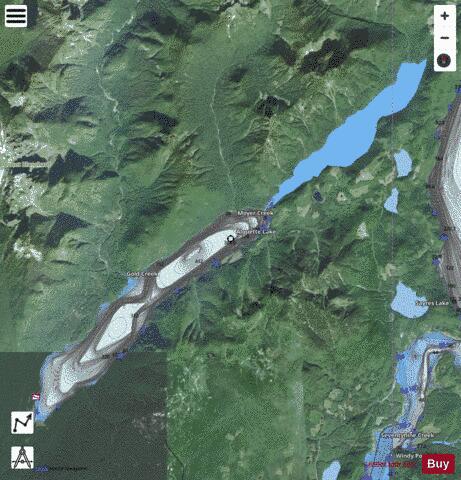
Alouette Lake, originally Lillooet Lake and not to be confused with the lake of that name farther north, is a lake and reservoir in Maple Ridge, British Columbia, Canada. It is located at the southeast foot of the mountain group known as the Golden Ears and is about 16 km in length on a northeast–southwest axis. It and the Alouette River, formerly the Lillooet River, were renamed in 1914 to avoid confusion with the larger river and lake farther north, with "Alouette", the French word for "lark", being chosen as being melodious and reminiscent of the original name in tone. Most of the basin of Alouette Lake has never been logged and its north flank is protected as part of Golden Ears Provincial Park (formerly part of Garibaldi Provincial Park until that park's division). A small portion of the lake and its largely inaccessible northwestern shore, near its narrows, are actually part of the District of Mission due to the rectangular shape of that district's boundary. North of the portion of the lake that is in Mission, the rest of its northern end is not in either municipality.
More on Wikipedia...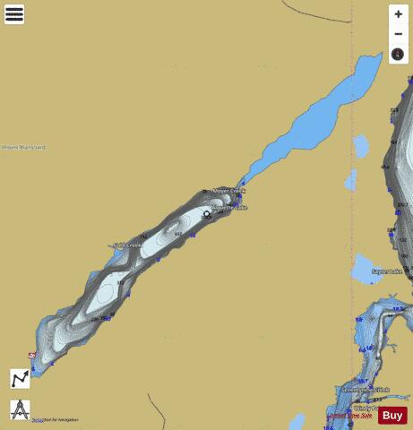
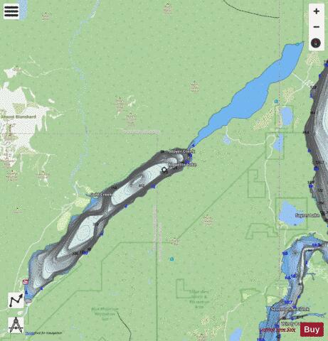
Alouette Lake Fishing Map Stats | |
| Title | Alouette Lake |
| Scale | 1:24000 |
| Districts | Fraser Valley, Greater Vancouver |
| Nearby Cities | Mission, Aldergrove, Aldergrove East, Abbotsford, White Rock, Chilliwack, Cultus Lake, Vancouver, Harrison Hot Springs, Kent |
| Area * | 3926.82 acres |
| Shoreline * | 24.24 miles |
| Min Longitude | -122.49 |
| Min Latitude | 49.29 |
| Max Longitude | -122.32 |
| Max Latitude | 49.39 |
| Edition Label 1 | |
| Edition Label 2 | |
| Edition Label 3 | |
| Id | CA_BC_alouette_lake_bc |
| Country | CA |
| Projection | Mercator |
| * some Stats may include nearby/connecting waterbodies | |
| |||||||||||||||||||||||||||||||||||||||||||||||||||||||||||||||||||||||||||||||||||||||||||||||||||||||
|