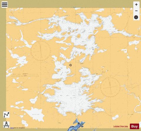
Wahwashkesh Lake fishing map is included in Ontario Lakes nautical charts folio. It is available as part of iBoating : Canada Marine & Fishing App (now supported on multiple platforms including Android, iPhone/iPad, MacBook, and Windows(tablet and phone)/PC based chartplotter. ).
With our Lake Maps App, you get all the great marine chart app features like fishing spots, along with Wahwashkesh Lake depth map. The fishing maps app include HD lake depth contours, along with advanced features found in Fish Finder / Gps Chart Plotter systems, turning your device into a Depth Finder. The Wahwashkesh Lake Navigation App provides advanced features of a Marine Chartplotter including adjusting water level offset and custom depth shading. Fishing spots and depth contours layers are available in most Lake maps. Lake navigation features include advanced instrumentation to gather wind speed direction, water temperature, water depth, and accurate GPS with AIS receivers(using NMEA over TCP/UDP). Autopilot support can be enabled during ‘Goto WayPoint’ and ‘Route Assistance’.
Now i-Boating supports Fishing Points in Wahwashkesh Lake.
Have more questions about the Nautical Chart App? Ask us.
Fishing Info for Wahwashkesh Lake
Wahwashkesh Lake is a lake in Whitestone, Parry Sound District, Ontario, Canada, and is the largest lake in Parry Sound District, with a surface area of 1,721 hectares (4,253 acres) and over 106 km of shoreline. Approximately 30% of the shoreline property is Crown Land. The lake has two distinct basins: (1) the north basin or Top Lake is the smaller of the two, and (2) the south basin is the Big Lake. Wahwashkesh is part of the Magnetawan River system, and the lake is renowned for an extremely severe spring freshet with the lake levels often rising 3 to 4 meters above the concrete weir at the outlet of the river. The lake has a diverse fishery with over 12 species of sport fish, including Northern Pike, Walleye, Smallmouth, and Largemouth Bass. In addition, Wahwashkesh is famous for its Atlantic Coastal Plain Flora. The lake ranks in the top five of all lakes in Ontario for such flora, which the Natural Heritage League and the World Wildlife Fund documented extensively in a 1989 study. Wahwashkesh is from Ojibwa wâwâshkeshi 'deer'. Established in 1954, the Lake Wah-Wash-Kesh Conservation Association is a not-for-profit association of cottagers and residents on Lake Wahwashkesh, Ontario, Canada. In May 2009, the Association in partnership with the Ministry of Natural Resources installed a new water level monitoring station in Bennett's Bay, to provide direct information on a continuous basis. The Lake Wahwahskesh monitoring station provides real time daily data on the lake's water level, water temperature, air temperature, and rainfall amount.
More on Wikipedia...Wahwashkesh Lake Fishing Map Stats | |
| Title | Wahwashkesh Lake |
| Scale | 1:24000 |
| Districts | Parry Sound |
| Nearby Cities | Parry Sound, Sturgeon Falls, Powassan, North Bay, Huntsville, Midland, Bracebridge, Tay, Gravenhurst |
| Area * | 4573.05 acres |
| Shoreline * | 78.85 miles |
| Min Longitude | -80.10 |
| Min Latitude | 45.68 |
| Max Longitude | -79.98 |
| Max Latitude | 45.75 |
| Edition Label 1 | |
| Edition Label 2 | |
| Edition Label 3 | |
| Id | CA_ON_wahwashkesh_mm_on |
| Country | CA |
| Projection | Mercator |
| * some Stats may include nearby/connecting waterbodies | |
|


