Botsford Lake fishing map is included in Ontario Lakes nautical charts folio. It is available as part of iBoating : Canada Marine & Fishing App (now supported on multiple platforms including Android, iPhone/iPad, MacBook, and Windows(tablet and phone)/PC based chartplotter. ).
With our Lake Maps App, you get all the great marine chart app features like fishing spots, along with Botsford Lake depth map. The fishing maps app include HD lake depth contours, along with advanced features found in Fish Finder / Gps Chart Plotter systems, turning your device into a Depth Finder. The Botsford Lake Navigation App provides advanced features of a Marine Chartplotter including adjusting water level offset and custom depth shading. Fishing spots and depth contours layers are available in most Lake maps. Lake navigation features include advanced instrumentation to gather wind speed direction, water temperature, water depth, and accurate GPS with AIS receivers(using NMEA over TCP/UDP). Autopilot support can be enabled during ‘Goto WayPoint’ and ‘Route Assistance’.
Now i-Boating supports Fishing Points in Botsford Lake.
Have more questions about the Nautical Chart App? Ask us.
Fishing Info for Botsford Lake
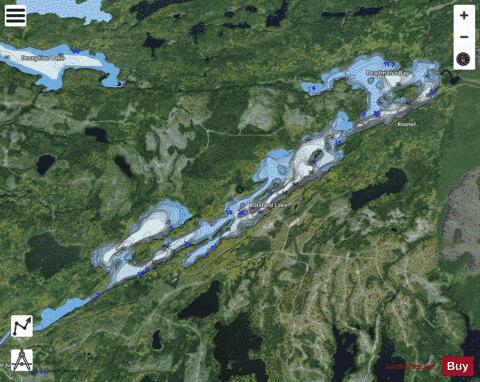
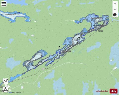
Botsford Lake is a lake in the Hudson Bay drainage basin in Kenora District in northwestern Ontario, Canada. It is about 15 kilometres (9 mi) long and 2.2 kilometres (1.4 mi) wide, is at an elevation of 357 metres (1,171 ft), and lies between the settlements of Superior Junction and McDougall Mills; Rosnel is on the south shore of the lake. The CN transcontinental rail line travels the along the entire south shore. Highway 642 runs west of the lake, and Highway 516 runs approximately parallel to the north shore of the lake at a distance of about 6 kilometres (4 mi). The primary inflow and outflow is the Marchington River, coming in at the northeast end of the lake just downstream of McDougall Falls, and exiting at the southwest end a few kilometres upstream of the river's mouth at Abram Lake on the English River. A secondary inflow, at the south, is an unnamed creek coming from Black Lake.
More on Wikipedia...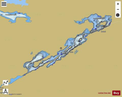
Botsford Lake Fishing Map Stats | |
| Title | Botsford Lake |
| Scale | 1:24000 |
| Districts | Kenora |
| Nearby Cities | Sioux Lookout |
| Area * | 3641.37 acres |
| Shoreline * | 43.37 miles |
| Min Longitude | -91.75 |
| Min Latitude | 50.10 |
| Max Longitude | -91.57 |
| Max Latitude | 50.18 |
| Edition Label 1 | |
| Edition Label 2 | |
| Edition Label 3 | |
| Id | CA_ON_V_103404808 |
| Country | CA |
| Projection | Mercator |
| * some Stats may include nearby/connecting waterbodies | |
| |||||||||||||||||||||||||||||||||||||||||||||||||||||||||||||||||||||||||||||||||||||||||||||||||||||||
|