Black Donald Lake fishing map is included in Ontario Lakes nautical charts folio. It is available as part of iBoating : Canada Marine & Fishing App (now supported on multiple platforms including Android, iPhone/iPad, MacBook, and Windows(tablet and phone)/PC based chartplotter. ).
With our Lake Maps App, you get all the great marine chart app features like fishing spots, along with Black Donald Lake depth map. The fishing maps app include HD lake depth contours, along with advanced features found in Fish Finder / Gps Chart Plotter systems, turning your device into a Depth Finder. The Black Donald Lake Navigation App provides advanced features of a Marine Chartplotter including adjusting water level offset and custom depth shading. Fishing spots and depth contours layers are available in most Lake maps. Lake navigation features include advanced instrumentation to gather wind speed direction, water temperature, water depth, and accurate GPS with AIS receivers(using NMEA over TCP/UDP). Autopilot support can be enabled during ‘Goto WayPoint’ and ‘Route Assistance’.
Now i-Boating supports Fishing Points in Black Donald Lake.
Have more questions about the Nautical Chart App? Ask us.
Fishing Info for Black Donald Lake
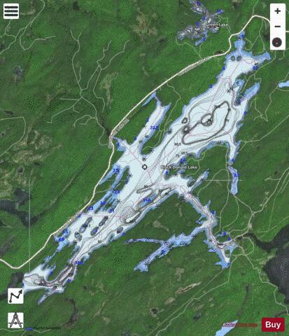
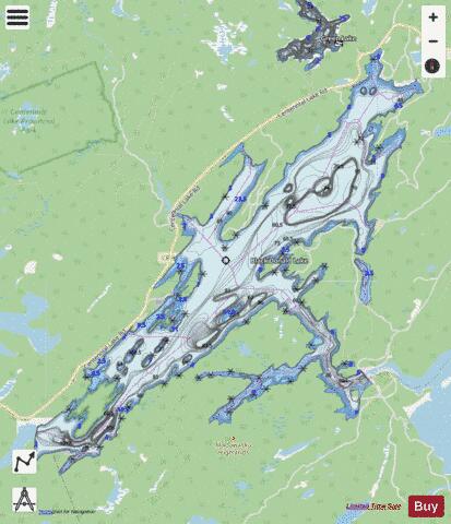
Black Donald Lake is a reservoir lake in the Township of Greater Madawaska, Renfrew County and the Township of North Frontenac, Frontenac County in Eastern Ontario, Canada. It is on the Madawaska River and is part of the Saint Lawrence River drainage basin. The major inflow, at the west, is the Madawaska River, which arrives directly from Centennial Lake at the same elevation as Black Donald Lake. Secondary inflows are Black Donald Creek and Little Black Donald Creek at the centre north. The major outflow is also the Madawaska River, which flows over the dam at the Ontario Power Generation Mountain Chute Generating Station (hydroelectric) to Norcan Lake at the southeast. Norcan Lake drains via the Madawaska River to the Ottawa River to the Saint Lawrence River and thence to the Atlantic Ocean. The settlement of Black Donald appears in the Natural Resources Canada Place names database and displays as being located on the southeast shore of the lake at the intersection of Chimo Road South and Far Side Lane. In fact, there is no town of Black Donald, at that location or anywhere else. The town of Black Donald was flooded after the construction of Mountain Chute dam and no longer exists. From the outflow of the lake almost to the major inflow of the Madawaska River from Centennial Lake, Black Donald Lake forms the boundary between Greater Madawaska, Renfrew County and North Frontenac, Frontenac County.
More on Wikipedia...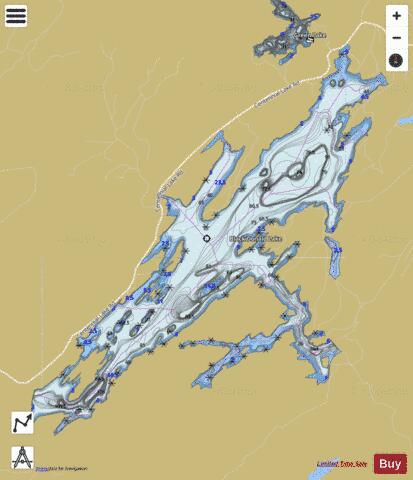
Black Donald Lake Fishing Map Stats | |
| Title | Black Donald Lake |
| Scale | 1:24000 |
| Districts | Frontenac, Renfrew |
| Nearby Cities | Renfrew, Eganville, Shawville, Arnprior, Pembroke, Fort-Coulonge, Almonte, Perth, Petawawa, Barry's Bay |
| Area * | 4237.91 acres |
| Shoreline * | 65.30 miles |
| Min Longitude | -77.00 |
| Min Latitude | 45.18 |
| Max Longitude | -76.89 |
| Max Latitude | 45.26 |
| Edition Label 1 | |
| Edition Label 2 | |
| Edition Label 3 | |
| Id | CA_ON_V_103381537 |
| Country | CA |
| Projection | Mercator |
| * some Stats may include nearby/connecting waterbodies | |
|