Chandos Lake fishing map is included in Ontario Lakes nautical charts folio. It is available as part of iBoating : Canada Marine & Fishing App (now supported on multiple platforms including Android, iPhone/iPad, MacBook, and Windows(tablet and phone)/PC based chartplotter. ).
With our Lake Maps App, you get all the great marine chart app features like fishing spots, along with Chandos Lake depth map. The fishing maps app include HD lake depth contours, along with advanced features found in Fish Finder / Gps Chart Plotter systems, turning your device into a Depth Finder. The Chandos Lake Navigation App provides advanced features of a Marine Chartplotter including adjusting water level offset and custom depth shading. Fishing spots and depth contours layers are available in most Lake maps. Lake navigation features include advanced instrumentation to gather wind speed direction, water temperature, water depth, and accurate GPS with AIS receivers(using NMEA over TCP/UDP). Autopilot support can be enabled during ‘Goto WayPoint’ and ‘Route Assistance’.
Now i-Boating supports Fishing Points in Chandos Lake.
Have more questions about the Nautical Chart App? Ask us.
Fishing Info for Chandos Lake
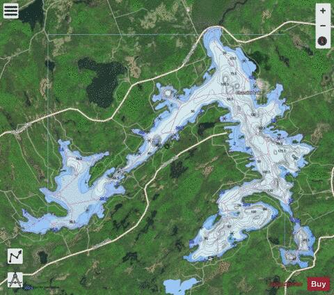
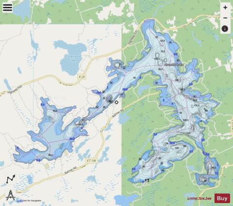
Chandos Lake is a lake in North Kawartha, Ontario, Canada. The lake is in the shape of a reversed L, with three main bays: West Bay, connected to the main body of the lake by a long Narrows; South Bay, extending southwest and separated by a curved peninsula; and Gilmour Bay, a smaller, two-lobed bay on the southern tip of the lake, connected by Gilmour Bay Narrows. Chandos Lake is in the Atlantic watershed; fed by springs, it drains from its north end into Flat Creek, which flows into Paudash Lake, thence to the Crowe River, the Trent River, and Lake Ontario. Chandos is the largest lake in the Crowe River watershed. Chandos Lake measures 1,387 hectares and has a maximum depth of 48 metres. Chandos Lake was originally called Mongosogan by the Mississauga Anishinabe, on whose traditional territory it lies. Although not one of the Kawartha Lakes proper, Chandos Lake is part of the Kawartha cottage country; the lake is lined with some 1,200 cottages. The lake features three marinas and a public beach. The towns of Apsley, Glen Alda, and Lasswade are located on or near the lake. County Roads 620 and 504 encircle the lake.
More on Wikipedia...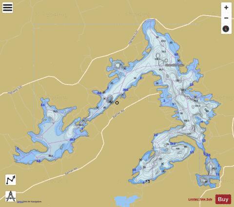
Chandos Lake Fishing Map Stats | |
| Title | Chandos Lake |
| Scale | 1:24000 |
| Districts | Peterborough |
| Nearby Cities | Havelock, Norwood, Marmora, Lakefield, Hastings, Campbellford, Haliburton Village, Bridgenorth - Chemong Park Area, Peterborough, Madoc |
| Area * | 4077.29 acres |
| Shoreline * | 53.23 miles |
| Min Longitude | -78.06 |
| Min Latitude | 44.78 |
| Max Longitude | -77.95 |
| Max Latitude | 44.84 |
| Edition Label 1 | |
| Edition Label 2 | |
| Edition Label 3 | |
| Id | CA_ON_V_103380579 |
| Country | CA |
| Projection | Mercator |
| * some Stats may include nearby/connecting waterbodies | |
|