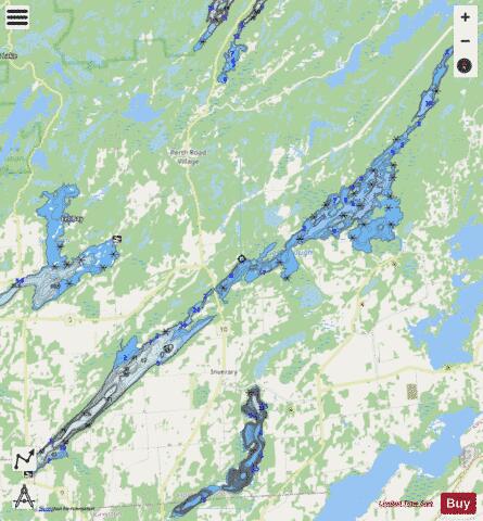
Loughborough Lake fishing map is included in Ontario Lakes nautical charts folio. It is available as part of iBoating : Canada Marine & Fishing App (now supported on multiple platforms including Android, iPhone/iPad, MacBook, and Windows(tablet and phone)/PC based chartplotter. ).
With our Lake Maps App, you get all the great marine chart app features like fishing spots, along with Loughborough Lake depth map. The fishing maps app include HD lake depth contours, along with advanced features found in Fish Finder / Gps Chart Plotter systems, turning your device into a Depth Finder. The Loughborough Lake Navigation App provides advanced features of a Marine Chartplotter including adjusting water level offset and custom depth shading. Fishing spots and depth contours layers are available in most Lake maps. Lake navigation features include advanced instrumentation to gather wind speed direction, water temperature, water depth, and accurate GPS with AIS receivers(using NMEA over TCP/UDP). Autopilot support can be enabled during ‘Goto WayPoint’ and ‘Route Assistance’.
Now i-Boating supports Fishing Points in Loughborough Lake.
Have more questions about the Nautical Chart App? Ask us.
Fishing Info for Loughborough Lake
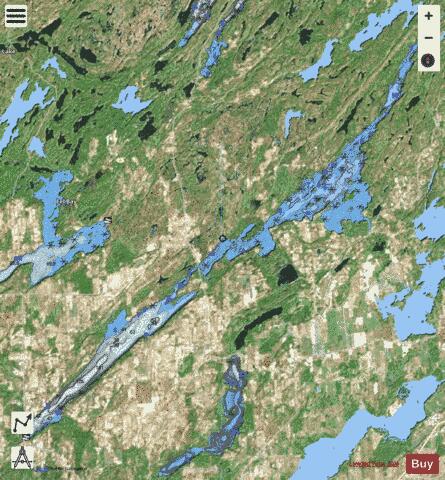
Loughborough Lake is a lake in Eastern Ontario, Canada. The lake is mostly in the municipality of South Frontenac, Frontenac County, except for the southern tip which is in and on the northern border of the separated city of Kingston, and is about 20 kilometres (12 mi) north of the town centre of Kingston. Loughborough Lake is in the Great Lakes Basin, is 24 kilometres (15 mi) long and 18.90 square kilometres (7.30 sq mi) in area, with many small islands, and has 119 kilometres (74 mi) of shoreline. Loon Island in the centre of the lake is privately owned by actor Dan Aykroyd.
More on Wikipedia...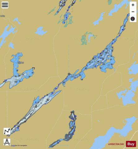
Loughborough Lake Fishing Map Stats | |
| Title | Loughborough Lake |
| Scale | 1:24000 |
| Districts | Frontenac |
| Nearby Cities | Kingston, Gananoque, Bath, Napanee, Perth, Deseronto, Smiths Falls, Carleton Place, Picton, Brockville |
| Area * | 4683.57 acres |
| Shoreline * | 75.46 miles |
| Min Longitude | -76.57 |
| Min Latitude | 44.35 |
| Max Longitude | -76.36 |
| Max Latitude | 44.51 |
| Edition Label 1 | |
| Edition Label 2 | |
| Edition Label 3 | |
| Id | CA_ON_loughborough_lake_on |
| Country | CA |
| Projection | Mercator |
| * some Stats may include nearby/connecting waterbodies | |
|