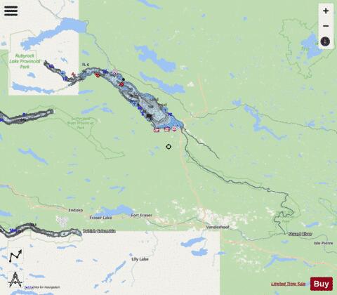
Stuart Lake fishing map is included in Lakes and Rivers of British Columbia nautical charts folio. It is available as part of iBoating : Canada Marine & Fishing App (now supported on multiple platforms including Android, iPhone/iPad, MacBook, and Windows(tablet and phone)/PC based chartplotter. ).
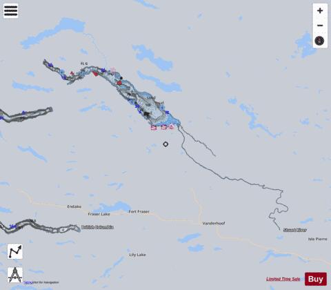
With our Lake Maps App, you get all the great marine chart app features like fishing spots, along with Stuart Lake depth map. The fishing maps app include HD lake depth contours, along with advanced features found in Fish Finder / Gps Chart Plotter systems, turning your device into a Depth Finder. The Stuart Lake Navigation App provides advanced features of a Marine Chartplotter including adjusting water level offset and custom depth shading. Fishing spots and depth contours layers are available in most Lake maps. Lake navigation features include advanced instrumentation to gather wind speed direction, water temperature, water depth, and accurate GPS with AIS receivers(using NMEA over TCP/UDP). Autopilot support can be enabled during ‘Goto WayPoint’ and ‘Route Assistance’.
Now i-Boating supports Fishing Points in Stuart Lake.
Have more questions about the Nautical Chart App? Ask us.
Fishing Info for Stuart Lake
Stuart Lake, or Nak'albun ("Mount Pope Lake", Athabaskan pronunciation: [nakʼalpʌn]) in the Carrier (Dakelh) language is a lake situated in the Northern Interior of British Columbia, Canada. The town of Fort St. James is situated by the lake near the outlet (Stuart River or Nak'alkoh - ″Mount Pope River″). Stuart Lake is 66 kilometres (41 mi) long, 10 kilometres (6.2 mi) wide and relatively shallow, with an average depth of 26 metres (85 ft). Stuart Lake offers boating, swimming and sunbathing at sandy beaches, fishing, water skiing, viewing ancient aboriginal pictographs, camping, snowmobiling, ice fishing, ice sailing, and dog sledding. Two provincial park campgrounds, Paarens Beach and Sowchea Bay, are located on the southern shore of the lake, and there are several motels, lodges and private campgrounds in the area. Moorage is available at several marinas. Fort St. James has several lumber mills as do several smaller aboriginal communities in the basin. The lake is usually ice-covered from mid-December to early May. Stuart Lake contains rainbow trout, char or lake trout, whitefish, kokanee, Dolly Varden, and burbot fish.
More on Wikipedia...Popular fish species in this lake include Burbot, Rainbow trout and Salvelinus.
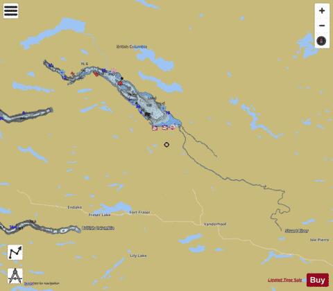
Stuart Lake Fishing Map Stats | |
| Title | Stuart Lake |
| Scale | 1:48000 |
| Districts | Bulkley-Nechako, Fraser-Fort George |
| Nearby Cities | Fort St. James, Vanderhoof, Burns Lake, Prince George |
| Area * | 92616.14 acres |
| Shoreline * | 367.18 miles |
| Min Longitude | -125.25 |
| Min Latitude | 53.99 |
| Max Longitude | -123.48 |
| Max Latitude | 54.71 |
| Edition Label 1 | |
| Edition Label 2 | |
| Edition Label 3 | |
| Id | CA_BC_stuart_mm_on |
| Country | CA |
| Projection | Mercator |
| * some Stats may include nearby/connecting waterbodies | |
|