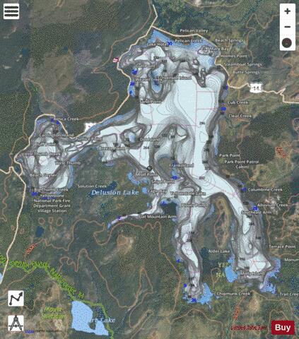
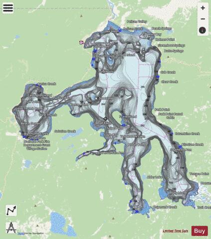
Yellowstone Lake fishing map is available as part of iBoating : USA Marine & Fishing App(now supported on multiple platforms including Android, iPhone/iPad, MacBook, and Windows(tablet and phone)/PC based chartplotter.).
With our Lake Maps App, you get all the great marine chart app features like fishing spots, along with Yellowstone Lake depth map. The fishing maps app include HD lake depth contours, along with advanced features found in Fish Finder / Gps Chart Plotter systems, turning your device into a Depth Finder. The Yellowstone Lake Navigation App provides advanced features of a Marine Chartplotter including adjusting water level offset and custom depth shading. Fishing spots and depth contours layers are available in most Lake maps. Lake navigation features include advanced instrumentation to gather wind speed direction, water temperature, water depth, and accurate GPS with AIS receivers(using NMEA over TCP/UDP). Autopilot support can be enabled during ‘Goto WayPoint’ and ‘Route Assistance’.
Now i-Boating supports Fishing Points in Yellowstone Lake.
Have more questions about the Nautical Chart App? Ask us.
Fishing Info for Yellowstone Lake
Yellowstone Lake is the largest body of water in Yellowstone National Park. The lake is 7,732 feet (2,357 m) above sea level and covers 136 square miles (350 km2) with 110 miles (180 km) of shoreline. While the average depth of the lake is 139 ft (42 m), its greatest depth is at least 394 ft (120 m). Yellowstone Lake is the largest freshwater lake above 7,000 ft (2,100 m) in North America. In winter, ice nearly 3 ft (0.91 m) thick covers much of the lake except where shallow water covers hot springs. The lake freezes over by early December and can remain frozen until late May or early June.
More on Wikipedia...Popular fish species in this lake include Lake trout, Longnose sucker and Rainbow trout.
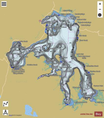
Yellowstone Lake Fishing Map Stats | |
| Title | Yellowstone Lake |
| Scale | 1:12000 |
| Counties | Park, Teton |
| Nearby Cities | West Thumb, Lake, Moran, Mammoth, Silver Gate, Jardine, Gardiner, West Yellowstone, Cooke City, Corwin Springs |
| Area * | 84447.49 acres |
| Shoreline * | 146.73 miles |
| Min Longitude | -110.58 |
| Min Latitude | 44.28 |
| Max Longitude | -110.20 |
| Max Latitude | 44.56 |
| Edition Label 1 | |
| Edition Label 2 | |
| Edition Label 3 | |
| Id | US_WY_01609324 |
| Country | US |
| Projection | Mercator |
| * some Stats may include nearby/connecting waterbodies | |
|