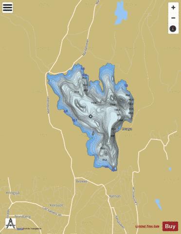
Maridalsvannet fishing map is included in ֳ˜stfold nautical charts folio. It is available as part of iBoating : Norway Marine & Fishing App (now supported on multiple platforms including Android, iPhone/iPad, MacBook, and Windows(tablet and phone)/PC based chartplotter. ).
With our Lake Maps App, you get all the great marine chart app features like fishing spots, along with Maridalsvannet lake depth map. The fishing maps app include HD lake depth contours, along with advanced features found in Fish Finder / Gps Chart Plotter systems, turning your device into a Depth Finder. The Maridalsvannet Navigation App provides advanced features of a Marine Chartplotter including adjusting water level offset and custom depth shading. Fishing spots and depth contours layers are available in most Lake maps. Lake navigation features include advanced instrumentation to gather wind speed direction, water temperature, water depth, and accurate GPS with AIS receivers(using NMEA over TCP/UDP). Autopilot support can be enabled during ג€˜Goto WayPointג€™ and ג€˜Route Assistanceג€™.
Have more questions about the Nautical Chart App? Ask us.
Fishing Info for Maridalsvannet
Maridalsvannet (English: Lake Maridal) is a lake in Maridalen, Oslo, Norway. It is the largest lake in the municipality of Oslo, and serves as the main drinking water supply for the city. The lake drains via the river Akerselva to the Oslofjord. The primary inflows are and . The Hammeren Hydroelectric Power Station exploits the fall from Skjֳ¦rsjֳ¸en to Maridalsvannet. The shores of the lake and substantial areas of woods and fields around it are owned by the city of Oslo to protect the water supply. Some farms are still operated under city supervision, but others were closed down in the mid 20th century; their remains are marked by historical signs. Hiking, cycling, and cross-country ski trails run near the south side of the lake and connect to the large system of trails in the forests that surround Oslo. They can be reached by a short walk from the Kjelsֳ¥s trolley, bus, or train stations. Trails run alongside Akerselva from the Marridalsvannet dam almost all the way to Oslofjord. The Gjֳ¸vik Line runs along the same shore.
More on Wikipedia...Maridalsvannet Fishing Map Stats | |
| Title | Maridalsvannet |
| Scale | 1:12000 |
| Min Longitude | 10.75 |
| Min Latitude | 59.97 |
| Max Longitude | 10.80 |
| Max Latitude | 60.00 |
| Edition Label 1 | |
| Edition Label 2 | |
| Edition Label 3 | |
| Id | NO_LK_298 |
| Country | Norway |
| Projection | Mercator |
| * some Stats may include nearby/connecting waterbodies | |
| |||||||||||||||||||||||||||||||||||||||||||||||||||||||||||||||||||||||||||||||||||||||||||||||||||||||
|

