New! i-Hunting Topo Maps now available -  

iPhone / iPad Marine Navigation App  and WMTS App are now available -  

New! Macbook ChartPlotter, and Windows Marine Navigation App now available -  
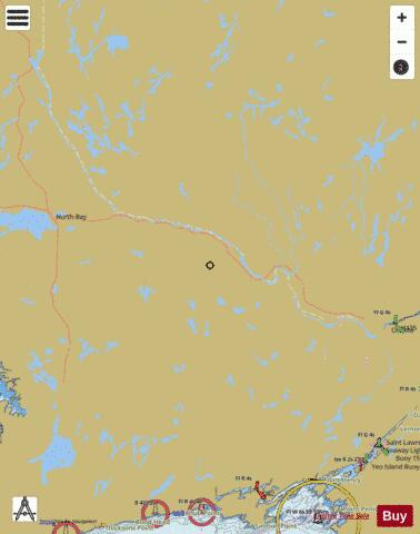
Rideau Canal - Ottawa River Marine Charts

Here is the list of Rideau Canal - Ottawa River marine charts and fishing maps available on iBoating : Canada Marine & Fishing App. Marine charts app now supports multiple plaforms including Android, iPhone/iPad, MacBook, and Windows/PC based chartplotter. The Marine Navigation App provides advanced features of a Marine Chartplotter including adjusting water level offset and custom depth shading. Fishing spots, Relief Shading and depth contours layers are available in most Lake maps. Nautical navigation features include advanced instrumentation to gather wind speed direction, water temperature, water depth, and accurate GPS with AIS receivers(using NMEA over TCP/UDP). Autopilot support can be enabled during ‘Goto WayPoint’ and ‘Route Assistance’. If marine chart / fishing map you are looking for is not listed in correct folio, please let us know.

Nautical Chart TitleScale
Big Rideau Lake - Harbour Detail (1:4,800)1:4800
Big Rideau Lake (Lower Reach Park, Smiths Falls) - Harbour Detail (1:4,800)1:4800
Big Rideau Lake (Lower Reach Park, Smiths Falls) - Inland / Approach Chart (1:19,993)1:19993
Big Rideau Lake (Narrows Lock, Cordwood Island) - Inland / Approach Chart (1:20,000)1:20000
Big Rideau Lake (Narrows Lock) - Harbour Detail (1:4,800)1:4800
Big Rideau Lake (Rideau Ferry Harbour, Hog Island) - Harbour Detail (1:4,800)1:4800
Big Rideau Lake (Rideau Ferry Harbour, Perth) - Inland / Approach Chart (1:20,000)1:20000
Big Rideau Lake (Sheep Island) - Harbour Detail (1:4,800)1:4800
Cataraqui River - Harbour Detail (1:4,800)1:4800
Chenal de la Culbute (Île John Park) - Harbour Detail (1:2,400)1:2400
Dog Lake (Seeley's Bay Public Dock, Kingston) - Inland / Approach Chart (1:20,000)1:20000
Dow's Lake (Ottawa) - Harbour Detail (1:4,800)1:4800
Kemptville Creek - Inland / Approach Chart (1:20,000)1:20000
Lac Beauchêne - Inland / Approach Chart (1:25,000)1:25000
Lac des Chats (Les Collines-de-l'Outaouais) - Inland / Approach Chart (1:25,000)1:25000
Lac des Chats (Renfrew) - Inland / Approach Chart (1:25,000)1:25000
Lac des Chats (The Narrows, Arnprior) - Inland / Approach Chart (1:25,000)1:25000
Lake Ontario (Portsmouth Olympic Harbour, Kingston) - Inland / Approach Chart (1:20,000)1:20000
Lake Temiskaming (Haileybury) - Harbour Chart (1:10,000)1:10000
Lake Temiskaming (Opimika Narrows, Sandbar Island) - Inland / Approach Chart (1:35,000)1:35000
Lake Temiskaming (Temiskaming Shores) - Harbour Chart (1:10,000)1:10000
Lake Temiskaming (Temiskaming Shores) - Inland / Approach Chart (1:35,000)1:35000
Lake Temiskaming (Ville-Marie) - Harbour Chart (1:10,000)1:10000
Lake Temiskaming (Ville-Marie) - Inland / Approach Chart (1:35,000)1:35000
Little Cranberry Lake (Seeley's Bay Public Dock) - Harbour Detail (1:4,800)1:4800
Navigational Sector (CFB Petawawa) - Harbour Detail (1:2,400)1:2400
Navigational Sector (Corinne Island) - Harbour Detail (1:2,400)1:2400
Navigational Sector (Deep River) - Harbour Detail (1:4,800)1:4800
Navigational Sector - Harbour Detail (1:2,400)1:2400
Navigational Sector - Harbour Detail (1:3,600)1:3600
Navigational Sector (Île à Bertrand) - Harbour Detail (1:2,400)1:2400
Navigational Sector (Île Davidson) - Harbour Detail (1:2,400)1:2400
Navigational Sector (Mattawa) - Harbour Detail (1:2,400)1:2400
Navigational Sector (Pembroke) - Harbour Detail (1:3,000)1:3000
Navigational Sector (Pembroke) - Harbour Detail (1:4,800)1:4800
Navigational Sector (Petawawa) - Harbour Detail (1:2,400)1:2400
Newboro Lake (Davis Lock, Whitehall Island) - Inland / Approach Chart (1:20,000)1:20000
Newboro Lake (Lewis Island) - Harbour Detail (1:4,800)1:4800
Opinicon Lake (Davis Lock, Merriman Island) - Harbour Detail (1:4,800)1:4800
Opinicon Lake (Goose Island) - Harbour Detail (1:4,800)1:4800
Ottawa Locks (Hull Island) - Harbour Detail (1:4,800)1:4800
Ottawa River (Black Rapids, Île du Grand Calumet) - Inland / Approach Chart (1:25,000)1:25000
Ottawa River (Britannia Island) - Harbour Chart (1:12,000)1:12000
Ottawa River (Britannia Island) - Harbour Detail (1:2,400)1:2400
Ottawa River (CFB Petawawa, Fish Island) - Inland / Approach Chart (1:25,000)1:25000
Ottawa River (Coliseum rapids, Île du Grand Calumet) - Inland / Approach Chart (1:25,000)1:25000
Ottawa River (Deep River) - Inland / Approach Chart (1:25,000)1:25000
Ottawa River - Harbour Chart (1:10,000)1:10000
Ottawa River - Harbour Detail (1:4,800)1:4800
Ottawa River (Île Marcotte) - Inland / Approach Chart (1:25,000)1:25000
Ottawa River (Île Mohr) - Harbour Detail (1:3,600)1:3600
Ottawa River - Inland / Approach Chart (1:25,000)1:25000
Ottawa River (Les Collines-de-l'Outaouais) - Inland / Approach Chart (1:25,000)1:25000
Ottawa River (Mattawa) - Inland / Approach Chart (1:25,000)1:25000
Ottawa River (Opimika Narrows) - Harbour Chart (1:15,000)1:15000
Ottawa River (Opimika Narrows, Île du club Wabinning) - Inland / Approach Chart (1:35,000)1:35000
Ottawa River (Pembroke) - Inland / Approach Chart (1:25,000)1:25000
Ottawa River (Richie Ave, Les Collines-de-l'Outaouais) - Inland / Approach Chart (1:25,000)1:25000
Ottawa River (Rocher Capitaine Island) - Inland / Approach Chart (1:25,000)1:25000
Ottawa River (Témiscamingue) - Harbour Chart (1:10,000)1:10000
Rideau Canal (Ottawa) - Harbour Detail (1:4,800)1:4800
Rideau River (Aylings Boatyard, Merrickville) - Harbour Detail (1:4,800)1:4800
Rideau River (Aylings Boatyard, Merrickville) - Inland / Approach Chart (1:19,993)1:19993
Rideau River (Black Rapids) - Harbour Detail (1:4,800)1:4800
Rideau River (Burritts Rapids Locks) - Harbour Detail (1:4,800)1:4800
Rideau River (Burritts Rapids Locks, Kemptville) - Inland / Approach Chart (1:19,993)1:19993
Rideau River - Harbour Detail (1:4,800)1:4800
Rideau River (Mahogany Harbour Landing, Kemptville) - Inland / Approach Chart (1:20,000)1:20000
Rideau River (Merrickville) - Harbour Detail (1:4,800)1:4800
Rideau River (Nicolls Island) - Harbour Detail (1:4,800)1:4800
Rideau River (Smiths Falls) - Harbour Detail (1:4,800)1:4800
Ruisseau de la Brasserie (Quai des Artistes, Ottawa) - Inland / Approach Chart (1:20,000)1:20000
Sand Lake (Davis Lock, Kingston) - Inland / Approach Chart (1:20,000)1:20000
Tay River (Perth) - Harbour Detail (1:4,800)1:4800
Tay River (Perth) - Inland / Approach Chart (1:20,000)1:20000
Upper Rideau Lake - Harbour Detail (1:4,800)1:4800
Upper Rideau Lake (Narrows Lock Road, Second Island) - Inland / Approach Chart (1:20,000)1:20000
Whitefish Lake (Hog Island) - Harbour Detail (1:4,800)1:4800