
New! i-Hunting Topo Maps now available -  

iPhone / iPad Marine Navigation App  and WMTS App are now available -  

New! Macbook ChartPlotter, and Windows Marine Navigation App now available -  
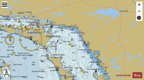
Lakes around Georgian Bay Marine Charts

Here is the list of Lakes around Georgian Bay marine charts and fishing maps available on iBoating : Canada Marine & Fishing App. Marine charts app now supports multiple plaforms including Android, iPhone/iPad, MacBook, and Windows/PC based chartplotter. The Marine Navigation App provides advanced features of a Marine Chartplotter including adjusting water level offset and custom depth shading. Fishing spots, Relief Shading and depth contours layers are available in most Lake maps. Nautical navigation features include advanced instrumentation to gather wind speed direction, water temperature, water depth, and accurate GPS with AIS receivers(using NMEA over TCP/UDP). Autopilot support can be enabled during ‘Goto WayPoint’ and ‘Route Assistance’. If marine chart / fishing map you are looking for is not listed in correct folio, please let us know.

Nautical Chart TitleScale
Blind River - Harbour Chart (1:8,000)1:8000
Blind River (Susanne Island) - Harbour Chart (1:12,000)1:12000
Indian River (Lakeview Park Island) - Harbour Detail (1:5,000)1:5000
Lake Duborne (Blind River) - Harbour Chart (1:12,000)1:12000
Lake Joseph (Chief's Island) - Inland / Approach Chart (1:25,000)1:25000
Lake Kagawong (Gore Bay) - Inland / Approach Chart (1:30,000)1:30000
Lake Manitou (The Narrows, Lone Tree Island) - Inland / Approach Chart (1:30,000)1:30000
Lake Muskoka (Coulter Narrows, Gravenhurst) - Inland / Approach Chart (1:25,000)1:25000
Lake Muskoka (Lighthouse Narrows, Bracebridge) - Inland / Approach Chart (1:25,000)1:25000
Lake Nipissing (Canoe Pass, Elliot Island) - Harbour Chart (1:15,000)1:15000
Lake Nipissing (Canoe Pass, North Bay) - Inland / Approach Chart (1:40,000)1:40000
Lake Nipissing - Harbour Detail (1:5,000)1:5000
Lake Nipissing (Hay Narrows, Lavigne) - Inland / Approach Chart (1:25,000)1:25000
Lake Nipissing (Lavigne) - Inland / Approach Chart (1:25,000)1:25000
Lake Nipissing (North Bay) - Harbour Detail (1:5,000)1:5000
Lake Nipissing (Upper Chaudiere Rapids, Elizabeth Island) - Harbour Chart (1:15,000)1:15000
Lake of Bays - Harbour Chart (1:12,000)1:12000
Lake of Bays (Reuben Island) - Harbour Chart (1:12,000)1:12000
Lake of Bays (The Narrows, Bigwin Island) - Inland / Approach Chart (1:25,000)1:25000
Lake Rosseau (Forman Narrows, Tobin Island) - Inland / Approach Chart (1:25,000)1:25000
Lake Wolsey (Gore Bay) - Inland / Approach Chart (1:30,000)1:30000
Magnetawan River (Indian Narrows, Ketchums Island) - Harbour Chart (1:12,000)1:12000
Martin Creek (The Narrows) - Harbour Chart (1:12,000)1:12000