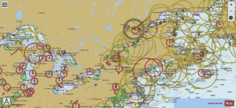
| Nautical Chart Title | Scale | |
| Back River (Kirkland) - Harbour Chart (1:12,000) | 1:12000 |
| Baie de Cloridorme (Honguedo Strait) - Harbour Detail (1:4,000) | 1:4000 |
| Baie de Godbout - Harbour Detail (1:4,000) | 1:4000 |
| Baie de la Trinité (Cayes Joncas) - Harbour Detail (1:4,000) | 1:4000 |
| Baie des Anglais (CLUB NAUTIQUE DE BAIE-COMEAU) - Harbour Chart (1:12,000) | 1:12000 |
| Baie des Sept Îles (Chenal du Milieu, Sept-Îles) - Harbour Chart (1:8,000) | 1:8000 |
| Baie des Sept Îles (Chenal du Milieu, Sept-Îles) - Harbour Chart (1:8,000) | 1:8000 |
| Baie des Sept Îles (Sept-Îles) - Harbour Chart (1:8,000) | 1:8000 |
| Baie des Sept Îles (Sept-Îles) - Harbour Chart (1:8,000) | 1:8000 |
| Baie Gamache (Honguedo Strait) - Harbour Chart (1:12,000) | 1:12000 |
| Bassin de Chambly (Richelieu) - Harbour Chart (1:12,000) | 1:12000 |
| Bonne Bay (Woody Point) - Inland / Approach Chart (1:22,000) | 1:22000 |
| Canal de la Petite-Nation - Harbour Chart (1:12,000) | 1:12000 |
| Chenal de Mingan (Caye à Ti-Joseph) - Harbour Chart (1:12,000) | 1:12000 |
| Colonel By Lake - Harbour Detail (1:4,800) | 1:4800 |
| Estuaire de la Rivière au Tonnerre - Harbour Detail (1:4,000) | 1:4000 |
| Gananoque River (Ormiston Island) - Harbour Detail (1:2,500) | 1:2500 |
| Gatineau River (Port de Plaisance Kitchissipi, Ottawa) - Harbour Chart (1:12,000) | 1:12000 |
| Gatineau River (Quai des Artistes, Dinelle Twins Island) - Harbour Chart (1:12,000) | 1:12000 |
| Grand River (Fishmasters Ultimate Charters, Dunnville) - Harbour Chart (1:7,500) | 1:7500 |
| Gulf of Saint Lawrence (Covehead Harbour, Rural Municipality of North Shore) - Harbour Chart (1:12,000) | 1:12000 |
| Gulf of Saint Lawrence - Harbour Chart (1:12,000) | 1:12000 |
| Gulf of Saint Lawrence - Harbour Chart (1:12,000) | 1:12000 |
| Gulf of Saint Lawrence - Overview Chart (1:350,000) | 1:350000 |
| Gulf of Saint Lawrence - Overview Chart (1:350,000) | 1:350000 |
| Gulf of Saint Lawrence (Rocky Harbour) - Inland / Approach Chart (1:22,000) | 1:22000 |
| Gulf of Saint Lawrence (Rustico Bay Harbour, Robinsons Island) - Harbour Chart (1:12,000) | 1:12000 |
| Gulf of Saint Lawrence (Trout River) - Inland / Approach Chart (1:22,000) | 1:22000 |
| Hare Bay (Goose Cove East) - Harbour Chart (1:12,000) | 1:12000 |
| Honguedo Strait - Harbour Chart (1:8,000) | 1:8000 |
| Honguedo Strait - Harbour Chart (1:8,000) | 1:8000 |
| Honguedo Strait - Harbour Detail (1:4,000) | 1:4000 |
| Honguedo Strait - Harbour Detail (1:4,000) | 1:4000 |
| Honguedo Strait - Inland / Approach Chart (1:45,000) | 1:45000 |
| Honguedo Strait - Inland / Approach Chart (1:45,000) | 1:45000 |
| Honguedo Strait (Roche à Bonneau) - Harbour Detail (1:4,000) | 1:4000 |
| Jacques Cartier Strait (Chenal de Mingan, Île Nue de Mingan) - Inland / Approach Chart (1:45,000) | 1:45000 |
| Jacques Cartier Strait (Grosse île au Marteau) - Harbour Chart (1:12,000) | 1:12000 |
| Jacques Cartier Strait (Île à Calculot) - Harbour Chart (1:12,000) | 1:12000 |
| Jacques Cartier Strait (Île du Havre) - Harbour Chart (1:12,000) | 1:12000 |
| Jacques Cartier Strait (Îles de Mingan) - Harbour Chart (1:12,000) | 1:12000 |
| Jacques Cartier Strait (Îles de Mingan) - Harbour Chart (1:12,000) | 1:12000 |
| Jacques Cartier Strait (Le Petit Passage, Grosse île au Marteau) - Inland / Approach Chart (1:45,000) | 1:45000 |
| Lac Dollard-des-Ormeaux (Carillon Rapids, Centre de p���che de Pointe-Fortune, Ïles aux Chats) - Harbour Chart (1:12,000) | 1:12000 |
| Lac Dollard-des-Ormeaux - Harbour Chart (1:12,000) | 1:12000 |
| Lac Dollard-des-Ormeaux (Hawkesbury) - Harbour Chart (1:12,000) | 1:12000 |
| Lac Dollard-des-Ormeaux (Hawkesbury) - Harbour Chart (1:12,000) | 1:12000 |
| Lac Georges (Île à Crépault) - Harbour Chart (1:12,000) | 1:12000 |
| Lachine Canal (Windmill Point Basin, Montreal, ���cluse no.4) - Harbour Chart (1:12,000) | 1:12000 |
| Lac Saint-Jean - Coastal Navigation (1:90,000) | 1:90000 |
| Lac Saint-Jean - Coastal Navigation (1:90,000) | 1:90000 |
| Lac Saint-Jean - Harbour Chart (1:12,000) | 1:12000 |
| Lac Saint-Jean - Harbour Chart (1:12,000) | 1:12000 |
| Lac Saint-Jean - Harbour Chart (1:12,000) | 1:12000 |
| Lac Saint-Jean - Harbour Chart (1:8,000) | 1:8000 |
| Lac Saint-Jean - Harbour Detail (1:4,000) | 1:4000 |
| Lac Saint-Jean - Harbour Detail (1:4,000) | 1:4000 |
| Lac Saint-Jean - Harbour Detail (1:4,000) | 1:4000 |
| Lac Saint-Jean (Île d'Alma) - Harbour Chart (1:8,000) | 1:8000 |
| Lac Saint-Jean (Île du Phare) - Harbour Chart (1:8,000) | 1:8000 |
| Lac Saint-Jean (Roberval) - Harbour Detail (1:4,000) | 1:4000 |
| Lac Saint-Pierre (Halte 103, Le Bourg D'Eau, D'Autray) - Inland / Approach Chart (1:45,000) | 1:45000 |
| Lac Saint-Pierre (Nicolet) - Harbour Detail (1:4,000) | 1:4000 |
| Lac Saint-Pierre (North Grondines Anchorage, Bécancour) - Inland / Approach Chart (1:45,000) | 1:45000 |
| Lac Saint-Pierre (Sorel-Tracy) - Harbour Chart (1:8,000) | 1:8000 |
| Lac Saint-Pierre (Sorel-Tracy) - Harbour Chart (1:8,000) | 1:8000 |
| La Grande Décharge (Île aux Gagnon) - Harbour Detail (1:4,000) | 1:4000 |
| Lake Erie - Harbour Chart (1:7,500) | 1:7500 |
| Lake Erie - Overview Chart (1:200,000) | 1:200000 |
| Lake Erie (Port Colborne) - Harbour Chart (1:7,500) | 1:7500 |
| Lake Huron (Amedroz Island) - Harbour Chart (1:10,000) | 1:10000 |
| Lake Huron (Barrier Island) - Inland / Approach Chart (1:40,000) | 1:40000 |
| Lake Huron (Beckwith Island) - Inland / Approach Chart (1:20,000) | 1:20000 |
| Lake Huron (Bedford Island) - Harbour Chart (1:10,000) | 1:10000 |
| Lake Huron (Bellebay Island) - Harbour Detail (1:2,400) | 1:2400 |
| Lake Huron (Big Jameson Rapids, Green Island) - Inland / Approach Chart (1:20,000) | 1:20000 |
| Lake Huron (Boat Passage, Snake Island) - Inland / Approach Chart (1:30,000) | 1:30000 |
| Lake Huron (Boat Passage, Wardrope Island) - Harbour Chart (1:7,500) | 1:7500 |
| Lake Huron (Boat Passage, Wikwemikong) - Inland / Approach Chart (1:30,000) | 1:30000 |
| Lake Huron (Brignall Banks Narrows, Bigwood Island) - Inland / Approach Chart (1:20,000) | 1:20000 |
| Lake Huron (Brignall Banks Narrows, Black Bill Islands) - Inland / Approach Chart (1:30,000) | 1:30000 |
| Lake Huron (Brignall Banks Narrows, Olive Island) - Inland / Approach Chart (1:20,000) | 1:20000 |
| Lake Huron (Bruce Mines) - Harbour Detail (1:2,500) | 1:2500 |
| Lake Huron (Cachia Island) - Harbour Chart (1:10,000) | 1:10000 |
| Lake Huron (Canoe Dock, Penetanguishene) - Inland / Approach Chart (1:20,000) | 1:20000 |
| Lake Huron (Cash Island) - Inland / Approach Chart (1:20,000) | 1:20000 |
| Lake Huron (Chapman Island) - Harbour Detail (1:5,000) | 1:5000 |
| Lake Huron (Chimney Island) - Harbour Detail (1:5,000) | 1:5000 |
| Lake Huron (City of Grand Rapids, Devil Island) - Harbour Chart (1:7,500) | 1:7500 |
| Lake Huron (Claw Island) - Harbour Detail (1:5,000) | 1:5000 |
| Lake Huron - Coastal Navigation (1:100,000) | 1:100000 |
| Lake Huron - Coastal Navigation (1:60,000) | 1:60000 |
| Lake Huron - Coastal Navigation (1:60,000) | 1:60000 |
| Lake Huron - Coastal Navigation (1:90,000) | 1:90000 |
| Lake Huron - Coastal Navigation (1:90,000) | 1:90000 |
| Lake Huron - Coastal Navigation (1:90,000) | 1:90000 |
| Lake Huron - Coastal Navigation (1:90,000) | 1:90000 |
| Lake Huron (Collingwood) - Harbour Chart (1:6,000) | 1:6000 |
| Lake Huron (Dalles Rapids, French River Island) - Inland / Approach Chart (1:20,000) | 1:20000 |
| Lake Huron (Dog Home Passage, Pardsay Crag Island) - Harbour Chart (1:15,000) | 1:15000 |
| Lake Huron (Dog Home Passage, Whitefish Falls) - Harbour Chart (1:15,000) | 1:15000 |
| Lake Huron (Drew Island) - Harbour Detail (1:4,000) | 1:4000 |
| Lake Huron (East Sampson Island) - Harbour Chart (1:15,000) | 1:15000 |
| Lake Huron (East Sampson Island) - Harbour Chart (1:6,000) | 1:6000 |
| Lake Huron (Fox Island) - Inland / Approach Chart (1:20,000) | 1:20000 |
| Lake Huron (Free Drinks Passage, Bekanon Island) - Harbour Detail (1:5,000) | 1:5000 |
| Lake Huron (Free Drinks Passage, Champlain Island) - Inland / Approach Chart (1:20,000) | 1:20000 |
| Lake Huron (Goderich) - Harbour Detail (1:2,500) | 1:2500 |
| Lake Huron (Gun Island) - Harbour Detail (1:2,400) | 1:2400 |
| Lake Huron - Harbour Detail (1:1,800) | 1:1800 |
| Lake Huron - Harbour Detail (1:2,000) | 1:2000 |
| Lake Huron - Harbour Detail (1:3,000) | 1:3000 |
| Lake Huron - Harbour Detail (1:5,000) | 1:5000 |
| Lake Huron (Humbum Island) - Inland / Approach Chart (1:20,000) | 1:20000 |
| Lake Huron - Inland / Approach Chart (1:20,000) | 1:20000 |
| Lake Huron (Iroquois Island) - Harbour Chart (1:6,000) | 1:6000 |
| Lake Huron (Iroquois Island) - Harbour Detail (1:5,000) | 1:5000 |
| Lake Huron (Iroquois Island) - Harbour Detail (1:5,000) | 1:5000 |
| Lake Huron (Jumbo Island) - Harbour Detail (1:5,000) | 1:5000 |
| Lake Huron (Little Current Government Dock, Creak Island) - Inland / Approach Chart (1:20,000) | 1:20000 |
| Lake Huron (Little Current Government Dock, Goat Island) - Harbour Chart (1:7,500) | 1:7500 |
| Lake Huron (Meaford) - Harbour Detail (1:3,000) | 1:3000 |
| Lake Huron (Middle Sampson Island) - Harbour Chart (1:6,000) | 1:6000 |
| Lake Huron (Narrows Island, Sparks Island) - Harbour Chart (1:10,000) | 1:10000 |
| Lake Huron (Northeast Passage, Bustard Islands) - Inland / Approach Chart (1:30,000) | 1:30000 |
| Lake Huron (Northeast Passage, Mica Island) - Inland / Approach Chart (1:20,000) | 1:20000 |
| Lake Huron (Old Camp Manitou Boat Dock, Whitefish Falls) - Inland / Approach Chart (1:30,000) | 1:30000 |
| Lake Huron (Owen Sound) - Harbour Chart (1:6,000) | 1:6000 |
| Lake Huron (Owen Sound) - Inland / Approach Chart (1:40,000) | 1:40000 |
| Lake Huron (Port Elgin Harbour Centre) - Harbour Detail (1:2,000) | 1:2000 |
| Lake Huron (Port Elgin) - Inland / Approach Chart (1:45,000) | 1:45000 |
| Lake Huron (Rabbit Island) - Harbour Detail (1:2,400) | 1:2400 |
| Lake Huron (Rabbit Narrows, Bigwood Island) - Harbour Chart (1:6,000) | 1:6000 |
| Lake Huron (Sauble Beach) - Harbour Chart (1:10,000) | 1:10000 |
| Lake Huron (Sauble Beach) - Inland / Approach Chart (1:45,000) | 1:45000 |
| Lake Huron (Southampton) - Harbour Chart (1:12,500) | 1:12500 |
| Lake Huron (Telos Island) - Harbour Detail (1:5,000) | 1:5000 |
| Lake Huron (Thallata Island) - Harbour Chart (1:10,000) | 1:10000 |
| Lake Huron (Thessalon) - Harbour Detail (1:2,500) | 1:2500 |
| Lake Huron (Thornbury) - Harbour Detail (1:5,000) | 1:5000 |
| Lake Huron (Trail end & rapids, Midland) - Inland / Approach Chart (1:20,000) | 1:20000 |
| Lake Huron (Twelve Mile Bay Government Dock and Boat Launch, Umbrella Islands) - Inland / Approach Chart (1:30,000) | 1:30000 |
| Lake Huron (Two Mile Narrows, Parry Sound) - Harbour Chart (1:10,000) | 1:10000 |
| Lake Huron (Umwah Island) - Harbour Detail (1:1,200) | 1:1200 |
| Lake Huron (Umwah Island) - Inland / Approach Chart (1:20,000) | 1:20000 |
| Lake Huron (Wardrope Island) - Harbour Detail (1:5,000) | 1:5000 |
| Lake Huron (Westyle Island) - Harbour Chart (1:10,000) | 1:10000 |
| Lake Huron (Wiarton) - Harbour Chart (1:8,000) | 1:8000 |
| Lake Huron (Zinkan Island) - Harbour Chart (1:10,000) | 1:10000 |
| Lake Memphremagog (Chemin Narrows, La Brise, Memphrémagog) - Inland / Approach Chart (1:45,000) | 1:45000 |
| Lake Memphremagog - Harbour Detail (1:4,000) | 1:4000 |
| Lake Memphremagog (Newport City Dock, Bell Island) - Inland / Approach Chart (1:45,000) | 1:45000 |
| Lake of Two Mountains (Carillon Rapids, Centre de p���che de Pointe-Fortune, Vaudreuil-Soulanges) - Inland / Approach Chart (1:22,000) | 1:22000 |
| Lake of Two Mountains - Harbour Detail (1:4,000) | 1:4000 |
| Lake of Two Mountains (Hudson) - Harbour Detail (1:4,000) | 1:4000 |
| Lake of Two Mountains (Hudson) - Harbour Detail (1:4,000) | 1:4000 |
| Lake of Two Mountains (Quai du Capitaine, Deux-Montagnes) - Harbour Chart (1:12,000) | 1:12000 |
| Lake of Two Mountains (Quai du Capitaine, Deux-Montagnes) - Harbour Chart (1:12,000) | 1:12000 |
| Lake Ontario (Adolphus Reach, Kingston) - Harbour Chart (1:15,000) | 1:15000 |
| Lake Ontario (Belleville) - Harbour Detail (1:3,000) | 1:3000 |
| Lake Ontario (Bowmanville) - Harbour Detail (1:5,000) | 1:5000 |
| Lake Ontario (Bronte Harbour, Toronto) - Inland / Approach Chart (1:25,000) | 1:25000 |
| Lake Ontario (CFB Trenton, Quinte West) - Harbour Chart (1:9,000) | 1:9000 |
| Lake Ontario (CFB Trenton, Stillwater Basin, Quinte West) - Harbour Chart (1:15,000) | 1:15000 |
| Lake Ontario - Coastal Navigation (1:77,700) | 1:77700 |
| Lake Ontario (Cobourg) - Harbour Detail (1:5,000) | 1:5000 |
| Lake Ontario (Deseronto) - Harbour Chart (1:12,000) | 1:12000 |
| Lake Ontario (Foster's Fishing Centre, Belleville) - Harbour Chart (1:15,000) | 1:15000 |
| Lake Ontario (Hamilton) - Harbour Detail (1:2,500) | 1:2500 |
| Lake Ontario (Hamilton) - Harbour Detail (1:5,000) | 1:5000 |
| Lake Ontario - Harbour Detail (1:2,000) | 1:2000 |
| Lake Ontario - Harbour Detail (1:2,500) | 1:2500 |
| Lake Ontario - Harbour Detail (1:3,750) | 1:3750 |
| Lake Ontario - Harbour Detail (1:5,000) | 1:5000 |
| Lake Ontario - Harbour Detail (1:5,000) | 1:5000 |
| Lake Ontario (Henley Island) - Harbour Detail (1:5,000) | 1:5000 |
| Lake Ontario - Overview Chart (1:200,000) | 1:200000 |
| Lake Ontario (Pickering) - Harbour Chart (1:10,000) | 1:10000 |
| Lake Ontario (Picton) - Harbour Detail (1:3,750) | 1:3750 |
| Lake Ontario (Picton) - Harbour Detail (1:3,750) | 1:3750 |
| Lake Ontario (Picton) - Inland / Approach Chart (1:30,000) | 1:30000 |
| Lake Ontario (Port Hope) - Harbour Detail (1:5,000) | 1:5000 |
| Lake Ontario (Port Hope) - Inland / Approach Chart (1:36,200) | 1:36200 |
| Lake Ontario (Quinte West) - Inland / Approach Chart (1:35,000) | 1:35000 |
| Lake Ontario (Telegraph Island) - Harbour Chart (1:6,000) | 1:6000 |
| Lake Ontario (Toronto) - Harbour Chart (1:7,500) | 1:7500 |
| Lake Ontario (Whitby) - Harbour Detail (1:5,000) | 1:5000 |
| Lake Ontario (Wilson Harbor, Toronto) - Inland / Approach Chart (1:50,000) | 1:50000 |
| Lake Saint-Louis - Harbour Chart (1:12,000) | 1:12000 |
| Lake Saint-Louis (Montreal West) - Harbour Chart (1:12,000) | 1:12000 |
| Lake Saint-Louis (Quai du Capitaine, Club Nautique de l`���le Perrot, Urban agglomeration of Montreal) - Inland / Approach Chart (1:45,000) | 1:45000 |
| Lake Saint-Louis (Roussillon) - Harbour Chart (1:12,000) | 1:12000 |
| Lake Saint-Louis (Sainte-Anne-de-Bellevue Rapids National Historic Site, Ville de L'Île-Perrot) - Harbour Chart (1:8,000) | 1:8000 |
| Lake Saint-Louis (Vaudreuil-Dorion) - Harbour Chart (1:8,000) | 1:8000 |
| Lake Superior (Caribou Island) - Inland / Approach Chart (1:48,640) | 1:48640 |
| Lake Superior (Channel Island) - Harbour Chart (1:6,080) | 1:6080 |
| Lake Superior - Harbour Chart (1:6,000) | 1:6000 |
| Lake Superior - Harbour Chart (1:9,000) | 1:9000 |
| Lake Superior - Inland / Approach Chart (1:45,000) | 1:45000 |
| Lake Superior (Little Trout Bay Dock, Thunder Bay) - Inland / Approach Chart (1:50,000) | 1:50000 |
| Lake Superior (Marathon) - Harbour Chart (1:12,172) | 1:12172 |
| Lake Superior (Marathon) - Inland / Approach Chart (1:36,505) | 1:36505 |
| Lake Superior (Michipicoten) - Harbour Chart (1:9,600) | 1:9600 |
| Lake Superior (Michipicoten) - Inland / Approach Chart (1:48,000) | 1:48000 |
| Lake Superior (Michipicoten Island) - Harbour Chart (1:6,000) | 1:6000 |
| Lake Superior (Montreal Island) - Inland / Approach Chart (1:37,243) | 1:37243 |
| Lake Superior (One Lake Island) - Inland / Approach Chart (1:45,000) | 1:45000 |
| Lake Superior (Passage Island, Cargill Island) - Inland / Approach Chart (1:37,258) | 1:37258 |
| Lake Superior (Red Rock) - Harbour Chart (1:10,000) | 1:10000 |
| Lake Superior (Red Rock) - Inland / Approach Chart (1:30,400) | 1:30400 |
| Lake Superior (Schreiber) - Inland / Approach Chart (1:36,484) | 1:36484 |
| Lake Superior (St. Patrick Island) - Harbour Chart (1:12,180) | 1:12180 |
| Lake Superior (Thunder Bay) - Inland / Approach Chart (1:20,000) | 1:20000 |
| Maritime Estuary of the Saint Lawrence River (Baie-Comeau) - Harbour Chart (1:12,000) | 1:12000 |
| Maritime Estuary of the Saint Lawrence River (BAIE DES SEPT ���LES, Sept-Îles) - Inland / Approach Chart (1:45,000) | 1:45000 |
| Maritime Estuary of the Saint Lawrence River (Chenal du Bic, Les Basques) - Inland / Approach Chart (1:45,000) | 1:45000 |
| Maritime Estuary of the Saint Lawrence River (Forestville) - Harbour Chart (1:12,000) | 1:12000 |
| Maritime Estuary of the Saint Lawrence River - Harbour Chart (1:12,000) | 1:12000 |
| Maritime Estuary of the Saint Lawrence River - Harbour Chart (1:12,000) | 1:12000 |
| Maritime Estuary of the Saint Lawrence River - Harbour Chart (1:12,000) | 1:12000 |
| Maritime Estuary of the Saint Lawrence River - Harbour Chart (1:12,000) | 1:12000 |
| Maritime Estuary of the Saint Lawrence River - Harbour Chart (1:12,000) | 1:12000 |
| Maritime Estuary of the Saint Lawrence River - Harbour Chart (1:12,000) | 1:12000 |
| Maritime Estuary of the Saint Lawrence River - Harbour Chart (1:12,000) | 1:12000 |
| Maritime Estuary of the Saint Lawrence River - Harbour Chart (1:12,000) | 1:12000 |
| Maritime Estuary of the Saint Lawrence River - Harbour Chart (1:8,000) | 1:8000 |
| Maritime Estuary of the Saint Lawrence River - Harbour Chart (1:8,000) | 1:8000 |
| Maritime Estuary of the Saint Lawrence River - Harbour Chart (1:8,000) | 1:8000 |
| Maritime Estuary of the Saint Lawrence River - Harbour Chart (1:8,000) | 1:8000 |
| Maritime Estuary of the Saint Lawrence River - Harbour Chart (1:8,000) | 1:8000 |
| Maritime Estuary of the Saint Lawrence River - Harbour Chart (1:8,000) | 1:8000 |
| Maritime Estuary of the Saint Lawrence River - Harbour Detail (1:4,000) | 1:4000 |
| Maritime Estuary of the Saint Lawrence River (Île aux Foins) - Harbour Chart (1:12,000) | 1:12000 |
| Maritime Estuary of the Saint Lawrence River (Île du Grand Caoui) - Inland / Approach Chart (1:45,000) | 1:45000 |
| Maritime Estuary of the Saint Lawrence River - Inland / Approach Chart (1:45,000) | 1:45000 |
| Maritime Estuary of the Saint Lawrence River - Inland / Approach Chart (1:45,000) | 1:45000 |
| Maritime Estuary of the Saint Lawrence River - Overview Chart (1:350,000) | 1:350000 |
| Maritime Estuary of the Saint Lawrence River - Overview Chart (1:350,000) | 1:350000 |
| Maritime Estuary of the Saint Lawrence River (Passe d'en Bas, Les Basques) - Inland / Approach Chart (1:45,000) | 1:45000 |
| Maritime Estuary of the Saint Lawrence River (Port-Cartier) - Harbour Chart (1:12,000) | 1:12000 |
| Maritime Estuary of the Saint Lawrence River (Port-Cartier) - Harbour Chart (1:12,000) | 1:12000 |
| Maritime Estuary of the Saint Lawrence River (Quaie des pêcheurs, Matane) - Harbour Chart (1:12,000) | 1:12000 |
| Maritime Estuary of the Saint Lawrence River (Sainte-Anne-des-Monts) - Inland / Approach Chart (1:45,000) | 1:45000 |
| Middle Estuary of the Saint Lawrence River - Harbour Chart (1:8,000) | 1:8000 |
| Middle Estuary of the Saint Lawrence River - Harbour Chart (1:8,000) | 1:8000 |
| Middle Estuary of the Saint Lawrence River - Harbour Detail (1:4,000) | 1:4000 |
| Middle Estuary of the Saint Lawrence River - Harbour Detail (1:4,000) | 1:4000 |
| Middle Estuary of the Saint Lawrence River - Harbour Detail (1:4,000) | 1:4000 |
| Middle Estuary of the Saint Lawrence River - Harbour Detail (1:4,000) | 1:4000 |
| Middle Estuary of the Saint Lawrence River (Industries Océan, La Bourroche) - Harbour Detail (1:4,000) | 1:4000 |
| Middle Estuary of the Saint Lawrence River (La Malbaie) - Harbour Detail (1:4,000) | 1:4000 |
| Middle Estuary of the Saint Lawrence River (Mouillage de la Prairie, Montmagny) - Inland / Approach Chart (1:45,000) | 1:45000 |
| Middle Estuary of the Saint Lawrence River (Passe de l'Île aux Lièvres, Rivière-du-Loup) - Inland / Approach Chart (1:45,000) | 1:45000 |
| Middle Estuary of the Saint Lawrence River (Rivière-du-Loup) - Harbour Detail (1:4,000) | 1:4000 |
| Mill Lake (Philip Edward Island) - Harbour Chart (1:10,000) | 1:10000 |
| Navigational Sector (Brossard) - Harbour Chart (1:12,000) | 1:12000 |
| Navigational Sector (Île Bouchard) - Harbour Chart (1:8,000) | 1:8000 |
| Navigational Sector - Inland / Approach Chart (1:20,000) | 1:20000 |
| Navigational Sector - Overview Chart (1:3,500,000) | 1:3500000 |
| Navigational Sector - Overview Chart (1:3,500,000) | 1:3500000 |
| Navigational Sector - Overview Chart (1:3,500,000) | 1:3500000 |
| Navigational Sector - Overview Chart (1:3,500,000) | 1:3500000 |
| Navigational Sector - Overview Chart (1:3,500,000) | 1:3500000 |
| Navigational Sector - Overview Chart (1:3,500,000) | 1:3500000 |
| Navigational Sector - Overview Chart (1:3,500,000) | 1:3500000 |
| Navigational Sector - Overview Chart (1:3,500,000) | 1:3500000 |
| Navigational Sector (Verchères) - Harbour Detail (1:4,000) | 1:4000 |
| Ottawa River - Harbour Chart (1:12,000) | 1:12000 |
| Ottawa River - Harbour Chart (1:12,000) | 1:12000 |
| Ottawa River - Harbour Chart (1:12,000) | 1:12000 |
| Ottawa River - Harbour Chart (1:12,000) | 1:12000 |
| Ottawa River - Harbour Chart (1:12,000) | 1:12000 |
| Ottawa River (Lower Duck Island) - Harbour Chart (1:12,000) | 1:12000 |
| Ottawa River (Rockland) - Harbour Chart (1:12,000) | 1:12000 |
| Ottawa River (Rockland) - Harbour Chart (1:12,000) | 1:12000 |
| Ottawa River (Thurso) - Harbour Chart (1:12,000) | 1:12000 |
| Port au Port Bay - Harbour Chart (1:8,000) | 1:8000 |
| Rade de Rimouski (Île Saint-Barnabé) - Harbour Chart (1:12,000) | 1:12000 |
| Rivière Ashuapmushuan (Saint-Félicien) - Harbour Detail (1:4,000) | 1:4000 |
| Rivière des Prairies (Dollard-des-Ormeaux) - Harbour Chart (1:12,000) | 1:12000 |
| Rivière des Prairies (Île Mathieu) - Harbour Chart (1:12,000) | 1:12000 |
| Rivière des Prairies (Île Rochon) - Harbour Chart (1:12,000) | 1:12000 |
| Rivière des Prairies (L'Assomption) - Harbour Chart (1:12,000) | 1:12000 |
| Rivière des Prairies (Les Moulins) - Harbour Chart (1:12,000) | 1:12000 |
| Rivière des Prairies (Rapides Lalemant, Dollard-des-Ormeaux) - Harbour Chart (1:12,000) | 1:12000 |
| Rivière des Prairies (Site nautique de Sophie-Barat, Île de la Visitation) - Harbour Chart (1:12,000) | 1:12000 |
| Rivière Métabetchouane - Harbour Chart (1:8,000) | 1:8000 |
| Rivière Péribonka - Harbour Detail (1:4,000) | 1:4000 |
| Rivière Richelieu (Belœil) - Harbour Chart (1:12,000) | 1:12000 |
| rivière Richelieu - Harbour Chart (1:12,000) | 1:12000 |
| rivière Richelieu - Harbour Chart (1:12,000) | 1:12000 |
| Rivière Richelieu (Ile aux Cerfs) - Harbour Chart (1:12,000) | 1:12000 |
| rivière Richelieu (Ile aux Noix) - Harbour Chart (1:12,000) | 1:12000 |
| Rivière Richelieu (Île Darvard) - Harbour Chart (1:12,000) | 1:12000 |
| Rivière Richelieu (Île Deschaillons) - Harbour Chart (1:12,000) | 1:12000 |
| Rivière Richelieu (Ile Larue) - Harbour Chart (1:12,000) | 1:12000 |
| Rivière Richelieu (McMasterville) - Harbour Chart (1:12,000) | 1:12000 |
| rivière Richelieu (Montgomery Island) - Harbour Chart (1:12,000) | 1:12000 |
| Rivière Richelieu (Mont-Saint-Hilaire) - Harbour Chart (1:12,000) | 1:12000 |
| rivière Richelieu (Saint-Jean-sur-Richelieu) - Harbour Chart (1:12,000) | 1:12000 |
| rivière Richelieu (Saint-Jean-sur-Richelieu) - Harbour Chart (1:12,000) | 1:12000 |
| Rivière Rouge (Hawkesbury) - Harbour Chart (1:12,000) | 1:12000 |
| Rivière Saguenay (Baie ���ternit���, Îlet Saint-Jean) - Inland / Approach Chart (1:45,000) | 1:45000 |
| Rivière Saguenay - Harbour Chart (1:12,000) | 1:12000 |
| Rivière Saguenay - Harbour Chart (1:12,000) | 1:12000 |
| Rivière Saguenay - Harbour Chart (1:12,000) | 1:12000 |
| Rivière Saguenay - Harbour Detail (1:4,000) | 1:4000 |
| Rivière Saguenay (L'Îlet) - Harbour Chart (1:12,000) | 1:12000 |
| Saint Lawrence River (Boucherville) - Harbour Chart (1:12,000) | 1:12000 |
| Saint Lawrence River (Club Nautique M���zy, Marguerite-D'Youville) - Harbour Chart (1:12,000) | 1:12000 |
| Saint Lawrence River (Contrecœur) - Harbour Chart (1:8,000) | 1:8000 |
| Saint Lawrence River (Longueuil, Port Sainte-H���l���ne, Saint Helen's Island) - Harbour Chart (1:12,000) | 1:12000 |
| South Nation River - Harbour Chart (1:12,000) | 1:12000 |
| St. Marys River (Bamford Island) - Harbour Detail (1:5,000) | 1:5000 |
| St. Marys River - Harbour Detail (1:3,000) | 1:3000 |
| St. Marys River (Toolie Island) - Harbour Detail (1:2,500) | 1:2500 |
| Taylors Creek - Harbour Chart (1:12,000) | 1:12000 |
| Trent River - Harbour Detail (1:4,800) | 1:4800 |
| Trent River - Harbour Detail (1:4,800) | 1:4800 |
| Trent River - Harbour Detail (1:4,800) | 1:4800 |
| Trent River (Quinte West) - Harbour Detail (1:4,800) | 1:4800 |
| Trent River (Quinte West) - Harbour Detail (1:4,800) | 1:4800 |
| Trent River (Sills Island) - Harbour Detail (1:4,800) | 1:4800 |
| Upper Estuary of the Saint Lawrence River (Chantier Naval Davie, L'Ïle-d'Orléans) - Harbour Chart (1:12,000) | 1:12000 |
| Upper Estuary of the Saint Lawrence River - Harbour Chart (1:12,000) | 1:12000 |
| Upper Estuary of the Saint Lawrence River - Harbour Detail (1:4,000) | 1:4000 |
| Upper Estuary of the Saint Lawrence River - Harbour Detail (1:4,000) | 1:4000 |
| Upper Estuary of the Saint Lawrence River - Harbour Detail (1:4,000) | 1:4000 |
| Upper Estuary of the Saint Lawrence River - Harbour Detail (1:4,000) | 1:4000 |
| Upper Estuary of the Saint Lawrence River (Île Carignan) - Harbour Chart (1:12,000) | 1:12000 |
| Upper Estuary of the Saint Lawrence River (Mouillage de la Pointe de Saint-Jean, Bellechasse) - Inland / Approach Chart (1:45,000) | 1:45000 |
| Upper Estuary of the Saint Lawrence River (Parc du Passage, Trois-Rivières) - Harbour Chart (1:12,000) | 1:12000 |
| Upper Estuary of the Saint Lawrence River (Parc Nautique Lévy, Parc nautique L���vy, Lévis) - Harbour Chart (1:12,000) | 1:12000 |
| Upper Estuary of the Saint Lawrence River (Port de Québec - Secteur Beauport, Quebec) - Harbour Chart (1:12,000) | 1:12000 |
| Upper Estuary of the Saint Lawrence River (Port of Québec - Anse au Foulon Sector, Parc nautique L���vy, Urban agglomeration of Québec) - Inland / Approach Chart (1:45,000) | 1:45000 |
| Upper Estuary of the Saint Lawrence River (Port of Québec - Anse au Foulon Sector, Urban agglomeration of Québec) - Harbour Chart (1:12,000) | 1:12000 |
| Upper Estuary of the Saint Lawrence River (Trois-Rivières) - Harbour Chart (1:12,000) | 1:12000 |
| Upper Estuary of the Saint Lawrence River (Urban agglomeration of Québec) - Harbour Chart (1:12,000) | 1:12000 |