
New! i-Hunting Topo Maps now available -  

iPhone / iPad Marine Navigation App  and WMTS App are now available -  

New! Macbook ChartPlotter, and Windows Marine Navigation App now available -  
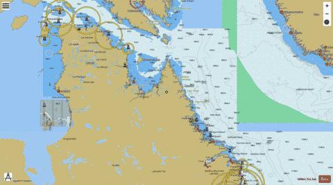
Labrador Coast Marine Charts

Here is the list of Labrador Coast marine charts and fishing maps available on iBoating : Canada Marine & Fishing App. Marine charts app now supports multiple plaforms including Android, iPhone/iPad, MacBook, and Windows/PC based chartplotter. The Marine Navigation App provides advanced features of a Marine Chartplotter including adjusting water level offset and custom depth shading. Fishing spots, Relief Shading and depth contours layers are available in most Lake maps. Nautical navigation features include advanced instrumentation to gather wind speed direction, water temperature, water depth, and accurate GPS with AIS receivers(using NMEA over TCP/UDP). Autopilot support can be enabled during ‘Goto WayPoint’ and ‘Route Assistance’. If marine chart / fishing map you are looking for is not listed in correct folio, please let us know.

Nautical Chart TitleScale
Alexis Bay (Dark Tickle, Grove Island) - Inland / Approach Chart (1:22,000)1:22000
Alexis River Estuary (Bassmans Tickle, Port Hope Simpson) - Inland / Approach Chart (1:22,000)1:22000
Anaktalik Brook - Inland / Approach Chart (1:45,000)1:45000
Baie Kyak (Napatak Island) - Inland / Approach Chart (1:22,000)1:22000
Baie Kyak (Passe Mikittuq, Île Anarniq) - Inland / Approach Chart (1:22,000)1:22000
Baie Payne (Passe de l'Illusion, Île Ikirasalik) - Inland / Approach Chart (1:22,000)1:22000
Baie Payne (Passe Ikirasaq, Natsik Islet) - Inland / Approach Chart (1:22,000)1:22000
Baie Payne (Passe Mikittuq, Île Innaarulikallak) - Inland / Approach Chart (1:22,000)1:22000
Baie Profonde (Tasiujaq) - Harbour Chart (1:12,000)1:12000
Baie Sèche (Tasiujaq) - Harbour Chart (1:12,000)1:12000
Baie Uugarsiuvik (Mouillage Akulivik) - Inland / Approach Chart (1:22,000)1:22000
Bassin Payne (Chenal Nakirtuq, Kangirsuk) - Inland / Approach Chart (1:22,000)1:22000
Bassin Payne (Kangirsuk) - Inland / Approach Chart (1:22,000)1:22000
Bassin Payne (Passe Mikittuq, Kangirsuk) - Inland / Approach Chart (1:22,000)1:22000
Big Bay - Coastal Navigation (1:90,000)1:90000
Big Pond (Shoal Tickle, Williams Harbour) - Inland / Approach Chart (1:25,000)1:25000
Bowdoin Harbour (Robinson Island) - Harbour Chart (1:7,500)1:7500
Caplin Bay (Entry Island) - Inland / Approach Chart (1:22,000)1:22000
Caplin Bay (Squasho Run, Hawke Island) - Inland / Approach Chart (1:22,000)1:22000
Cut Throat Tickle - Harbour Chart (1:12,000)1:12000
Daniel Island Harbour - Harbour Chart (1:9,000)1:9000
Daniel Rattle (Natuashish) - Harbour Detail (1:4,000)1:4000
Dead Islands Bay (Narrows Island, Pinsents Arm) - Harbour Chart (1:12,000)1:12000
Deep Inlet - Coastal Navigation (1:90,000)1:90000
Diana Bay (Ankle Passage, Fingernail Island) - Harbour Chart (1:10,000)1:10000
Diana Bay (Hudson Strait, Quaqtaq) - Harbour Detail (1:2,500)1:2500
Digges Sound (Ivujivik) - Inland / Approach Chart (1:22,000)1:22000
Domino Run (Black Tickle) - Harbour Detail (1:4,000)1:4000
Eclipse Channel (North Aulatsivik Island) - Inland / Approach Chart (1:20,000)1:20000
Ekortiarsuk Fiord (Oo-olilik Island) - Inland / Approach Chart (1:20,000)1:20000
Estuaire de la Rivière George (The Narrows, Kangiqsualujjuaq) - Harbour Detail (1:5,000)1:5000
Estuaire de la Rivière George (The Narrows, Kangiqsualujjuaq) - Inland / Approach Chart (1:45,000)1:45000
Favorite Tickle (Cartwright) - Harbour Chart (1:12,000)1:12000
Favorite Tickle (The Narrows, Cartwright) - Harbour Chart (1:12,000)1:12000
Foxe Basin - Overview Chart (1:350,000)1:350000
Foxe Channel - Overview Chart (1:350,000)1:350000
Frobisher Bay - Coastal Navigation (1:75,000)1:75000
Georges Cove Run (Boyeans Tickle, Williams Harbour) - Inland / Approach Chart (1:25,000)1:25000
Georges Cove Run (Shoal Tickle, Williams Harbour) - Inland / Approach Chart (1:22,000)1:22000
Goose Bay - Coastal Navigation (1:90,000)1:90000
Goose Bay Narrows - Inland / Approach Chart (1:22,000)1:22000
Goose Bay (Terrington Narrows) - Harbour Chart (1:8,000)1:8000
Gray Strait (Ingirranikuluk Narrows, Lawson Island) - Inland / Approach Chart (1:20,000)1:20000
Groswater Bay - Coastal Navigation (1:90,000)1:90000
Hebron Fiord - Overview Chart (1:180,000)1:180000
Hill Harbour (Entry Island) - Harbour Chart (1:12,000)1:12000
Hopedale Harbour (Kretschmer Island) - Inland / Approach Chart (1:22,000)1:22000
Hopedale Run (Anniowaktorusek) - Inland / Approach Chart (1:22,000)1:22000
Hopedale Run - Coastal Navigation (1:90,000)1:90000
Hopewell Sound (Inukjuak) - Harbour Chart (1:6,000)1:6000
Hudson Bay (Akulivik) - Harbour Chart (1:15,000)1:15000
Hudson Bay (Akulivik) - Inland / Approach Chart (1:22,000)1:22000
Hudson Bay (Akulivik) - Inland / Approach Chart (1:50,000)1:50000
Hudson Bay (Hopewell Narrows, Inukjuak) - Harbour Chart (1:12,500)1:12500
Hudson Bay (Puvirnituq) - Inland / Approach Chart (1:30,000)1:30000
Hudson Strait - Coastal Navigation (1:100,000)1:100000
Hudson Strait (Kangiqsujuaq) - Inland / Approach Chart (1:50,000)1:50000
Hudson Strait (Kinngait) - Harbour Chart (1:12,500)1:12500
Hudson Strait (Kinngait) - Harbour Detail (1:5,000)1:5000
Hudson Strait (McLelan Strait, Killiniq Island) - Inland / Approach Chart (1:20,000)1:20000
Hudson Strait - Overview Chart (1:350,000)1:350000
Hudson Strait - Overview Chart (1:500,000)1:500000
Hudson Strait (Passe Ford, Salluit) - Inland / Approach Chart (1:37,500)1:37500
Jeanette Bay - Coastal Navigation (1:90,000)1:90000
Kaipokok Bay - Coastal Navigation (1:90,000)1:90000
Kaipokok Bay (Postville) - Harbour Detail (1:4,000)1:4000
Kangalaksiorvik Fiord - Inland / Approach Chart (1:20,000)1:20000
Kanggisuap Passage (Kangiqsualujjuaq) - Harbour Chart (1:15,000)1:15000
Kenamu River Estuary - Inland / Approach Chart (1:22,000)1:22000
Kingurutik Lake - Overview Chart (1:350,000)1:350000
Lac aux Feuilles - Harbour Chart (1:12,000)1:12000
Lac aux Feuilles (Tasiujaq) - Harbour Chart (1:12,000)1:12000
Lac aux Feuilles (Tasiujaq) - Inland / Approach Chart (1:45,000)1:45000
Lake Melville - Coastal Navigation (1:90,000)1:90000
Lake Melville (Goose Bay Narrows) - Inland / Approach Chart (1:22,000)1:22000
Lake Melville - Overview Chart (1:700,000)1:700000
Makkovik Harbour - Harbour Detail (1:4,000)1:4000
McLelan Strait - Harbour Chart (1:7,500)1:7500
Mecklenburg Harbour (Lamb Tickle, St. Lewis) - Inland / Approach Chart (1:25,000)1:25000
Mishta-natuashu - Coastal Navigation (1:90,000)1:90000
Mosquito Bay (Akulivik) - Inland / Approach Chart (1:22,000)1:22000
Mosquito Bay (Smith Island) - Inland / Approach Chart (1:22,000)1:22000
Mugford Bay - Overview Chart (1:180,000)1:180000
Nachvak Fiord (The Narrows, Waldron Islands) - Inland / Approach Chart (1:45,000)1:45000
Navigational Sector (Cape Tickle, Williams Harbour) - Inland / Approach Chart (1:22,000)1:22000
Navigational Sector - Coastal Navigation (1:90,000)1:90000
Navigational Sector - Harbour Chart (1:8,000)1:8000
Navigational Sector - Overview Chart (1:180,000)1:180000
Navigational Sector - Overview Chart (1:3,500,000)1:3500000
Occasional Harbour (Pinsents Arm) - Inland / Approach Chart (1:22,000)1:22000
Occasional Harbour (Salmon Gulch, Williams Harbour) - Inland / Approach Chart (1:22,000)1:22000
Okak Bay - Overview Chart (1:180,000)1:180000
Okak Bay - Overview Chart (1:3,500,000)1:3500000
Paradise Arm (Narrows, Paradise River) - Inland / Approach Chart (1:22,000)1:22000
Paradise River Estuary - Inland / Approach Chart (1:22,000)1:22000
Porcupine Bay - Coastal Navigation (1:90,000)1:90000
Port Burwell (Hudson Strait, Jackson Island) - Harbour Chart (1:7,500)1:7500
Port Hope Simpson (Bassmans Tickle, Grove Island) - Inland / Approach Chart (1:22,000)1:22000
Port Manvers Run - Coastal Navigation (1:90,000)1:90000
Povungnituk Bay - Inland / Approach Chart (1:22,000)1:22000
Povungnituk Bay (Innelatevik Island) - Inland / Approach Chart (1:22,000)1:22000
Povungnituk Bay (Inooksulik Island) - Inland / Approach Chart (1:22,000)1:22000
Povungnituk Bay (Puvirnituq) - Inland / Approach Chart (1:22,000)1:22000
Punchbowl (Frenchmans Run, Dog Island) - Harbour Chart (1:8,000)1:8000
Ryans Bay (Eclipse Channel, North Aulatsivik Island) - Inland / Approach Chart (1:45,000)1:45000
Ryans Bay - Inland / Approach Chart (1:20,000)1:20000
Saglek Anchorage - Harbour Detail (1:4,000)1:4000
Saglek Fiord - Overview Chart (1:180,000)1:180000
Salmon Bight (Black Tickle, Carrol Island) - Harbour Detail (1:4,000)1:4000
Sandwich Bay - Coastal Navigation (1:90,000)1:90000
Sebaskachu Bay - Overview Chart (1:3,500,000)1:3500000
St. Michaels Bay (Narrows Island, Pinsents Arm) - Harbour Chart (1:12,000)1:12000
St. Michaels Bay (Narrows Island, Williams Harbour) - Inland / Approach Chart (1:45,000)1:45000
Strait of Belle Isle - Overview Chart (1:700,000)1:700000
Table Bay - Coastal Navigation (1:90,000)1:90000
Tasiuyak Arm - Inland / Approach Chart (1:50,000)1:50000
Telliaosilk Fiord - Harbour Chart (1:7,500)1:7500
Terrington Basin - Harbour Chart (1:8,000)1:8000
The Bridges Passage - Coastal Navigation (1:90,000)1:90000
The Narrows (Rigolet) - Harbour Chart (1:8,000)1:8000
Ungava Bay (Ankle Passage, Quaqtaq) - Inland / Approach Chart (1:45,000)1:45000
Ungava Bay (Aupaluk) - Inland / Approach Chart (1:45,000)1:45000
Ungava Bay (Chenal Tuvakutaaq, Inuksulik Island) - Inland / Approach Chart (1:45,000)1:45000
Ungava Bay - Coastal Navigation (1:90,000)1:90000
Ungava Bay - Inland / Approach Chart (1:22,000)1:22000
Ungava Bay (Kanggisuap Passage, Kangiqsualujjuaq) - Inland / Approach Chart (1:45,000)1:45000
Ungava Bay (Passe Ammajuq, Ivik Island) - Inland / Approach Chart (1:22,000)1:22000
Ungava Bay (Passe Ikirasaq, Aupaluk) - Inland / Approach Chart (1:22,000)1:22000
Ungava Bay (The Narrows, Île Hendry) - Harbour Chart (1:15,000)1:15000
Ungava Bay (The Narrows, Île Hendry) - Inland / Approach Chart (1:45,000)1:45000
Unity Bay (Nain) - Harbour Detail (1:4,000)1:4000
White Bear Arm (Charlottetown) - Harbour Chart (1:8,000)1:8000