New! i-Hunting Topo Maps now available -  

iPhone / iPad Marine Navigation App  and WMTS App are now available -  

New! Macbook ChartPlotter, and Windows Marine Navigation App now available -  
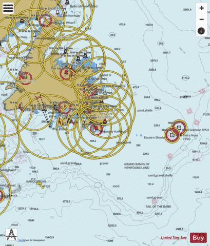
Newfoundland East and South Marine Charts

Here is the list of Newfoundland East and South marine charts and fishing maps available on iBoating : Canada Marine & Fishing App. Marine charts app now supports multiple plaforms including Android, iPhone/iPad, MacBook, and Windows/PC based chartplotter. The Marine Navigation App provides advanced features of a Marine Chartplotter including adjusting water level offset and custom depth shading. Fishing spots, Relief Shading and depth contours layers are available in most Lake maps. Nautical navigation features include advanced instrumentation to gather wind speed direction, water temperature, water depth, and accurate GPS with AIS receivers(using NMEA over TCP/UDP). Autopilot support can be enabled during ‘Goto WayPoint’ and ‘Route Assistance’. If marine chart / fishing map you are looking for is not listed in correct folio, please let us know.

Nautical Chart TitleScale
Alexis Pond1:12000
Alliger Lake1:12000
Anaktalik Lake1:24000
Andrews Pond1:12000
Aspen Pond1:6000
Awesome Lake1:12000
Baie Verte (Boat Pass, Coachman's Cove) - Inland / Approach Chart (1:22,000)1:22000
Baie Verte (Boat Pass, Ming's Bight) - Inland / Approach Chart (1:25,000)1:25000
Baie Verte (Duck Island) - Harbour Chart (1:6,000)1:6000
Baie Verte (Duck Island) - Inland / Approach Chart (1:22,000)1:22000
Baie Verte - Harbour Chart (1:6,000)1:6000
Bay Bulls - Harbour Chart (1:12,000)1:12000
Bay de Verde - Harbour Detail (1:4,000)1:4000
Bay de Verde Harbour - Harbour Detail (1:4,000)1:4000
Bay Le Moine (Rose Blanche) - Harbour Chart (1:7,500)1:7500
Bay of Exploits (Botwood) - Harbour Chart (1:12,000)1:12000
Bay of Exploits (Southern Passage, Moore's Cove) - Inland / Approach Chart (1:45,000)1:45000
Bay of Exploits (The Reach, Birchy Bay) - Inland / Approach Chart (1:45,000)1:45000
Bay of Exploits (The Reach, Port Albert) - Inland / Approach Chart (1:45,000)1:45000
Bay Roberts - Harbour Chart (1:12,000)1:12000
Beaver Pond1:6000
Bell Island Tickle - Harbour Detail (1:4,000)1:4000
Big Cooks Pond1:12000
Big Mosquito Cove (Sunnyside) - Harbour Chart (1:12,000)1:12000
Big Northeast Pond1:12000
Birchy Lake1:24000
Black Island Tickle - Harbour Chart (1:8,000)1:8000
Bonavista Bay - Coastal Navigation (1:90,000)1:90000
Bonavista Bay (Greenspond Harbour, New-Wes-Valley) - Inland / Approach Chart (1:22,000)1:22000
Bonavista Bay - Inland / Approach Chart (1:22,000)1:22000
Bonavista Bay (New-Wes-Valley) - Inland / Approach Chart (1:22,000)1:22000
Bonavista Bay - Overview Chart (1:180,000)1:180000
Bonavista Bay (Squarry Island) - Harbour Chart (1:8,000)1:8000
Bonne Bay Big Pond1:24000
Bonne Bay Little Pond1:12000
Bonne Bay (Middle Island) - Inland / Approach Chart (1:22,000)1:22000
Bonne Bay (Taylor Island) - Inland / Approach Chart (1:22,000)1:22000
Brennans Lake1:12000
Bryans Hole - Harbour Detail (1:4,000)1:4000
Burgeo Port (Short Reach, Grandy Island) - Harbour Chart (1:12,000)1:12000
Calling Shots Lake1:12000
Canada Bay (Englee) - Harbour Chart (1:12,000)1:12000
Cape Rouge Harbour (Conche) - Harbour Chart (1:15,000)1:15000
Cape Rouge Harbour (Conche) - Inland / Approach Chart (1:22,000)1:22000
Carbonear Bay - Harbour Detail (1:4,000)1:4000
Carmanville Arm - Inland / Approach Chart (1:22,000)1:22000
Cheeseman Lake1:6000
Come By Chance (EE) - Inland / Approach Chart (1:22,000)1:22000
Conception Bay - Coastal Navigation (1:90,000)1:90000
Conception Bay (Harbour Main - Chapel's Cove - Lakeview) - Inland / Approach Chart (1:22,000)1:22000
Conception Bay - Inland / Approach Chart (1:22,000)1:22000
Conception Bay (The Narrows, Paradise) - Harbour Detail (1:4,000)1:4000
Conche Harbour - Overview Chart (1:180,000)1:180000
Copper Lake1:12000
Country Pond1:12000
Crémaillère Harbour (St. Anthony) - Harbour Chart (1:15,000)1:15000
Crooks Lake1:24000
Croque Harbour - Inland / Approach Chart (1:22,000)1:22000
Croque Harbour (Observatory Island) - Harbour Chart (1:15,000)1:15000
Croque Harbour (Observatory Island) - Inland / Approach Chart (1:22,000)1:22000
Crystal Lake1:12000
Dead Dog Pond1:12000
Diver Pond (Charles Brook) - Inland / Approach Chart (1:40,000)1:40000
East Castor Pond1:12000
Eastern Channel - Coastal Navigation (1:90,000)1:90000
Eastern Channel - Harbour Chart (1:8,000)1:8000
Eastern Channel (Long Island) - Harbour Chart (1:8,000)1:8000
Eastern Channel (Red Island) - Harbour Chart (1:8,000)1:8000
Fermeuse Harbour - Harbour Chart (1:8,000)1:8000
First Burnt Pond1:12000
First Gulch (Fortune Gut) - Harbour Chart (1:8,000)1:8000
Fishy Lake1:12000
Flat Pond1:12000
Fly Pond1:6000
Forked Feeder Pond1:12000
Fortune Bay - Coastal Navigation (1:90,000)1:90000
Fortune Bay (Grand Bank Gut) - Harbour Chart (1:8,000)1:8000
François Bay - Inland / Approach Chart (1:22,000)1:22000
Freshwater Bay - Coastal Navigation (1:90,000)1:90000
Garia Bay (Rose Blanche) - Inland / Approach Chart (1:25,000)1:25000
Gaultois Harbour - Harbour Chart (1:12,000)1:12000
Gibbons Pond1:12000
Grandy Brook - Coastal Navigation (1:90,000)1:90000
Great Islets Harbour (Le Goulot, Gros Plomb Island) - Harbour Chart (1:15,000)1:15000
Great St. Julien Harbour (St. Julien Tickle) - Harbour Chart (1:15,000)1:15000
Great St. Lawrence Harbour - Harbour Chart (1:6,000)1:6000
Grey River - Inland / Approach Chart (1:22,000)1:22000
Halls Bay (South Brook) - Harbour Chart (1:12,000)1:12000
Halls Bay (South Brook) - Inland / Approach Chart (1:37,400)1:37400
Halls Bay (Springdale) - Harbour Chart (1:12,000)1:12000
Halls Bay (Springdale) - Harbour Detail (1:3,000)1:3000
Halls Bay (Sunday Cove Tickle, Coffee Cove) - Inland / Approach Chart (1:37,400)1:37400
Hampden Bay (West Anchorage, Millers Island) - Harbour Chart (1:12,000)1:12000
Happy Adventure Bays (Goats Island) - Harbour Chart (1:8,000)1:8000
Harbour Breton - Harbour Chart (1:12,000)1:12000
Harbour Grace - Harbour Detail (1:4,000)1:4000
Hare Bay (American Tickle, Main Brook) - Inland / Approach Chart (1:25,000)1:25000
Hare Bay (Goose Cove East) - Harbour Chart (1:12,000)1:12000
Hare Bay (Grassy Island) - Harbour Chart (1:15,000)1:15000
Hare Bay (MacGray Island) - Inland / Approach Chart (1:22,000)1:22000
Hare Bay (Port Island) - Inland / Approach Chart (1:22,000)1:22000
Hare Bay (Starboard Island) - Inland / Approach Chart (1:22,000)1:22000
Head of Placentia Bay (AA, Arnold's Cove) - Inland / Approach Chart (1:22,000)1:22000
Head of Placentia Bay (Arnold's Cove) - Inland / Approach Chart (1:22,000)1:22000
Head of Placentia Bay (DD, Arnold's Cove) - Inland / Approach Chart (1:45,000)1:45000
Heart's Content - Inland / Approach Chart (1:22,000)1:22000
Hermitage Bay (Gaultois) - Harbour Chart (1:12,000)1:12000
Hermitage Cove - Harbour Chart (1:12,000)1:12000
Igloo Lake1:24000
Iglusuataliksuak Lake1:24000
Jims Lake1:6000
Konrad Lake1:24000
Lake Crystal1:12000
Lake Karen1:12000
Lake Katherine1:12000
Lake Kathleen1:12000
Lamaline Bay (Allan's Island) - Inland / Approach Chart (1:20,000)1:20000
La Poile Bay - Harbour Chart (1:12,000)1:12000
La Scie Harbour - Harbour Chart (1:7,500)1:7500
La Scie Harbour - Harbour Chart (1:8,000)1:8000
La Scie Harbour (LaScie) - Inland / Approach Chart (1:25,000)1:25000
Lewisporte Harbour - Harbour Chart (1:8,000)1:8000
Little Bay Arm (Coffee Cove) - Harbour Detail (1:3,000)1:3000
Little Bay Arm (Otter Island Narrows, Coffee Cove) - Harbour Chart (1:8,000)1:8000
Little Guines Lake1:12000
Little Harbour Deep - Harbour Chart (1:12,000)1:12000
Little St. Lawrence Harbour - Inland / Approach Chart (1:22,000)1:22000
Little Ward Harbour (Otter Island) - Harbour Chart (1:8,000)1:8000
Long Cove Pond - Harbour Detail (1:4,000)1:4000
Long Harbour - Harbour Chart (1:8,000)1:8000
Long Pond (West Anchorage, Hampden) - Harbour Chart (1:12,160)1:12160
Middle Tickle (Fogo) - Harbour Detail (1:4,000)1:4000
Mortier Bay (The Narrows, Marystown) - Harbour Chart (1:12,000)1:12000
Motion Bay (Petty Harbour-Maddox Cove) - Harbour Chart (1:8,000)1:8000
Muddy Hole (Musgrave Harbour) - Harbour Chart (1:8,000)1:8000
Navigational Sector (Burgeo) - Harbour Chart (1:12,000)1:12000
Navigational Sector - Coastal Navigation (1:90,000)1:90000
Navigational Sector - Overview Chart (1:180,000)1:180000
Navigational Sector - Overview Chart (1:3,500,000)1:3500000
Navigational Sector - Overview Chart (1:700,000)1:700000
Navigational Sector (St. Anthony) - Inland / Approach Chart (1:22,000)1:22000
Normans Pond1:6000
Northeast Passage (Ramea) - Harbour Chart (1:8,000)1:8000
North Tickle (Lumsden) - Inland / Approach Chart (1:22,000)1:22000
Northwest Arm (Clarenville) - Harbour Chart (1:8,000)1:8000
Notre Dame Bay (Boatswain Tickle, Fogo) - Harbour Chart (1:12,000)1:12000
Notre Dame Bay (Boatswain Tickle, Fogo) - Harbour Chart (1:7,500)1:7500
Notre Dame Bay (Boatswain Tickle, Fogo) - Harbour Detail (1:4,000)1:4000
Notre Dame Bay (Burnt Island Tickle, Back Harbour) - Inland / Approach Chart (1:22,000)1:22000
Notre Dame Bay (Burnt Island Tickle, Back Harbour) - Inland / Approach Chart (1:45,000)1:45000
Notre Dame Bay (Crow Head) - Inland / Approach Chart (1:22,000)1:22000
Notre Dame Bay (Easter Tickle, Change Islands) - Inland / Approach Chart (1:45,000)1:45000
Notre Dame Bay (Flat Rock Tickle, Pilley's Island) - Harbour Chart (1:10,620)1:10620
Notre Dame Bay (La Scie) - Harbour Chart (1:12,000)1:12000
Notre Dame Bay (Nippers Harbour) - Harbour Chart (1:12,000)1:12000
Notre Dame Bay (Otter Island Narrows, Beachside) - Harbour Chart (1:8,000)1:8000
Notre Dame Bay (Otter Island Narrows, Little Bay) - Harbour Chart (1:6,000)1:6000
Notre Dame Bay (Otter Island Narrows, Little Bay) - Harbour Chart (1:8,000)1:8000
Notre Dame Bay - Overview Chart (1:180,000)1:180000
Notre Dame Bay - Overview Chart (1:3,500,000)1:3500000
Notre Dame Bay (Pretty Tickle, Triton) - Inland / Approach Chart (1:24,476)1:24476
Notre Dame Bay (Shoal Tickle, Joe Batt's Arm) - Harbour Chart (1:12,000)1:12000
Notre Dame Bay (Thimble Tickles, Leading Tickles) - Harbour Chart (1:12,275)1:12275
Notre Dame Bay (Triton) - Harbour Chart (1:8,000)1:8000
Osprey Lake1:24000
Otter Island Narrows (Little Bay) - Harbour Detail (1:3,000)1:3000
Pacquet Harbour - Harbour Chart (1:12,000)1:12000
Placentia Bay (Burin) - Harbour Detail (1:1,200)1:1200
Placentia Bay (Burin Passage) - Inland / Approach Chart (1:20,000)1:20000
Placentia Bay - Coastal Navigation (1:90,000)1:90000
Placentia Bay (Fox Harbour) - Inland / Approach Chart (1:22,000)1:22000
Placentia Bay (Fox Island) - Inland / Approach Chart (1:22,000)1:22000
Placentia Bay - Inland / Approach Chart (1:22,000)1:22000
Placentia Bay (Marystown) - Harbour Chart (1:12,000)1:12000
Placentia Bay - Overview Chart (1:700,000)1:700000
Placentia Bay (Pushthrough Passage, Boat Harbour) - Inland / Approach Chart (1:25,000)1:25000
Placentia Bay (St. Bride's) - Harbour Chart (1:8,000)1:8000
Placentia Bay (St. Lawrence) - Inland / Approach Chart (1:20,000)1:20000
Placentia Bay (St. Lawrence) - Inland / Approach Chart (1:22,000)1:22000
Placentia Road (Placentia Gut, Ontario Isles) - Inland / Approach Chart (1:22,000)1:22000
Port Nelson (Pond Tickle, Badger's Quay) - Inland / Approach Chart (1:22,000)1:22000
Portugal Cove (Bell Island Tickle) - Harbour Detail (1:4,000)1:4000
Raft Pond1:12000
Renews Harbour - Overview Chart (1:180,000)1:180000
Right Lake1:12000
Rodney Pond1:24000
Rose Blanche Bay (Cains Island) - Harbour Chart (1:10,000)1:10000
Ruisseau de Savoyard (Anse à Rodrigue, Saint Pierre Island) - Harbour Chart (1:15,000)1:15000
Ruisseau du Couvral - Coastal Navigation (1:90,000)1:90000
Seal Bay (Leading Tickles) - Inland / Approach Chart (1:24,620)1:24620
Second Burnt Pond1:12000
Second Saunders Pond1:12000
Sir Charles Hamilton Sound (Frederickton) - Inland / Approach Chart (1:45,000)1:45000
Snooks Arm - Harbour Chart (1:12,000)1:12000
Snooks Arm (Pigeon Island) - Harbour Chart (1:12,000)1:12000
South Arm (Holyrood) - Inland / Approach Chart (1:22,000)1:22000
South Tickle (North Tickle, Lumsden) - Inland / Approach Chart (1:22,000)1:22000
South Tickle (Southern Cat Island) - Inland / Approach Chart (1:22,000)1:22000
Southwest Arm (Harbour Breton) - Harbour Chart (1:12,000)1:12000
St. Anthony Bight (Dog Island) - Inland / Approach Chart (1:22,000)1:22000
St. John's Bay - Harbour Detail (1:4,000)1:4000
St. John's Harbour - Harbour Detail (1:4,000)1:4000
St. Lunaire Bay (Granchain Island) - Harbour Chart (1:15,000)1:15000
St. Mary's Bay - Coastal Navigation (1:90,000)1:90000
Summerford Arm (Strong's Island) - Harbour Detail (1:4,000)1:4000
The Narrows (Jackson's Arm) - Harbour Chart (1:6,132)1:6132
Third Saunders Pond1:12000
Tilt Cove - Harbour Detail (1:1,200)1:1200
Toilet Seat Lake1:6000
Tom Roses Pond1:12000
Trepassey Bay - Inland / Approach Chart (1:22,000)1:22000
Trepassey Harbour - Inland / Approach Chart (1:22,000)1:22000
Trinity Bay - Coastal Navigation (1:90,000)1:90000
Trinity Bay (Little Catalina) - Inland / Approach Chart (1:22,000)1:22000
Trinity Bay (Manuel Island) - Inland / Approach Chart (1:22,000)1:22000
Trinity Bay (Old Perlican) - Inland / Approach Chart (1:22,000)1:22000
Trinity Harbour (Admiral Island) - Harbour Detail (1:4,000)1:4000
Valleyfield Harbour (Middle Tickle, New-Wes-Valley) - Inland / Approach Chart (1:22,000)1:22000
Western Brook Pond1:24000
White Bay - Harbour Chart (1:12,000)1:12000
White Bay - Harbour Chart (1:12,500)1:12500
White Bay - Inland / Approach Chart (1:20,000)1:20000
White Bay (Jackson's Arm) - Harbour Chart (1:10,653)1:10653
White Bay - Overview Chart (1:180,000)1:180000
White Bay (The Narrows, Jackson's Arm) - Harbour Chart (1:12,275)1:12275
White Bay (The Tickle, Georges Island) - Inland / Approach Chart (1:18,452)1:18452
White Bay (Westport) - Harbour Chart (1:12,189)1:12189
White Bear Bay - Coastal Navigation (1:90,000)1:90000
Wolf Cove (South Brook) - Harbour Detail (1:4,000)1:4000