
New! i-Hunting Topo Maps now available -  

iPhone / iPad Marine Navigation App  and WMTS App are now available -  

New! Macbook ChartPlotter, and Windows Marine Navigation App now available -  
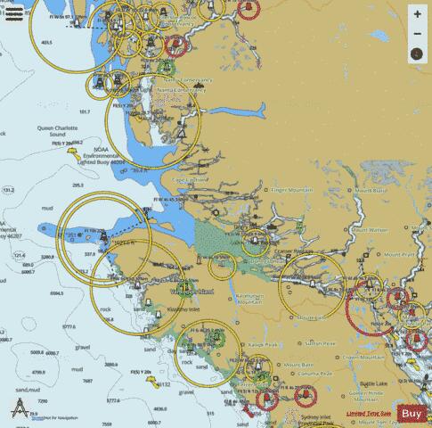
Mount Waddington District Fishing Maps

Looking for fishing distinations in Mount Waddington District? Our app supports the following lake maps in Mount Waddington District. If marine chart / fishing map you are looking for is not listed in correct folio, please let us know.

Lake / Marine Chart TitleScale
Alice Lake1:24000
Angler Lake1:6000
Ann Lake1:6000
Anutz Lake1:12000
Atluck Lake1:12000
Beaver Lake1:6000
Benson Lake1:12000
Bonanza Lake1:24000
Burnett Lake1:6000
Claud Elliott Lake1:6000
Colony Lake1:6000
Crowman Lake1:6000
Diane Lake1:6000
D Lake1:6000
Frost Lake1:6000
Georgie Lake1:12000
Haihte Lake1:6000
Hoomak Lake1:12000
Howie Bowlett Lake1:6000
Huaskin Lake1:24000
Huson Lake / Hutsan Lake1:12000
Ida Lake1:12000
Iron Lake1:6000
Joes Lake1:6000
Kains Lake1:12000
Kaipit Lake1:12000
Kakweiken Lake1:6000
Kathleen Lake1:12000
Keogh Lake1:12000
Klaklakama Lakes1:12000
Knot Lakes1:24000
Larry Lake1:6000
Le Mare Lake1:12000
Lottie Lake1:6000
Maynard Lake1:12000
Misty Lake1:6000
Moore Lake1:6000
Mukwilla Lake1:6000
Nahwitti Lake1:12000
Quatse Lake1:12000
Rooney Lake1:6000
Roselle Lake1:6000
Sara Lake1:6000
Schoen Lake1:12000
Thiemer Lake1:6000
Three Isle Lake1:6000
Tsiko Lake1:6000
Vernon Lake1:24000
Victoria Lake1:24000
Viola Lake1:12000
Wolfe Lake1:6000
Woss Lake1:24000
Sea Otter Cove (Helen Islands) - Harbour Chart (1:14,000)1:14000
Brooks Bay (Gay Passage, Scarf Island) - Inland / Approach Chart (1:45,000)1:45000
Broughton Strait (Cormorant Island) - Harbour Chart (1:10,000)1:10000
Broughton Strait - Harbour Detail (1:2,000)1:2000
Coal Harbour - Harbour Detail (1:3,000)1:3000
Drury Inlet (Stuart Narrows, Leche Islet) - Harbour Chart (1:10,000)1:10000
Forward Inlet (McAllister Islet) - Harbour Chart (1:7,500)1:7500
Goletas Channel (Hope Island) - Harbour Chart (1:10,000)1:10000
Hardy Bay - Harbour Chart (1:7,500)1:7500
Havannah Channel (Chatham Channel, Cracroft) - Harbour Chart (1:10,000)1:10000
Johnstone Strait (Baronet Passage, Cracroft) - Inland / Approach Chart (1:45,000)1:45000
Johnstone Strait (Jesse Island) - Inland / Approach Chart (1:22,000)1:22000
Johnstone Strait (Race Passage, Peterson Islet) - Inland / Approach Chart (1:22,000)1:22000
Johnstone Strait (Telegraph Cove, Port McNeill) - Inland / Approach Chart (1:45,000)1:45000
Kenneth Passage (Watson Island) - Harbour Chart (1:10,000)1:10000
Kingcome Inlet (Hopetown Passage, Sullivan Bay) - Inland / Approach Chart (1:45,000)1:45000
Kyuquot Sound (Eelstow Passage, Expedition Islets) - Inland / Approach Chart (1:45,000)1:45000
Loughborough Inlet (Mayne Passage, West Thurlow Island) - Inland / Approach Chart (1:45,000)1:45000
Muchalat Inlet (Critter Cove, Victor Island) - Inland / Approach Chart (1:45,000)1:45000
Neroutsos Inlet (Ketchen Island) - Harbour Detail (1:750)1:750
Neroutsos Inlet (Port Alice) - Harbour Chart (1:7,500)1:7500
Nootka Sound (Critter Cove) - Inland / Approach Chart (1:45,000)1:45000
Port McNeill (Broughton Strait) - Harbour Chart (1:10,000)1:10000
Quatsino Sound (Kitten Island) - Harbour Chart (1:6,000)1:6000
Quatsino Sound (Port Alice) - Inland / Approach Chart (1:45,000)1:45000
Queen Charlotte Sound (Alexandra Passage, Oar Island) - Inland / Approach Chart (1:45,000)1:45000
Queen Charlotte Strait (Augustine Islands) - Harbour Chart (1:7,500)1:7500
Queen Charlotte Strait (Bate Passage, Port Hardy) - Inland / Approach Chart (1:45,000)1:45000
Queen Charlotte Strait (George Passage, Sullivan Bay) - Inland / Approach Chart (1:45,000)1:45000
Queen Charlotte Strait (Haddington Passage, Port McNeill) - Inland / Approach Chart (1:45,000)1:45000
Queen Charlotte Strait (Labouchere Passage, Port Hardy) - Inland / Approach Chart (1:45,000)1:45000
Queen Charlotte Strait (Nakwakto Rapids, Murray Labyrinth) - Harbour Chart (1:10,000)1:10000
Scouler Entrance (Anchorage Island) - Harbour Detail (1:5,000)1:5000
Seymour Inlet (Broad Reach, Greaves Island) - Inland / Approach Chart (1:45,000)1:45000
Seymour Inlet (Eclipse Narrows) - Inland / Approach Chart (1:45,000)1:45000
Simoom Sound (Penphrase Passage) - Harbour Chart (1:10,000)1:10000
Mount Waddington District Fishing App
Mount Waddington Map - i-Fishing App