What is Hi-Resolution/Sonar Bathymetry
How to enable Hi-Res bathy in the i-Boating app
Enabled by default for some waterways
Enable explicitly under Layers
Why Hi-Res Bathy matters for Anglers?
Why Sonar Bathy matters for Divers?
How does Hi-Res Bathy enhance marine navigation safety?
What does Hi-Res Bathy look like in the i-Boating app?
What is Hi-Resolution/Sonar Bathymetry
Bathymetry is the underwater equivalent of topography: the measurement and mapping of depths and physical features in oceans, lakes, and rivers.
Standard nautical charts provide depth information collected through hydrographic surveys. However, the density of depth measurements can vary significantly from one waterbody to another.
High-resolution (Hi-Res) bathymetry provides a much more detailed view of underwater terrain, revealing features that may not be visible on standard nautical charts.
Hi-resolution bathymetric data can come from several sources:
- Multibeam Echo Sounders (MBES): Emit fan-shaped sound rays to map vast swaths of the seafloor in high density.
- Crowdsourced Sonar Logs: Logs recorded by everyday boaters, anglers, and vessel fleets equipped with GPS-enabled fishfinders .
- Hydrographic & Government Data Pipelines: Hydrographic offices maintain a bathymetry layer covering commercial waterways.
When rendered inside web plotters or mobile apps, this multi-source data generates ultra-dense contour lines (often down to 1-foot or 0.5-meter intervals) and vivid 3D bottom-relief shading.
How to enable Hi-Res bathy in the i-Boating app
Enabled by default for some waterways
It is enabled by default for several lakes and waterways. For e.g. you can view hi-resolution contours for popular lakes like Lake Lanier, Lake Norman, Lake Allatoona etc. by default in hi-res. Since its enabled by default, there is nothing you need to do. It is on all the time for these lakes.
Enable explicitly under Layers
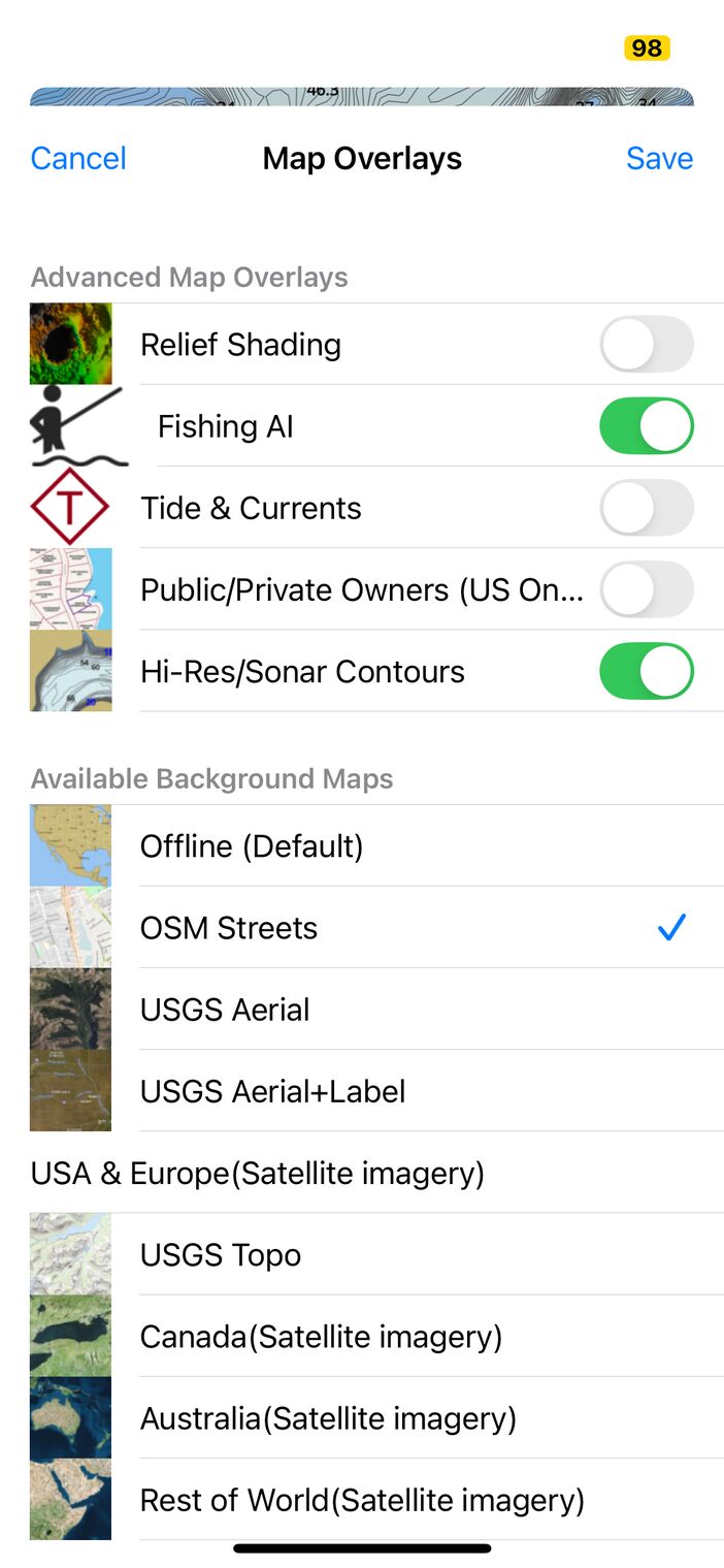
If you do not see your waterbody/region covered, drop us a line. Here is how to enable it:
- Tap layers icon
- Check box for Hi-Resolution/Sonar Maps
- Tap Save
Why Hi-Res Bathy matters for Anglers?
Game fish often congregate around underwater structural transitions such as humps, drop-offs, underwater islands, trenches, and reefs.
Standard nautical charts may not show these structures in sufficient detail. With high-resolution bathymetry enabled, anglers can identify tightly spaced depth contours that indicate steep drop-offs, underwater shelves, and submerged pinnacles.
These underwater features can provide valuable clues about potential fishing locations, helping anglers identify promising spots to explore rather than searching blindly.
Why Sonar Bathy matters for Divers?
Scuba divers and marine researchers can use high-resolution bathymetric maps to identify interesting underwater terrain, including submerged wrecks, artificial reefs, underwater ridges, and complex bottom structures.
Detailed depth contours and bottom-relief shading help divers understand the underwater landscape and identify potential areas of interest before planning a dive.
How does Hi-Res Bathy enhance marine navigation safety?
For deep-draft vessels, sailboats with fin keels, and boats navigating shallow or changing tidal channels, understanding underwater depth profiles is important.
High-resolution bathymetry helps mariners visualize shoals, underwater ridges, sandbars, and other changes in bottom depth that may not be apparent on less detailed charts.
This additional depth information can help boaters make better-informed route decisions and identify areas that deserve extra caution, reducing the risk of grounding.
Hi-Res bathymetry should be used as a supplementary navigation aid alongside official nautical charts, current navigational information, and appropriate depth-clearance precautions.
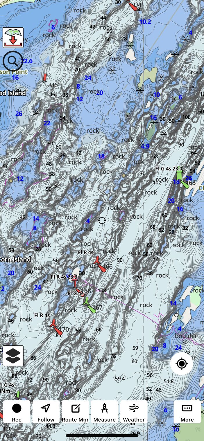
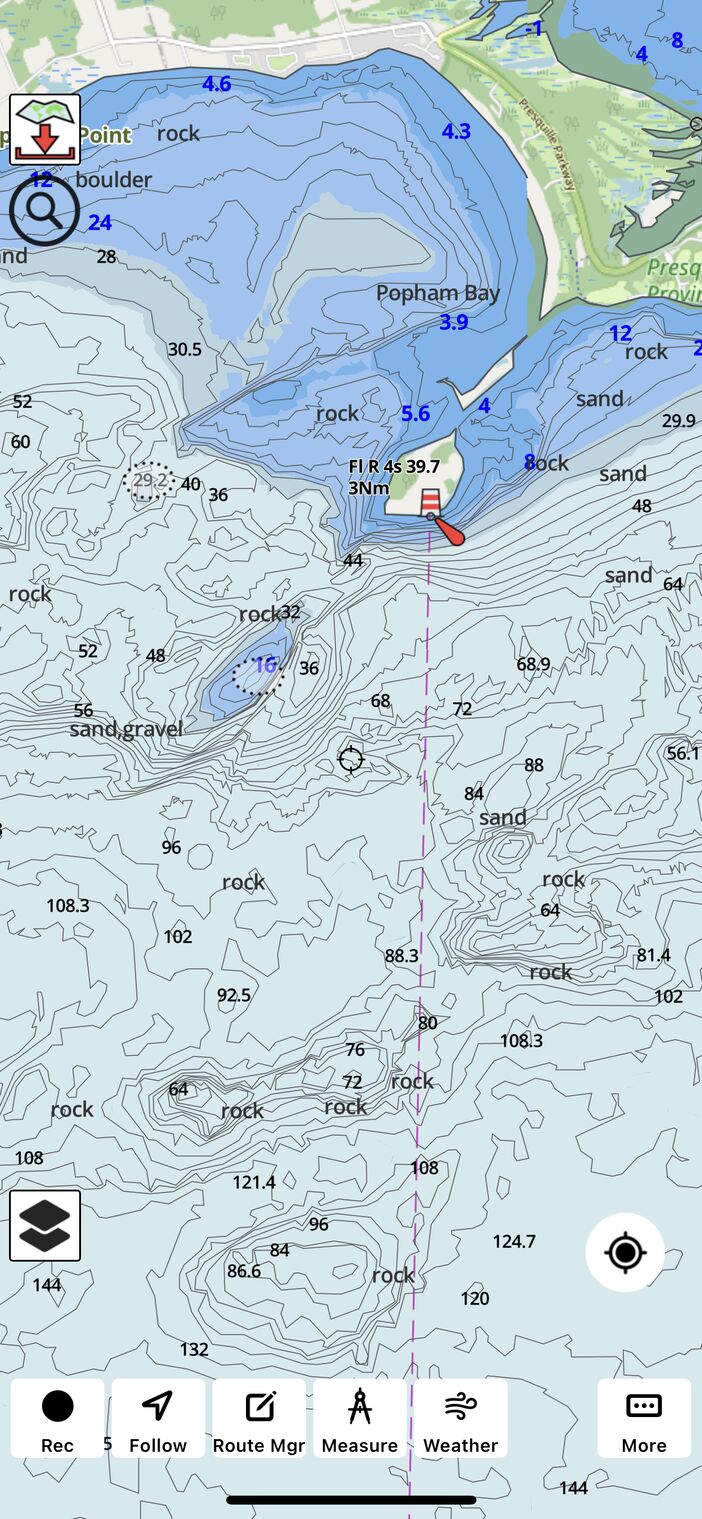
What does Hi-Res Bathy look like in the i-Boating app?
Here are a few screenshots.