Tweed River fishing map is included in New South Wales Fishing Maps nautical charts folio. It is available as part of iBoating : Australia Marine & Fishing App (now supported on multiple platforms including Android, iPhone/iPad, MacBook, and Windows(tablet and phone)/PC based chartplotter. ).
With our Lake Maps App, you get all the great marine chart app features like fishing spots, along with Tweed River lake depth map. The fishing maps app include HD lake depth contours, along with advanced features found in Fish Finder / Gps Chart Plotter systems, turning your device into a Depth Finder. The Tweed River Navigation App provides advanced features of a Marine Chartplotter including adjusting water level offset and custom depth shading. Fishing spots and depth contours layers are available in most Lake maps. Lake navigation features include advanced instrumentation to gather wind speed direction, water temperature, water depth, and accurate GPS with AIS receivers(using NMEA over TCP/UDP). Autopilot support can be enabled during ‘Goto WayPoint’ and ‘Route Assistance’.
Have more questions about the Nautical Chart App? Ask us.
Fishing Info for Tweed River
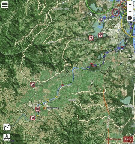
The Tweed River is a river situated in the Northern Rivers district of New South Wales, Australia. From the middle reaches of its course, the state boundary between New South Wales and Queensland is located approximately 10 kilometres (6.2 mi) north. The river rises on the eastern slopes of the Great Dividing Range; with its watershed bordered by the McPherson, Burringbar, Condong and Tweed ranges and containing a catchment area of 1,055 km2 (407 sq mi). The river flows generally north east, joined by eight tributaries including the Oxley and Rous rivers before reaching its mouth at its confluence with the Coral Sea of the South Pacific Ocean, south of Point Danger; descending 173 metres (568 ft) over its 78-kilometre (48 mi) course. On its journey, it passes through the major urban centres of Murwillumbah and Tweed Heads. The river's drainage basin consists mostly of the erosion caldera of the Tweed Volcano, a huge extinct volcano of which Mount Warning is the volcanic plug. The Tweed River area has a fine subtropical climate, high rainfall and fertile volcanic soils. It was originally covered by rainforest, much of which has been cleared. Some remains in several national parks and reserves. The lowlands along the river are used for farming sugar cane and other crops. The surrounding Tweed Shire is a local government area of New South Wales. Each year the river hosts a number of major aquatic events. The lower reaches of the Tweed River are a good recreational fishing site. Waterskiing, pleasure boating and rowing are other popular activities on the lower reaches of the river.
More on Wikipedia...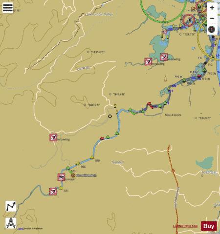
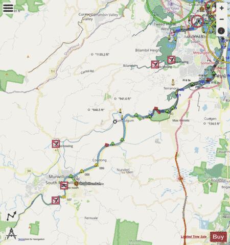
Tweed River Fishing Map Stats | |
| Title | Tweed River |
| Scale | 1:24000 |
| Area * | 4596.35 acres |
| Shoreline * | 125.75 miles |
| Min Longitude | 153.34 |
| Min Latitude | -28.39 |
| Max Longitude | 153.57 |
| Max Latitude | -28.17 |
| Edition Label 1 | |
| Edition Label 2 | |
| Edition Label 3 | |
| Id | AU_NSW_1_Tweed_River |
| Country | Australia |
| Projection | Mercator |
| * some Stats may include nearby/connecting waterbodies | |
| |||||||||||||||||||||||||||||||||||||||||||||||||||||||||||||||||||||||||||||||||||||||||||||||||||||||
|