Potholes Reservoir fishing map is available as part of iBoating : USA Marine & Fishing App(now supported on multiple platforms including Android, iPhone/iPad, MacBook, and Windows(tablet and phone)/PC based chartplotter.).
With our Lake Maps App, you get all the great marine chart app features like fishing spots, along with Potholes Reservoir depth map. The fishing maps app include HD lake depth contours, along with advanced features found in Fish Finder / Gps Chart Plotter systems, turning your device into a Depth Finder. The Potholes Reservoir Navigation App provides advanced features of a Marine Chartplotter including adjusting water level offset and custom depth shading. Fishing spots and depth contours layers are available in most Lake maps. Lake navigation features include advanced instrumentation to gather wind speed direction, water temperature, water depth, and accurate GPS with AIS receivers(using NMEA over TCP/UDP). Autopilot support can be enabled during ‘Goto WayPoint’ and ‘Route Assistance’.
Now i-Boating supports Fishing Points in Potholes Reservoir.
Have more questions about the Nautical Chart App? Ask us.
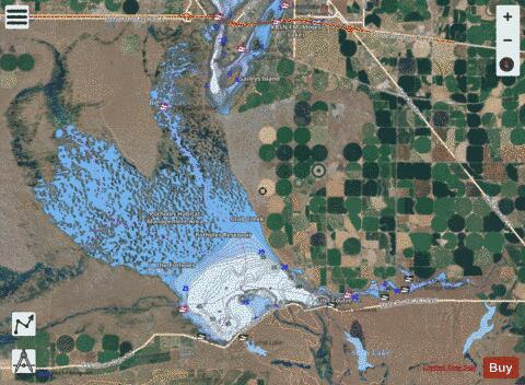
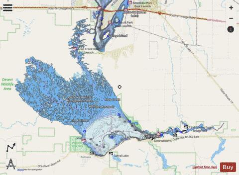
Fishing Info for Potholes Reservoir
The Potholes Reservoir is part of the Columbia Basin Irrigation Project. It is formed by the O'Sullivan Dam and located in central Washington, in the United States. The reservoir is fed by water from Moses Lake, part of the Crab Creek basin. The area features several lakes (typically 30-70 yards wide and 10–30 feet deep). These lakes, known as "potholes" were created through both natural and man made processes. The potholes were initially carved out during the Pleistocene by flood waters originating from Glacial Lake Missoula. Subsequent damming of the area by the Columbia Basin Project raised the water table high enough to allow these topographical depressions to become lakes.
More on Wikipedia...Popular fish species in this lake include Black crappie, Lake whitefish, Largemouth bass, Rainbow trout, Smallmouth bass, Walleye and Yellow perch.
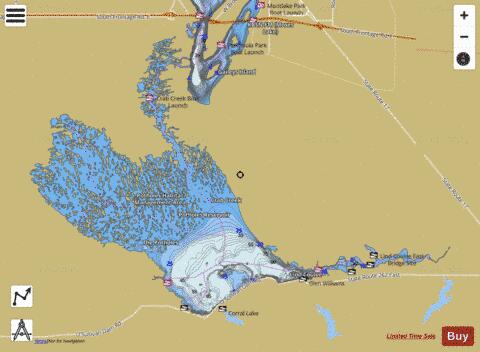
Potholes Reservoir Fishing Map Stats | |
| Title | Potholes Reservoir |
| Scale | 1:24000 |
| Counties | Grant |
| Nearby Cities | Moses Lake, McDonald, Warden, Wheeler, Othello, Royal City, Ruff, Ephrata, Smyrna, Schrag |
| Area * | 14291.99 acres |
| Shoreline * | 404.96 miles |
| Min Longitude | -119.44 |
| Min Latitude | 46.97 |
| Max Longitude | -119.16 |
| Max Latitude | 47.09 |
| Edition Label 1 | |
| Edition Label 2 | |
| Edition Label 3 | |
| Id | US_AA_WA_01513187 |
| Country | US |
| Projection | Mercator |
| * some Stats may include nearby/connecting waterbodies | |
|