Blue Ridge Lake fishing map is available as part of iBoating : USA Marine & Fishing App(now supported on multiple platforms including Android, iPhone/iPad, MacBook, and Windows(tablet and phone)/PC based chartplotter.).
With our Lake Maps App, you get all the great marine chart app features like fishing spots, along with Blue Ridge Lake depth map. The fishing maps app include HD lake depth contours, along with advanced features found in Fish Finder / Gps Chart Plotter systems, turning your device into a Depth Finder. The Blue Ridge Lake Navigation App provides advanced features of a Marine Chartplotter including adjusting water level offset and custom depth shading. Fishing spots and depth contours layers are available in most Lake maps. Lake navigation features include advanced instrumentation to gather wind speed direction, water temperature, water depth, and accurate GPS with AIS receivers(using NMEA over TCP/UDP). Autopilot support can be enabled during ‘Goto WayPoint’ and ‘Route Assistance’.
Have more questions about the Nautical Chart App? Ask us.
Fishing Info for Blue Ridge Lake
Blue Ridge Lake is a reservoir in Fannin County, in the northern portion of the U.S. state of Georgia. The reservoir encompasses 3,300-acre (1,300 ha) of water, and a "full summer pool" of approximately 1,686 feet (514 m) above mean sea level. It is managed by the Tennessee Valley Authority and is primarily fed by the Toccoa River. Blue Ridge Lake was created by the completion of Blue Ridge Dam and has approximately 60 miles (97 km) of shoreline and a flood storage capacity of 68,550 acre-feet (84,560,000 m3). The lake's levels fluctuate by about 20 feet (6.1 m) in a typical year. Blue Ridge Dam was completed in 1930. It stands 175 feet high and is 1,553 feet wide across the Toccoa river. The dam provides up to 13 megawatts of power via a single generator.
More on Wikipedia...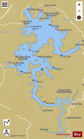
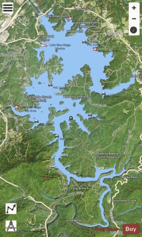
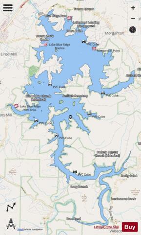
Blue Ridge Lake Fishing Map Stats | |
| Title | Blue Ridge Lake |
| Scale | 1:12000 |
| Counties | Fannin |
| Nearby Cities | Morganton, Mineral Bluff, Blue Ridge, Cherry Log, Epworth, McCaysville, Copperhill, Culberson, Ducktown, East Ellijay |
| Area * | 3018.10 acres |
| Shoreline * | 60.10 miles |
| Min Longitude | -84.30 |
| Min Latitude | 34.80 |
| Max Longitude | -84.23 |
| Max Latitude | 34.89 |
| Edition Label 1 | |
| Edition Label 2 | |
| Edition Label 3 | |
| Id | US_AA_GA_00354784 |
| Country | US |
| Projection | Mercator |
| * some Stats may include nearby/connecting waterbodies | |
|