Tappan fishing map is available as part of iBoating : USA Marine & Fishing App(now supported on multiple platforms including Android, iPhone/iPad, MacBook, and Windows(tablet and phone)/PC based chartplotter.).
With our Lake Maps App, you get all the great marine chart app features like fishing spots, along with Tappan lake depth map. The fishing maps app include HD lake depth contours, along with advanced features found in Fish Finder / Gps Chart Plotter systems, turning your device into a Depth Finder. The Tappan Navigation App provides advanced features of a Marine Chartplotter including adjusting water level offset and custom depth shading. Fishing spots and depth contours layers are available in most Lake maps. Lake navigation features include advanced instrumentation to gather wind speed direction, water temperature, water depth, and accurate GPS with AIS receivers(using NMEA over TCP/UDP). Autopilot support can be enabled during ‘Goto WayPoint’ and ‘Route Assistance’.
Now i-Boating supports Fishing Points in Tappan.
Have more questions about the Nautical Chart App? Ask us.
Fishing Info for Tappan
Tappan Lake, also known as Tappan Reservoir, is a reservoir in Harrison County, Ohio, United States. The lake covers 2,350 acres (9.5 km2) of water and 5,000 acres (20 km2) of surrounding land, as part of the Muskingum Watershed Conservancy District. Normal pool elevation is 899.3 ft (274.1 m) above sea level. The lake has a 399 horsepower (298 kW) limit for boats. There are two public launch ramps - one near the roadside rest area on U.S. 250, and the other across from Tappan Marina. A third launch ramp is located inside Tappan Lake Park. It is located between Cadiz and Dennison. U.S. Route 250 follows Tappan Lake for several miles on a series of causeways built during the construction of the lake in the 1930s. Tappan Lake took its name from the former community of Tappan, which was inundated with the completion of the lake in 1938. The former town of Laceyville lies beneath the lake.
More on Wikipedia...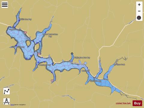
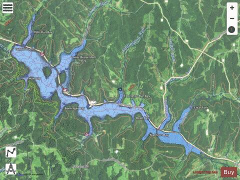
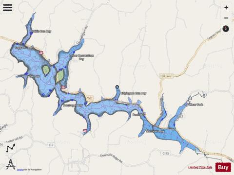
Tappan Fishing Map Stats | |
| Title | Tappan |
| Scale | 1:12000 |
| 1 ft Depth Contours for Anglers | Yes |
| Counties | Harrison |
| Nearby Cities | Deersville, Bowerston, Scio, Leesville, Stillwater, Tippecanoe, Dennison, Jewett, Cadiz, Uhrichsville |
| Area * | 2306.31 acres |
| Shoreline * | 50.50 miles |
| Min Longitude | -81.23 |
| Min Latitude | 40.31 |
| Max Longitude | -81.10 |
| Max Latitude | 40.37 |
| Edition Label 1 | |
| Edition Label 2 | |
| Edition Label 3 | |
| Id | US_OH_tappan |
| Country | US |
| Projection | Mercator |
| * some Stats may include nearby/connecting waterbodies | |
|