Irene fishing map is available as part of iBoating : USA Marine & Fishing App(now supported on multiple platforms including Android, iPhone/iPad, MacBook, and Windows(tablet and phone)/PC based chartplotter.).
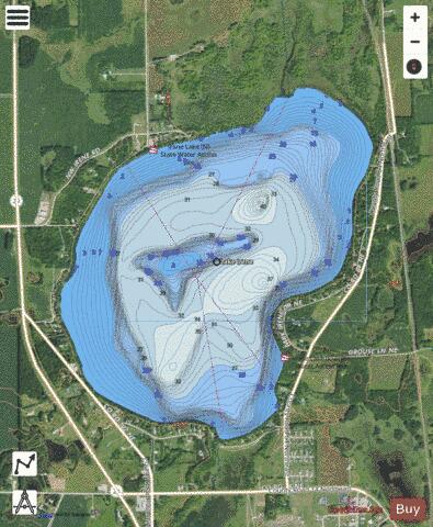
With our Lake Maps App, you get all the great marine chart app features like fishing spots, along with Irene lake depth map. The fishing maps app include HD lake depth contours, along with advanced features found in Fish Finder / Gps Chart Plotter systems, turning your device into a Depth Finder. The Irene Navigation App provides advanced features of a Marine Chartplotter including adjusting water level offset and custom depth shading. Fishing spots and depth contours layers are available in most Lake maps. Lake navigation features include advanced instrumentation to gather wind speed direction, water temperature, water depth, and accurate GPS with AIS receivers(using NMEA over TCP/UDP). Autopilot support can be enabled during ‘Goto WayPoint’ and ‘Route Assistance’.
Now i-Boating supports Fishing Points in Irene.
Have more questions about the Nautical Chart App? Ask us.
Fishing Info for Irene
Lake Irene is a lake in Douglas County, in the U.S. state of Minnesota. Lake Irene was named for Irene Roadruck, whose mother was honored with her own lake, Lake Miltona. Lake Irene is home to basketball legend Luke Janushka. Janushka is the first person from Irene to lead a major city pro-am league (Scottsdale) in three point %. His father Mark Janushka was notable in the 70's for catching the counties biggest fish. Some say if it wasn't for a knee injury he would have been even more accomplished than his son.
More on Wikipedia...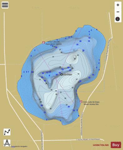
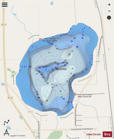
Irene Fishing Map Stats | |
| Title | Irene |
| Scale | 1:6000 |
| Counties | Douglas |
| Nearby Cities | Miltona, Carlos, Parkers Prairie, Rose City, Nelson, Alexandria, Urbank, Garfield, Wrightstown, Osakis |
| Area * | 637.89 acres |
| Shoreline * | 4.16 miles |
| Min Longitude | -95.32 |
| Min Latitude | 46.05 |
| Max Longitude | -95.29 |
| Max Latitude | 46.07 |
| Edition Label 1 | |
| Edition Label 2 | |
| Edition Label 3 | |
| Id | US_MN_21007600 |
| Country | US |
| Projection | Mercator |
| * some Stats may include nearby/connecting waterbodies | |
|