Orion, Lake fishing map is available as part of iBoating : USA Marine & Fishing App(now supported on multiple platforms including Android, iPhone/iPad, MacBook, and Windows(tablet and phone)/PC based chartplotter.).
With our Lake Maps App, you get all the great marine chart app features like fishing spots, along with Orion, Lake depth map. The fishing maps app include HD lake depth contours, along with advanced features found in Fish Finder / Gps Chart Plotter systems, turning your device into a Depth Finder. The Orion, Lake Navigation App provides advanced features of a Marine Chartplotter including adjusting water level offset and custom depth shading. Fishing spots and depth contours layers are available in most Lake maps. Lake navigation features include advanced instrumentation to gather wind speed direction, water temperature, water depth, and accurate GPS with AIS receivers(using NMEA over TCP/UDP). Autopilot support can be enabled during ‘Goto WayPoint’ and ‘Route Assistance’.
Now i-Boating supports Fishing Points in Orion, Lake.
Have more questions about the Nautical Chart App? Ask us.
Fishing Info for Orion, Lake
Lake Orion is an all-sports, 470-acre lake in Orion Township in Oakland County, Michigan. It has a maximum depth of 58 feet (18 m). The lake is located within the Village of Lake Orion and Orion Township. It is the eighth largest lake by area in Oakland County, Michigan. The current area of the lake was formed by a collection of smaller lakes over time, beginning with the damming of Paint Creek in the 1830s. Canals have also been dredged to maximize lake frontage. There is a public access boat launch on the northern side of the lake. It is administered by the Michigan Department of Natural Resources.
More on Wikipedia...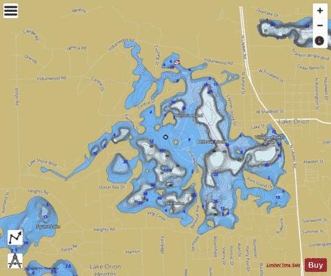
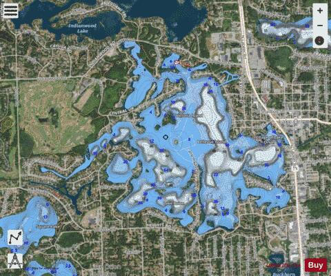
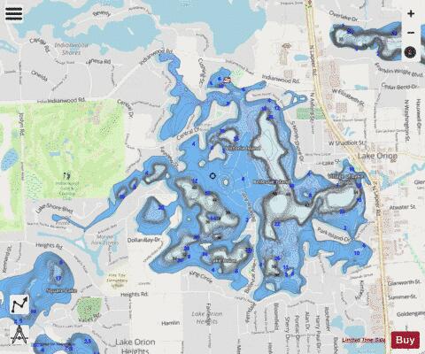
Orion, Lake Fishing Map Stats | |
| Title | Orion, Lake |
| Scale | 1:12000 |
| Includes Data from Fish Atlas | Yes |
| Counties | Oakland |
| Nearby Cities | Lake Orion, Oxford, Auburn Hills, Lake Angelus, Leonard, Pontiac, Rochester, Rochester Hills, Waterford, Metamora |
| Area * | 482.49 acres |
| Shoreline * | 14.26 miles |
| Min Longitude | -83.27 |
| Min Latitude | 42.77 |
| Max Longitude | -83.24 |
| Max Latitude | 42.79 |
| Edition Label 1 | |
| Edition Label 2 | |
| Edition Label 3 | |
| Id | US_MI_63_1221 |
| Country | US |
| Projection | Mercator |
| * some Stats may include nearby/connecting waterbodies | |
|