Gratiot, Lake fishing map is available as part of iBoating : USA Marine & Fishing App(now supported on multiple platforms including Android, iPhone/iPad, MacBook, and Windows(tablet and phone)/PC based chartplotter.).
With our Lake Maps App, you get all the great marine chart app features like fishing spots, along with Gratiot, Lake depth map. The fishing maps app include HD lake depth contours, along with advanced features found in Fish Finder / Gps Chart Plotter systems, turning your device into a Depth Finder. The Gratiot, Lake Navigation App provides advanced features of a Marine Chartplotter including adjusting water level offset and custom depth shading. Fishing spots and depth contours layers are available in most Lake maps. Lake navigation features include advanced instrumentation to gather wind speed direction, water temperature, water depth, and accurate GPS with AIS receivers(using NMEA over TCP/UDP). Autopilot support can be enabled during ‘Goto WayPoint’ and ‘Route Assistance’.
Now i-Boating supports Fishing Points in Gratiot, Lake.
Have more questions about the Nautical Chart App? Ask us.
Fishing Info for Gratiot, Lake
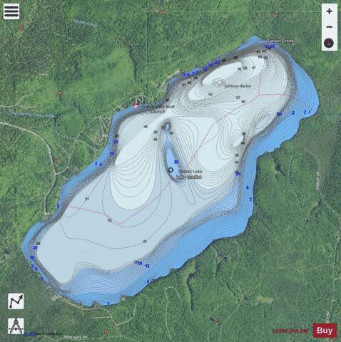
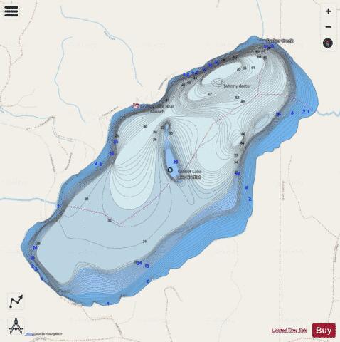
Lake Gratiot is a 1,438-acre (582 ha) lake in Keweenaw County, Michigan. The lake is surrounded by dense forest of the Keweenaw Peninsula. The bottom is mainly muck and it has a maximum depth of 70 feet (21 m). The lake flows through the Little Gratiot River into Lac La Belle and then into Lake Superior.
More on Wikipedia...Popular fish species in this lake include Bluntnose minnow, Brook stickleback, Iowa darter, Johnny darter, Mottled sculpin, Ninespine stickleback, Northern logperch, Northern pike, Rock bass, Smallmouth bass, Trout-perch, White sucker and Yellow perch.
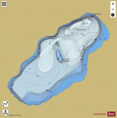
Gratiot, Lake Fishing Map Stats | |
| Title | Gratiot, Lake |
| Scale | 1:12000 |
| Includes Data from Fish Atlas | Yes |
| Counties | Keweenaw |
| Nearby Cities | Central, Eagle Harbor, Gay, Bete Grise, Eagle River, Mohawk, Copper Harbor, Copper City, Ahmeek, Lake Linden |
| Area * | 1453.22 acres |
| Shoreline * | 6.72 miles |
| Min Longitude | -88.15 |
| Min Latitude | 47.34 |
| Max Longitude | -88.10 |
| Max Latitude | 47.37 |
| Edition Label 1 | |
| Edition Label 2 | |
| Edition Label 3 | |
| Id | US_MI_42_36 |
| Country | US |
| Projection | Mercator |
| * some Stats may include nearby/connecting waterbodies | |
|