Lake Wasilla fishing map is available as part of iBoating : USA Marine & Fishing App(now supported on multiple platforms including Android, iPhone/iPad, MacBook, and Windows(tablet and phone)/PC based chartplotter.).
With our Lake Maps App, you get all the great marine chart app features like fishing spots, along with Lake Wasilla depth map. The fishing maps app include HD lake depth contours, along with advanced features found in Fish Finder / Gps Chart Plotter systems, turning your device into a Depth Finder. The Lake Wasilla Navigation App provides advanced features of a Marine Chartplotter including adjusting water level offset and custom depth shading. Fishing spots and depth contours layers are available in most Lake maps. Lake navigation features include advanced instrumentation to gather wind speed direction, water temperature, water depth, and accurate GPS with AIS receivers(using NMEA over TCP/UDP). Autopilot support can be enabled during ‘Goto WayPoint’ and ‘Route Assistance’.
Now i-Boating supports Fishing Points in Lake Wasilla.
Have more questions about the Nautical Chart App? Ask us.
Fishing Info for Lake Wasilla
Wasilla Lake is a lake in Wasilla, Alaska, named by workers constructing the Alaska Railroad after a nearby creek named Wasilla Creek. The lake shore is the site of a city park, Newcomb Park. It is the northern terminus of the Seven-Mile Canoe Trail, the other end being at Finger Lake. Outside of the park areas most of the shoreline is private property. The lake has a stable population of rainbow trout and fishing is considered good for bank, boat, and ice fishing.
More on Wikipedia...Popular fish species in this lake include Rainbow trout.
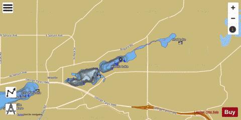
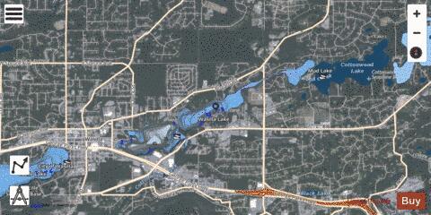
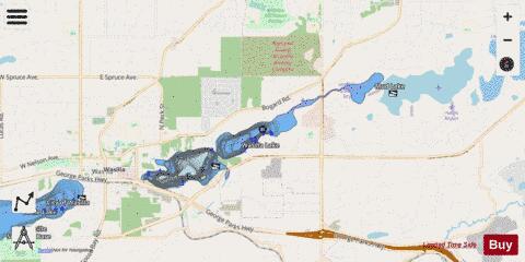
Lake Wasilla Fishing Map Stats | |
| Title | Lake Wasilla |
| Scale | 1:6000 |
| Counties | Matanuska-Susitna |
| Nearby Cities | Wasilla, Matanuska, Cottonwood, Chugiak, Palmer, Eagle River, Butte, Knik, Houston, Jonesville |
| Area * | 404.38 acres |
| Shoreline * | 8.98 miles |
| Min Longitude | -149.43 |
| Min Latitude | 61.58 |
| Max Longitude | -149.34 |
| Max Latitude | 61.60 |
| Edition Label 1 | |
| Edition Label 2 | |
| Edition Label 3 | |
| Id | US_AA_AK_lake_wasilla_ak |
| Country | US |
| Projection | Mercator |
| * some Stats may include nearby/connecting waterbodies | |
|