Breimsvatnet fishing map is included in Østfold nautical charts folio. It is available as part of iBoating : Norway Marine & Fishing App (now supported on multiple platforms including Android, iPhone/iPad, MacBook, and Windows(tablet and phone)/PC based chartplotter. ).
With our Lake Maps App, you get all the great marine chart app features like fishing spots, along with Breimsvatnet lake depth map. The fishing maps app include HD lake depth contours, along with advanced features found in Fish Finder / Gps Chart Plotter systems, turning your device into a Depth Finder. The Breimsvatnet Navigation App provides advanced features of a Marine Chartplotter including adjusting water level offset and custom depth shading. Fishing spots and depth contours layers are available in most Lake maps. Lake navigation features include advanced instrumentation to gather wind speed direction, water temperature, water depth, and accurate GPS with AIS receivers(using NMEA over TCP/UDP). Autopilot support can be enabled during ‘Goto WayPoint’ and ‘Route Assistance’.
Have more questions about the Nautical Chart App? Ask us.
Fishing Info for Breimsvatnet
Breimsvatn or Breimsvatnet is a lake in the municipalities of Gloppen and Sunnfjord in Vestland county, Norway. At 22.52 square kilometres (8.70 sq mi), it is the largest lake in Gloppen (followed by the lake Emhjellevatnet). The European route E39 highway runs along the north end of the lake, connecting the two nearby areas of Sandane and Byrkjelo. On the shores of the 17-kilometre (11 mi) long lake lie several villages including Re and Kandal. The lake flows into the Gloppenelva river which flows into the Gloppefjorden, an arm of the Nordfjorden. Historically, the area surrounding the lake was part of the municipality of Breim, which existed from 1886 until 1964.
More on Wikipedia...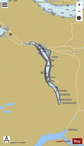
Breimsvatnet Fishing Map Stats | |
| Title | Breimsvatnet |
| Scale | 1:24000 |
| Min Longitude | 6.28 |
| Min Latitude | 61.62 |
| Max Longitude | 6.45 |
| Max Latitude | 61.76 |
| Edition Label 1 | |
| Edition Label 2 | |
| Edition Label 3 | |
| Id | NO_LK_1800 |
| Country | Norway |
| Projection | Mercator |
| * some Stats may include nearby/connecting waterbodies | |
|