Juklavatnet fishing map is included in ֳ˜stfold nautical charts folio. It is available as part of iBoating : Norway Marine & Fishing App (now supported on multiple platforms including Android, iPhone/iPad, MacBook, and Windows(tablet and phone)/PC based chartplotter. ).
With our Lake Maps App, you get all the great marine chart app features like fishing spots, along with Juklavatnet lake depth map. The fishing maps app include HD lake depth contours, along with advanced features found in Fish Finder / Gps Chart Plotter systems, turning your device into a Depth Finder. The Juklavatnet Navigation App provides advanced features of a Marine Chartplotter including adjusting water level offset and custom depth shading. Fishing spots and depth contours layers are available in most Lake maps. Lake navigation features include advanced instrumentation to gather wind speed direction, water temperature, water depth, and accurate GPS with AIS receivers(using NMEA over TCP/UDP). Autopilot support can be enabled during ג€˜Goto WayPointג€™ and ג€˜Route Assistanceג€™.
Have more questions about the Nautical Chart App? Ask us.
Fishing Info for Juklavatnet
Juklavatnet is a lake on the border of the municipalities of Kvinnherad and Ullensvang in Vestland county, Norway. The 3.61-square-kilometre (1.39 sq mi) lake lies just outside Folgefonna National Park and immediately to the west of the Nordre Folgefonna glacier. The only road access comes from the small village of Nordrepollen in the Mauranger area of Kvinnherad municipality, about 10 kilometres (6.2 mi) south of the lake. There is a dam on the western end of the lake which regulates the depth of the water so that it can be used for hydroelectric power generation. The lake is the largest reservoir that feeds into the Mauranger power station.
More on Wikipedia...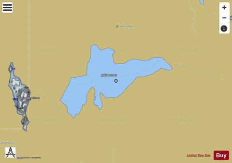
Juklavatnet Fishing Map Stats | |
| Title | Juklavatnet |
| Scale | 1:12000 |
| Min Longitude | 6.35 |
| Min Latitude | 60.20 |
| Max Longitude | 6.42 |
| Max Latitude | 60.22 |
| Edition Label 1 | |
| Edition Label 2 | |
| Edition Label 3 | |
| Id | NO_LK_1691 |
| Country | Norway |
| Projection | Mercator |
| * some Stats may include nearby/connecting waterbodies | |
|