Storsjֳ¸en fishing map is included in ֳ˜stfold nautical charts folio. It is available as part of iBoating : Norway Marine & Fishing App (now supported on multiple platforms including Android, iPhone/iPad, MacBook, and Windows(tablet and phone)/PC based chartplotter. ).
With our Lake Maps App, you get all the great marine chart app features like fishing spots, along with Storsjֳ¸en lake depth map. The fishing maps app include HD lake depth contours, along with advanced features found in Fish Finder / Gps Chart Plotter systems, turning your device into a Depth Finder. The Storsjֳ¸en Navigation App provides advanced features of a Marine Chartplotter including adjusting water level offset and custom depth shading. Fishing spots and depth contours layers are available in most Lake maps. Lake navigation features include advanced instrumentation to gather wind speed direction, water temperature, water depth, and accurate GPS with AIS receivers(using NMEA over TCP/UDP). Autopilot support can be enabled during ג€˜Goto WayPointג€™ and ג€˜Route Assistanceג€™.
Have more questions about the Nautical Chart App? Ask us.
Fishing Info for Storsjֳ¸en
Storsjֳ¸en (or Storsjֳ¸) is the ninth-deepest lake in Norway at 309 metres (1,014 ft) in depth. The 47.55-square-kilometre (18.36 sq mi) lake lies in Rendalen and ֳ…mot municipalities which are in Innlandet county, Norway. The lake is 35 kilometres (22 mi) long, but only 1.7 kilometres (1.1 mi) wide at its broadest point. The lake lies 251 metres (823 ft) above sea level, has an area of 51 square kilometres (20 sq mi), and a volume of 7.07 cubic kilometres (5,730,000 acreג‹…ft). Historically, the lake was used for floating timber downstream from the forests where it was cut to the downstream mills were it would be cut and sold.
More on Wikipedia...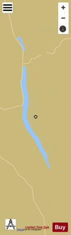
Storsjֳ¸en Fishing Map Stats | |
| Title | Storsjֳ¸en |
| Scale | 1:24000 |
| Min Longitude | 11.18 |
| Min Latitude | 61.39 |
| Max Longitude | 11.37 |
| Max Latitude | 61.69 |
| Edition Label 1 | |
| Edition Label 2 | |
| Edition Label 3 | |
| Id | NO_LK_125 |
| Country | Norway |
| Projection | Mercator |
| * some Stats may include nearby/connecting waterbodies | |
|