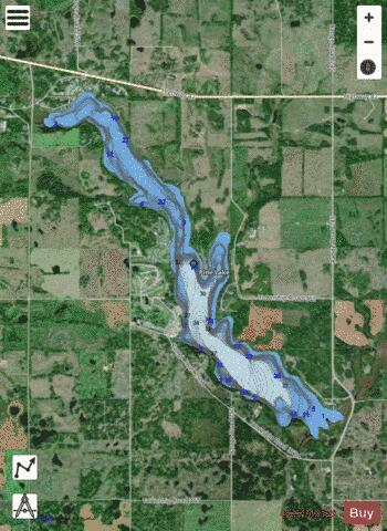
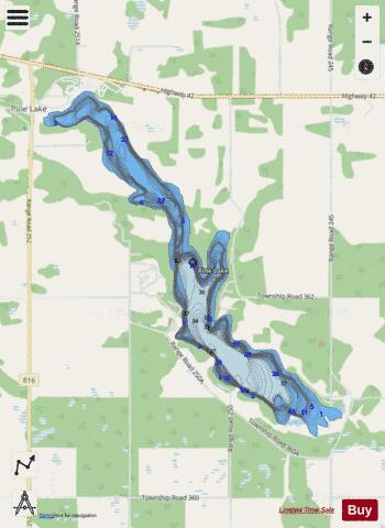
Pine Lake fishing map is included in Alberta Lakes nautical charts folio. It is available as part of iBoating : Canada Marine & Fishing App (now supported on multiple platforms including Android, iPhone/iPad, MacBook, and Windows(tablet and phone)/PC based chartplotter. ).
With our Lake Maps App, you get all the great marine chart app features like fishing spots, along with Pine Lake depth map. The fishing maps app include HD lake depth contours, along with advanced features found in Fish Finder / Gps Chart Plotter systems, turning your device into a Depth Finder. The Pine Lake Navigation App provides advanced features of a Marine Chartplotter including adjusting water level offset and custom depth shading. Fishing spots and depth contours layers are available in most Lake maps. Lake navigation features include advanced instrumentation to gather wind speed direction, water temperature, water depth, and accurate GPS with AIS receivers(using NMEA over TCP/UDP). Autopilot support can be enabled during ‘Goto WayPoint’ and ‘Route Assistance’.
Now i-Boating supports Fishing Points in Pine Lake.
Have more questions about the Nautical Chart App? Ask us.
Fishing Info for Pine Lake
Pine Lake is a lake in Alberta. Pine Lake is drained by Ghostpine Creek which eventually empties out into the Red Deer River. The lake is very rich in plant life which gives it fish. Some of the fish in this lake are northern pike, walleye, yellow perch and burbot. It is located 25 kilometers southeast of Red Deer, and is most notable for the Pine Lake tornado that struck the hamlet of Pine Lake in 2000.
More on Wikipedia...Popular fish species in this lake include Burbot, Northern pike, Walleye and Yellow perch.
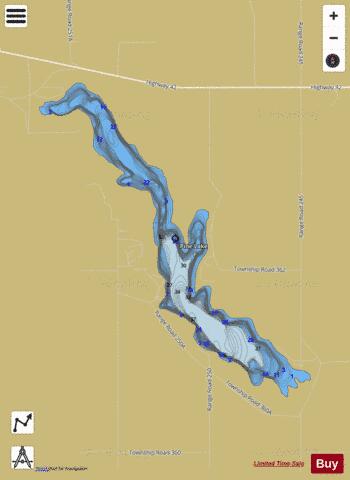
Pine Lake Fishing Map Stats | |
| Title | Pine Lake |
| Scale | 1:6000 |
| Districts | Division No. 8 |
| Nearby Cities | Trochu, Red Deer, Three Hills, Penhold, Springbrook, Blackfalds, Lacombe, Innisfail, Ponoka, Bowden |
| Area * | 1001.01 acres |
| Shoreline * | 12.45 miles |
| Min Longitude | -113.48 |
| Min Latitude | 52.06 |
| Max Longitude | -113.41 |
| Max Latitude | 52.11 |
| Edition Label 1 | |
| Edition Label 2 | |
| Edition Label 3 | |
| Id | CA_AB_pine_lake |
| Country | CA |
| Projection | Mercator |
| * some Stats may include nearby/connecting waterbodies | |
|