Birch fishing map is available as part of iBoating : USA Marine & Fishing App(now supported on multiple platforms including Android, iPhone/iPad, MacBook, and Windows(tablet and phone)/PC based chartplotter.).
With our Lake Maps App, you get all the great marine chart app features like fishing spots, along with Birch lake depth map. The fishing maps app include HD lake depth contours, along with advanced features found in Fish Finder / Gps Chart Plotter systems, turning your device into a Depth Finder. The Birch Navigation App provides advanced features of a Marine Chartplotter including adjusting water level offset and custom depth shading. Fishing spots and depth contours layers are available in most Lake maps. Lake navigation features include advanced instrumentation to gather wind speed direction, water temperature, water depth, and accurate GPS with AIS receivers(using NMEA over TCP/UDP). Autopilot support can be enabled during ‘Goto WayPoint’ and ‘Route Assistance’.
Now i-Boating supports Fishing Points in Birch.
Have more questions about the Nautical Chart App? Ask us.
Fishing Info for Birch
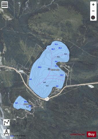
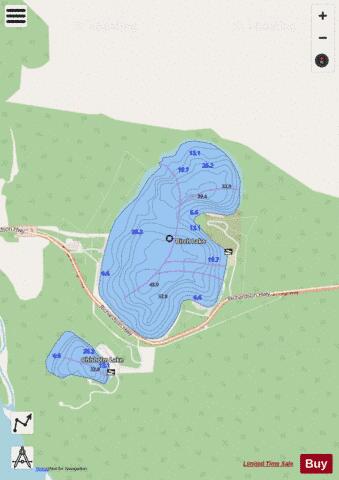
Birch Lake is a lake in Fairbanks North Star Borough, Alaska. The lake contains Arctic char, Arctic grayling, Chinook salmon, coho salmon, and rainbow trout and has been stocked extensively since 1966. It is a popular spot for both fishing from boats and ice fishing in the winter.
More on Wikipedia...Popular fish species in this lake include Arctic char, Arctic grayling and Rainbow trout.
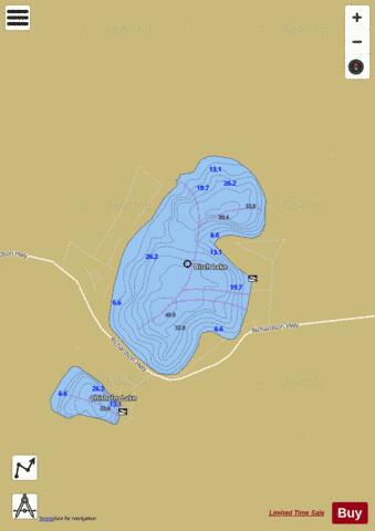
Birch Fishing Map Stats | |
| Title | Birch |
| Scale | 1:6000 |
| Counties | Fairbanks North Star |
| Nearby Cities | Harding Lake, Aurora Lodge, North Pole, Big Delta, Chena Hot Springs, Delta Junction, Donnelly |
| Area * | 773.96 acres |
| Shoreline * | 4.97 miles |
| Min Longitude | -146.68 |
| Min Latitude | 64.30 |
| Max Longitude | -146.64 |
| Max Latitude | 64.33 |
| Edition Label 1 | |
| Edition Label 2 | |
| Edition Label 3 | |
| Id | US_AK_ak_reg3_birchcontours_meters |
| Country | US |
| Projection | Mercator |
| * some Stats may include nearby/connecting waterbodies | |
|