Clay Lake fishing map is available as part of iBoating : USA Marine & Fishing App(now supported on multiple platforms including Android, iPhone/iPad, MacBook, and Windows(tablet and phone)/PC based chartplotter.).
With our Lake Maps App, you get all the great marine chart app features like fishing spots, along with Clay Lake depth map. The fishing maps app include HD lake depth contours, along with advanced features found in Fish Finder / Gps Chart Plotter systems, turning your device into a Depth Finder. The Clay Lake Navigation App provides advanced features of a Marine Chartplotter including adjusting water level offset and custom depth shading. Fishing spots and depth contours layers are available in most Lake maps. Lake navigation features include advanced instrumentation to gather wind speed direction, water temperature, water depth, and accurate GPS with AIS receivers(using NMEA over TCP/UDP). Autopilot support can be enabled during ‘Goto WayPoint’ and ‘Route Assistance’.
Now i-Boating supports Fishing Points in Clay Lake.
Have more questions about the Nautical Chart App? Ask us.
Fishing Info for Clay Lake
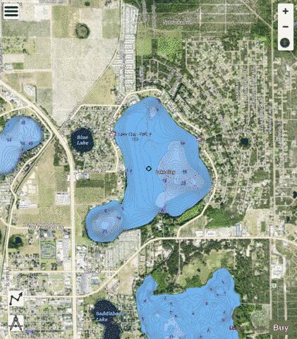
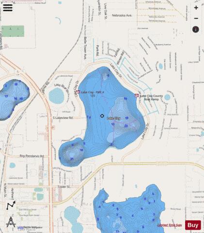
Lake Clay, on the north edge of Lake Placid, Florida, has a surface area of 353.33-acre (1,429,900 m2). Lake Clay is almost completely surrounded by residences. Only a few small grassy undeveloped areas exist around the lake. , a small round lake, is 610 feet (190 m) west of Lake Clay. Lake Clay has public access at two public boat ramps. One is on the east side of the lake, at 1650 Lake Clay Drive, and the other is on the west side, at 1300 Lake Clay Drive. Lake Clay Drive surrounds three-fourths of Lake Clay. The lake has no public swimming beach. There is no information about the types of fish in the lake available.
More on Wikipedia...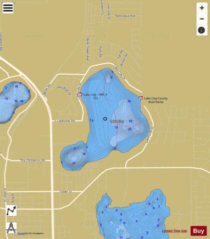
Clay Lake Fishing Map Stats | |
| Title | Clay Lake |
| Scale | 1:6000 |
| 1 ft Depth Contours for Anglers | Yes |
| Counties | Highlands |
| Nearby Cities | Lake Placid, Placid Lakes, De Soto City, Lorida, Plains, Sebring, Venus, Cornwell, Brighton, Fort Basinger |
| Area * | 353.61 acres |
| Shoreline * | 3.46 miles |
| Min Longitude | -81.36 |
| Min Latitude | 27.30 |
| Max Longitude | -81.34 |
| Max Latitude | 27.32 |
| Edition Label 1 | |
| Edition Label 2 | |
| Edition Label 3 | |
| Id | US_AA_FL_clay_fl |
| Country | US |
| Projection | Mercator |
| * some Stats may include nearby/connecting waterbodies | |
|