Jääsjärvi marine chart is included in Finland Lakes nautical charts folio. It is available as part of iBoating : Finland Marine & Fishing App (now supported on multiple platforms including Android, iPhone/iPad, MacBook, and Windows(tablet and phone)/PC based chartplotter. ).
When you purchase our Nautical Charts App, you get all the great marine chart app features like fishing spots, along with Jääsjärvi marine chart. The Marine Navigation App provides advanced features of a Marine Chartplotter including adjusting water level offset and custom depth shading. Fishing spots and depth contours layers are available in most Lake maps. Nautical navigation features include advanced instrumentation to gather wind speed direction, water temperature, water depth, and accurate GPS with AIS receivers(using NMEA over TCP/UDP). Autopilot support can be enabled during ‘Goto WayPoint’ and ‘Route Assistance’. Now Automatic Slip to Slip Boat routing based Boat's Draft (draught) is available for water mapped by this chart.
Have more questions about the Nautical Chart App? Ask us.
Fishing Info for Jääsjärvi
Jääsjärvi (Finnish: [ˈjæːsˌjærʋi]; lit. 'ice lake') is a medium-sized lake of Finland. It is located in the Hartola and Joutsa municipalities, in the Central Finland and Päijänne Tavastia regions. The water quality in the lake is excellent. The river Tainionvirta has its source in Jääsjärvi and flows through several smaller lakes to Päijänne. The water in Jääsjärvi is bright. The lake is part of the and Kymijoki main catchment area. There are dozens of islands in the lake. The biggest are Vehkasalo, Hirtesalo, Kotisalo, Ohrasaari, Urrionsaari, and Nautsalo. Vehkasalo, Hirtesalo, and Ohrasaari have roads connecting them to the mainland. In winter time, the lake typically freezes.
More on Wikipedia...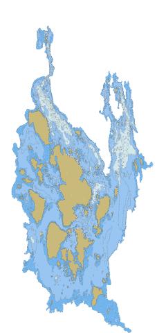
Jääsjärvi Stats | |
| Title | Jääsjärvi |
| Scale | 1:24000 |
| Min Longitude | 26.03 |
| Min Latitude | 61.52 |
| Max Longitude | 26.22 |
| Max Latitude | 61.72 |
| Edition Label 1 | |
| Edition Label 2 | |
| Edition Label 3 | |
| Id | FI_14_821_1_001 |
| Country | Finland |
| Projection | Mercator |
| * some Stats may include nearby/connecting waterbodies | |
|