Talon Lake fishing map is included in Ontario Lakes nautical charts folio. It is available as part of iBoating : Canada Marine & Fishing App (now supported on multiple platforms including Android, iPhone/iPad, MacBook, and Windows(tablet and phone)/PC based chartplotter. ).
With our Lake Maps App, you get all the great marine chart app features like fishing spots, along with Talon Lake depth map. The fishing maps app include HD lake depth contours, along with advanced features found in Fish Finder / Gps Chart Plotter systems, turning your device into a Depth Finder. The Talon Lake Navigation App provides advanced features of a Marine Chartplotter including adjusting water level offset and custom depth shading. Fishing spots and depth contours layers are available in most Lake maps. Lake navigation features include advanced instrumentation to gather wind speed direction, water temperature, water depth, and accurate GPS with AIS receivers(using NMEA over TCP/UDP). Autopilot support can be enabled during ‘Goto WayPoint’ and ‘Route Assistance’.
Now i-Boating supports Fishing Points in Talon Lake.
Have more questions about the Nautical Chart App? Ask us.
Fishing Info for Talon Lake
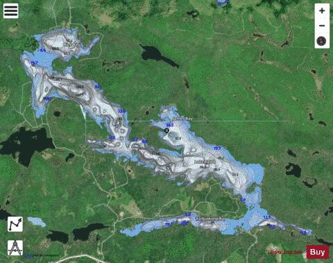
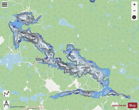
Lake Talon is a lake in Nipissing District, Ontario, Canada that is part of the Mattawa River system and the Ottawa River drainage basin. The majority of the water body is located in Bonfield Township with the rest in Calvin Township and the unincorporated Olrig Township. The lake is a popular cottaging spot during the summer, as it is dotted with cottages mostly along the southern shore. It also has a Nipissing University field station on the north shore of the eastern end. The lake and its shores, with the exception of Kaibuskong Bay, are protected as part of the Mattawa River Provincial Park. The primary inflows are the Mattawa River and the Kaibuskong River, and the primary outflow is the Mattawa River at Talon Chute, which flows to the Ottawa River.
More on Wikipedia...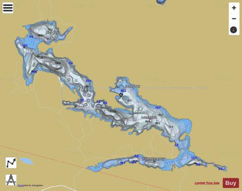
Talon Lake Fishing Map Stats | |
| Title | Talon Lake |
| Scale | 1:24000 |
| Districts | Nipissing |
| Nearby Cities | Mattawa, Powassan, North Bay, Témiscaming, Sturgeon Falls, Huntsville |
| Area * | 3523.43 acres |
| Shoreline * | 45.23 miles |
| Min Longitude | -79.13 |
| Min Latitude | 46.28 |
| Max Longitude | -79.00 |
| Max Latitude | 46.34 |
| Edition Label 1 | |
| Edition Label 2 | |
| Edition Label 3 | |
| Id | CA_ON_talon_lake_on |
| Country | CA |
| Projection | Mercator |
| * some Stats may include nearby/connecting waterbodies | |
|