Sproat Lake fishing map is included in Lakes and Rivers of British Columbia nautical charts folio. It is available as part of iBoating : Canada Marine & Fishing App (now supported on multiple platforms including Android, iPhone/iPad, MacBook, and Windows(tablet and phone)/PC based chartplotter. ).
With our Lake Maps App, you get all the great marine chart app features like fishing spots, along with Sproat Lake depth map. The fishing maps app include HD lake depth contours, along with advanced features found in Fish Finder / Gps Chart Plotter systems, turning your device into a Depth Finder. The Sproat Lake Navigation App provides advanced features of a Marine Chartplotter including adjusting water level offset and custom depth shading. Fishing spots and depth contours layers are available in most Lake maps. Lake navigation features include advanced instrumentation to gather wind speed direction, water temperature, water depth, and accurate GPS with AIS receivers(using NMEA over TCP/UDP). Autopilot support can be enabled during ‘Goto WayPoint’ and ‘Route Assistance’.
Now i-Boating supports Fishing Points in Sproat Lake.
Have more questions about the Nautical Chart App? Ask us.
Fishing Info for Sproat Lake
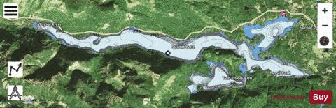
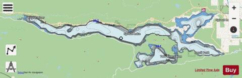
Sproat Lake is a lake on central Vancouver Island in British Columbia, Canada. It was known as Kleecoot, meaning "wide open" by local indigenous people. Roughly cross-shaped with four arms, it is over 25 kilometres in length, and has 90.8 kilometres of shoreline. Home of the last Martin Mars type waterbombers, and near Port Alberni, Sproat Lake is a popular summer recreational area for the Alberni Valley. Highway 4 runs along its north shore. The lake maintains a small wintering population of Marbled Murrelets which also nest in the area, the only freshwater alcids on Earth.
More on Wikipedia...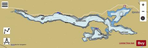
Sproat Lake Fishing Map Stats | |
| Title | Sproat Lake |
| Scale | 1:24000 |
| Districts | Alberni-Clayoquot |
| Nearby Cities | Port Alberni, Cumberland, Courtenay, Puntledge, Ucluelet, Parksville, Powell River, Campbell River, Fairwinds, Nanaimo |
| Area * | 10471.95 acres |
| Shoreline * | 64.61 miles |
| Min Longitude | -125.22 |
| Min Latitude | 49.23 |
| Max Longitude | -124.90 |
| Max Latitude | 49.29 |
| Edition Label 1 | |
| Edition Label 2 | |
| Edition Label 3 | |
| Id | CA_BC_sproat_lake_317802 |
| Country | CA |
| Projection | Mercator |
| * some Stats may include nearby/connecting waterbodies | |
| ||||||||||||||||||||||||||||||||||||||||||||||||||||||||||||||||||||||||||||||||||||||||||||||||||||||||
|