Crawfish Lake fishing map is available as part of iBoating : USA Marine & Fishing App(now supported on multiple platforms including Android, iPhone/iPad, MacBook, and Windows(tablet and phone)/PC based chartplotter.).
With our Lake Maps App, you get all the great marine chart app features like fishing spots, along with Crawfish Lake depth map. The fishing maps app include HD lake depth contours, along with advanced features found in Fish Finder / Gps Chart Plotter systems, turning your device into a Depth Finder. The Crawfish Lake Navigation App provides advanced features of a Marine Chartplotter including adjusting water level offset and custom depth shading. Fishing spots and depth contours layers are available in most Lake maps. Lake navigation features include advanced instrumentation to gather wind speed direction, water temperature, water depth, and accurate GPS with AIS receivers(using NMEA over TCP/UDP). Autopilot support can be enabled during ‘Goto WayPoint’ and ‘Route Assistance’.
Now i-Boating supports Fishing Points in Crawfish Lake.
Have more questions about the Nautical Chart App? Ask us.
Fishing Info for Crawfish Lake
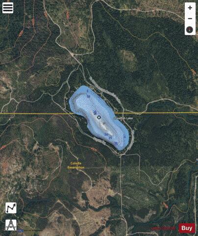
Crawfish Lake (48°28′55″N 119°12′57″W / 48.48194°N 119.21583°W) is a small lake located 15 miles (24 km) northeast of Omak, Washington. The lake has a surface area of 80 acres (32.37 ha) and is located at 4,475 ft (1,364 m) above sea level. The northeast portion of the lake borders the Okanogan–Wenatchee National Forest, and the south half is on the Colville Indian Reservation. Most of the property along the shoreline of the lake is privately owned, with a US Forest Service campground occupying the northeast side of the lake. Motors have been prohibited on the lake since 1996. The lake is used mainly for fishing, rowing, canoeing, kayaking and swimming. The lake once contained many crawfish but the state has recently poisoned it to contain the native water reed and thus kill the crawfish. * Crawfish Lake on a summer evening
More on Wikipedia...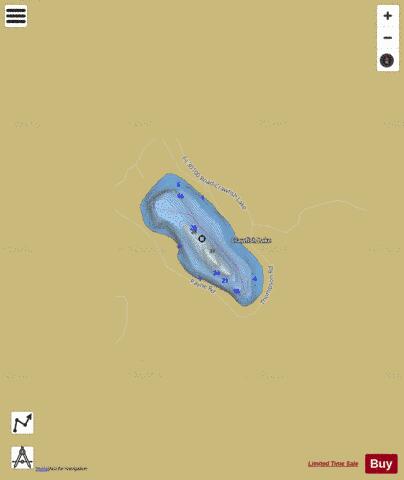
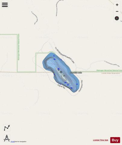
Crawfish Lake Fishing Map Stats | |
| Title | Crawfish Lake |
| Scale | 1:6000 |
| Counties | Okanogan |
| Nearby Cities | Synarep, Disautel, Aeneas, Riverside, Tonasket, Omak, Ellisforde, Okanogan, Nespelem, Cordell |
| Area * | 79.82 acres |
| Shoreline * | 1.54 miles |
| Min Longitude | -119.22 |
| Min Latitude | 48.48 |
| Max Longitude | -119.21 |
| Max Latitude | 48.49 |
| Edition Label 1 | |
| Edition Label 2 | |
| Edition Label 3 | |
| Id | US_WA_01518294 |
| Country | US |
| Projection | Mercator |
| * some Stats may include nearby/connecting waterbodies | |
|