Angle Lake fishing map is available as part of iBoating : USA Marine & Fishing App(now supported on multiple platforms including Android, iPhone/iPad, MacBook, and Windows(tablet and phone)/PC based chartplotter.).
With our Lake Maps App, you get all the great marine chart app features like fishing spots, along with Angle Lake depth map. The fishing maps app include HD lake depth contours, along with advanced features found in Fish Finder / Gps Chart Plotter systems, turning your device into a Depth Finder. The Angle Lake Navigation App provides advanced features of a Marine Chartplotter including adjusting water level offset and custom depth shading. Fishing spots and depth contours layers are available in most Lake maps. Lake navigation features include advanced instrumentation to gather wind speed direction, water temperature, water depth, and accurate GPS with AIS receivers(using NMEA over TCP/UDP). Autopilot support can be enabled during ‘Goto WayPoint’ and ‘Route Assistance’.
Now i-Boating supports Fishing Points in Angle Lake.
Have more questions about the Nautical Chart App? Ask us.
Fishing Info for Angle Lake
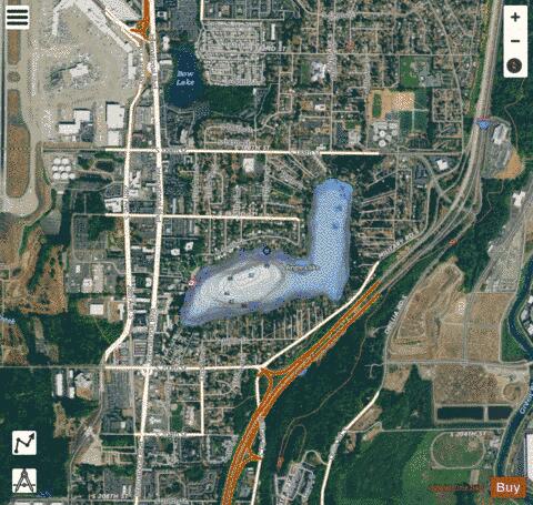
Angle Lake is an L-shaped lake in SeaTac, Washington, United States, occupying 102 acres (0.41 km2) between Interstate 5 and State Route 99. The lake most likely was so named on account of its outline. On the western shore is a 10-acre (0.040 km2) park, Angle Lake Park, administered by the City of SeaTac Parks and Recreation department. The remainder of the shoreline is ringed with private homes. The lake is stocked with rainbow trout by the Washington Department of Fish and Wildlife. It is also home to kokanee, largemouth bass, crappie, catfish, and yellow perch. The lake is open to fishing year-round. The Angle Lake light rail station is named for the lake, and is located to the southwest.
More on Wikipedia...Popular fish species in this lake include Crappie, Largemouth bass, Rainbow trout and Yellow perch.
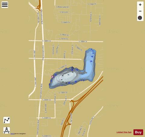
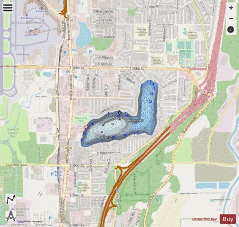
Angle Lake Fishing Map Stats | |
| Title | Angle Lake |
| Scale | 1:6000 |
| Counties | King |
| Nearby Cities | North Hill, Des Moines, SeaTac, Tukwila, Normandy Park, Zenith, Sunnydale, Allentown, Skyway, Kent |
| Area * | 102.75 acres |
| Shoreline * | 2.17 miles |
| Min Longitude | -122.29 |
| Min Latitude | 47.42 |
| Max Longitude | -122.28 |
| Max Latitude | 47.43 |
| Edition Label 1 | |
| Edition Label 2 | |
| Edition Label 3 | |
| Id | US_WA_01503037 |
| Country | US |
| Projection | Mercator |
| * some Stats may include nearby/connecting waterbodies | |
|