Shoshone Lake fishing map is available as part of iBoating : USA Marine & Fishing App(now supported on multiple platforms including Android, iPhone/iPad, MacBook, and Windows(tablet and phone)/PC based chartplotter.).
With our Lake Maps App, you get all the great marine chart app features like fishing spots, along with Shoshone Lake depth map. The fishing maps app include HD lake depth contours, along with advanced features found in Fish Finder / Gps Chart Plotter systems, turning your device into a Depth Finder. The Shoshone Lake Navigation App provides advanced features of a Marine Chartplotter including adjusting water level offset and custom depth shading. Fishing spots and depth contours layers are available in most Lake maps. Lake navigation features include advanced instrumentation to gather wind speed direction, water temperature, water depth, and accurate GPS with AIS receivers(using NMEA over TCP/UDP). Autopilot support can be enabled during ‘Goto WayPoint’ and ‘Route Assistance’.
Have more questions about the Nautical Chart App? Ask us.
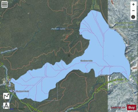
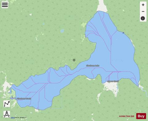
Fishing Info for Shoshone Lake
Shoshone Lake is a U.S. backcountry lake with the area of 8,050 acres (33 km2; 13 sq mi) elevated at 7,795 feet (2,376 m) in the southwest section of Yellowstone National Park, Wyoming. It lies at the headwaters of the Lewis River a tributary of the Snake River. The U.S. Fish and Wildlife Service believes that Shoshone Lake is the largest backcountry lake in the lower 48 states that cannot be reached by a road. The Yellowstone Caldera is located within the lake.
More on Wikipedia...Popular fish species in this lake include Lake trout and Utah chub.
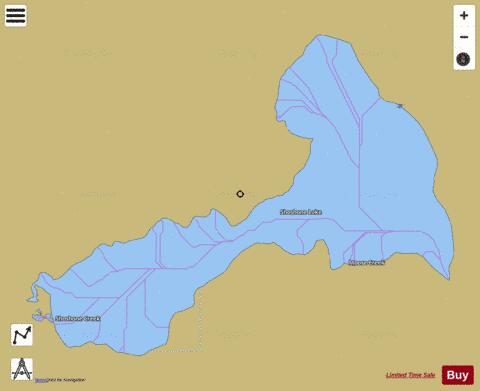
Shoshone Lake Fishing Map Stats | |
| Title | Shoshone Lake |
| Scale | 1:12000 |
| Counties | Teton |
| Nearby Cities | West Thumb, Lake, West Yellowstone, Big Springs, Moran, Lamont, Mammoth, Warm River, Island Park, Grayling |
| Area * | 7073.46 acres |
| Shoreline * | 24.19 miles |
| Min Longitude | -110.80 |
| Min Latitude | 44.34 |
| Max Longitude | -110.66 |
| Max Latitude | 44.41 |
| Edition Label 1 | |
| Edition Label 2 | |
| Edition Label 3 | |
| Id | US_UB_WY_01609298 |
| Country | US |
| Projection | Mercator |
| * some Stats may include nearby/connecting waterbodies | |
|